File:British Columbia (MODIS 2021-12-22).jpg
Original file (4,795 × 4,009 pixels, file size: 3.51 MB, MIME type: image/jpeg)
Captions
Captions
Summary[edit]
.jpg&action=edit§ion=1)
| Description |
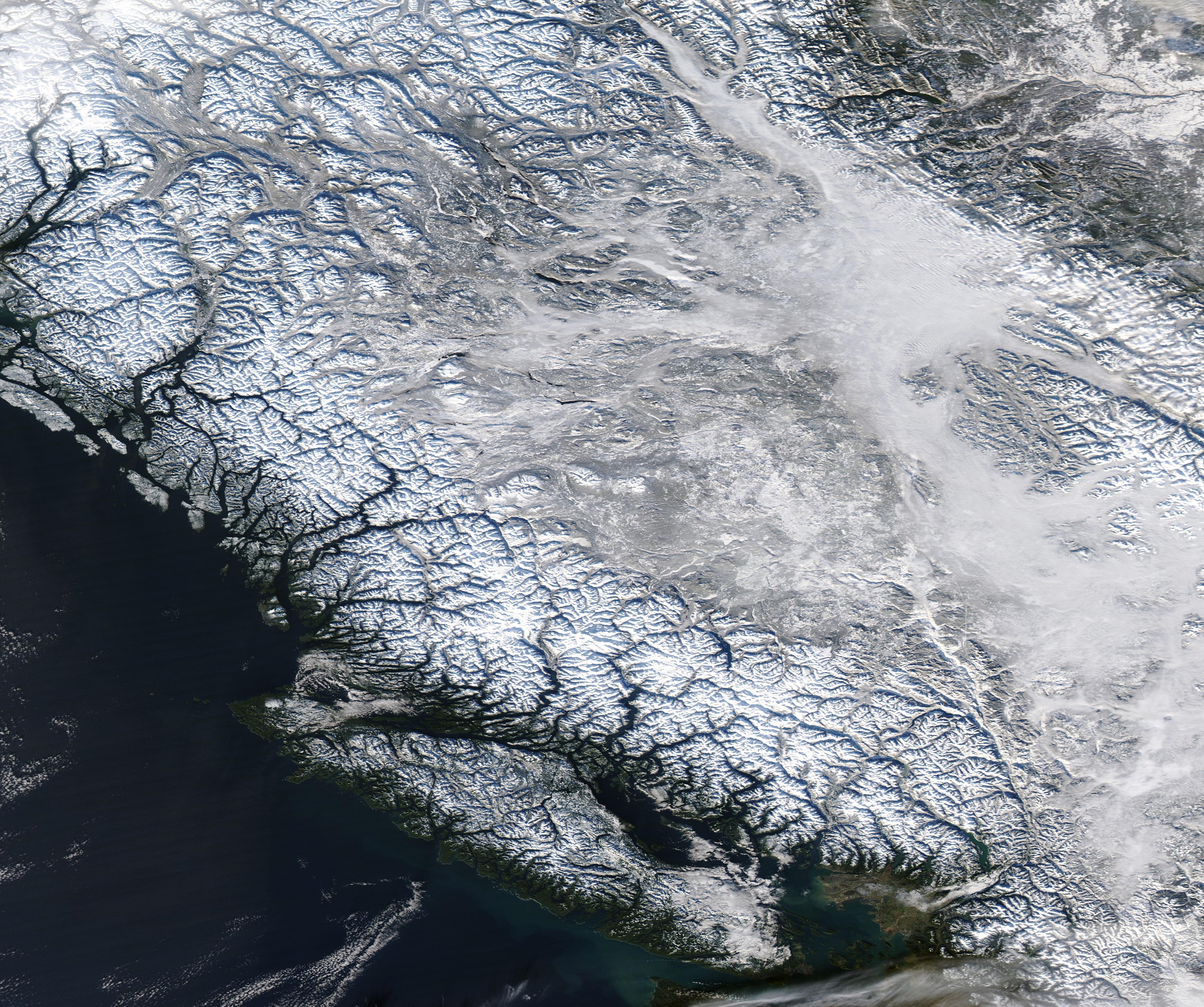
English: Fog filled the valleys of British Columbia, Canada on the last day of autumn, 2021. The Moderate Resolution Imaging Spectroradiometer (MODIS) on board NASA’s Aqua satellite acquired a true-color image of the scene on December 20.
Near the center and the southeast portion of the image, a bank of dense fog obscures the land from view. In several other locations, light gray fog flows through narrow valleys, flanked by bright-white snow that tops the high elevations, creating a vein-like structure across the region. In other locations, valleys appear green, thanks to the vegetation on the valley floors. Fog is simply a cloud lying on the ground. Like all clouds, it forms when the air reaches its dew point, which is the temperature to which an air mass must be cooled for the water vapor in it to condense into liquid droplets. Valley fog is common in the Pacific Northwest. On clear winter nights, the ground and overlying air cool off rapidly, especially at high elevations. Cold air is denser than warm air, and it sinks down into the valleys. The moist air in the valleys gets chilled to its dew point, and fog forms. If undisturbed by winds, such fog may persist for days. |
||
| Date | Taken on 20 December 2021 | ||
| Source |
British Columbia (direct link)
|
||
| Author | MODIS Land Rapid Response Team, NASA GSFC |
| This media is a product of the Aqua mission Credit and attribution belongs to the mission team, if not already specified in the "author" row |
Licensing[edit]
.jpg&action=edit§ion=2)
| This file is in the public domain in the United States because it was solely created by NASA. NASA copyright policy states that "NASA material is not protected by copyright unless noted". (See Template:PD-USGov, NASA copyright policy page or JPL Image Use Policy.) | ||
 |
Warnings:
|
File history
Click on a date/time to view the file as it appeared at that time.
| Date/Time | Thumbnail | Dimensions | User | Comment | |
|---|---|---|---|---|---|
| current | 00:20, 17 January 2024 | | 4,795 × 4,009 (3.51 MB) | OptimusPrimeBot (talk | contribs) | #Spacemedia - Upload of http://modis.gsfc.nasa.gov/gallery/images/image12222021_250m.jpg via Commons:Spacemedia |
You cannot overwrite this file.
File usage on Commons
There are no pages that use this file.
.jpg&oldid=842553167)