File:Broad Fourteens delisle 1743.jpg
Original file (888 × 864 pixels, file size: 242 KB, MIME type: image/jpeg)
Captions
Captions
| Description |
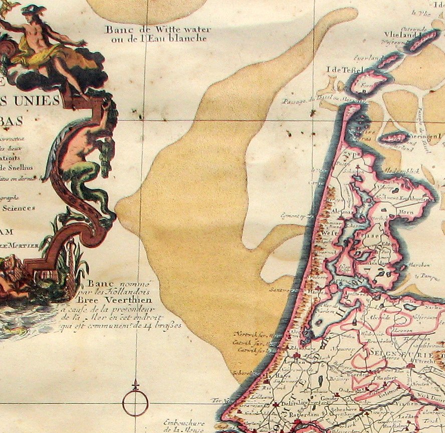
English: Map of The Netherlands (Broad Fourteens fragment), publication date circa 1743
Nederlands: Kaart van Nederland (Breeveertienfragment), publicatie ca 1743
Français : Carte des Provinces Unies des Pays Bas (Fragment "Breeveertien"), par G. de L'Isle, A Amsterdam 1743 |
| Date | (UTC) |
| Source |
|
| Author |
|
| This is a retouched picture, which means that it has been digitally altered from its original version. Modifications: cropped to Broad Fourteen area. The original can be viewed here: PaysBas delisle 1743.jpg:
|
|
This work is in the public domain in its country of origin and other countries and areas where the copyright term is the author's life plus 70 years or fewer.
| |
| This file has been identified as being free of known restrictions under copyright law, including all related and neighboring rights. | |
Original upload log
[edit]
This image is a derivative work of the following images:
- File:PaysBas_delisle_1743.jpg licensed with Cc-pd-mark-footer, PD-old
- 2011-05-30T18:47:41Z Hans Erren 2592x1944 (7082127 Bytes) colour correction
- 2010-06-26T20:56:34Z Hans Erren 2592x1944 (5523080 Bytes) {{Information |Description={{en|1=Map of The Netherlands, publication date circa 1743}} {{nl|1=Kaart van Nederland, publicatie ca 1743}} {{fr|1=Carte des Provinces Unies des Pays Bas, par G. de L'Isle, A Amsterdam 1743}} |Sou
Uploaded with derivativeFX
File history
Click on a date/time to view the file as it appeared at that time.
| Date/Time | Thumbnail | Dimensions | User | Comment | |
|---|---|---|---|---|---|
| current | 18:55, 30 May 2011 | | 888 × 864 (242 KB) | Hans Erren (talk | contribs) | {{Information |Description={{en|1=Map of The Netherlands (Broad Fourteens fragment), publication date circa 1743}} {{nl|1=Kaart van Nederland (Breeveertienfragment), publicatie ca 1743}} {{fr|1=Carte des Provinces Unies des Pays Bas (Fragment "Breeveert |
You cannot overwrite this file.
File usage on Commons
There are no pages that use this file.
File usage on other wikis
The following other wikis use this file:
- Usage on ar.wikipedia.org
- Usage on en.wikipedia.org
- Usage on hu.wikipedia.org
- Usage on it.wikipedia.org
- Usage on nl.wikipedia.org