File:BrooklynMap1766.jpg
Jump to navigation
Jump to search
Size of this preview: 693 × 600 pixels. Other resolutions: 277 × 240 pixels | 555 × 480 pixels | 887 × 768 pixels | 1,183 × 1,024 pixels | 1,882 × 1,629 pixels.
Original file (1,882 × 1,629 pixels, file size: 3.11 MB, MIME type: image/jpeg)
Captions
Captions
Add a one-line explanation of what this file represents
Summary[edit]
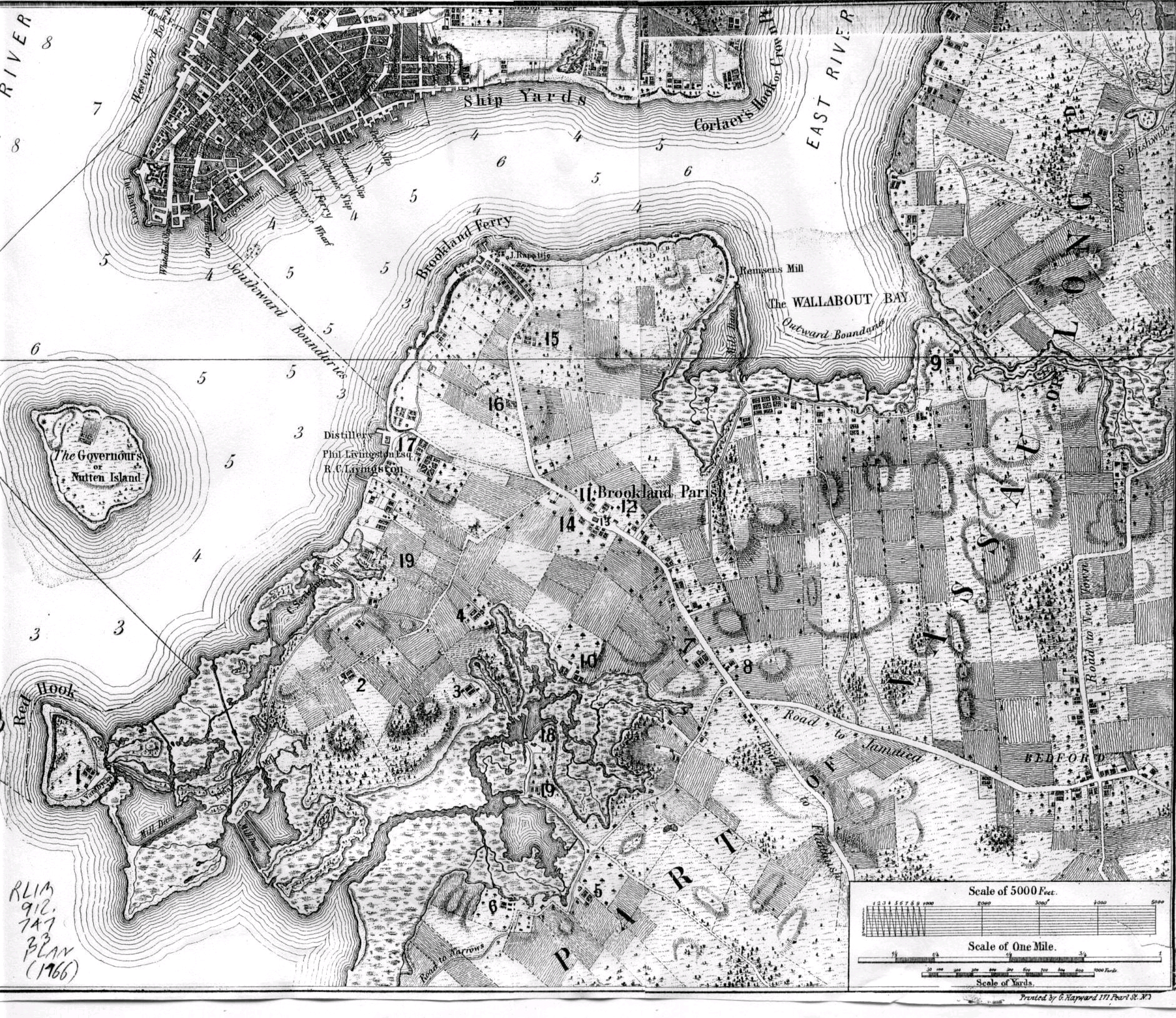
| Description | Map of Brooklyn, NY made in 1766 | ||||||||||||||||||||||
| Date | |||||||||||||||||||||||
| Source | http://bklyn-genealogy-info.stevemorse.org/Map/1766.Vill.Bklyn.html | ||||||||||||||||||||||
| Author |
|
||||||||||||||||||||||
| Other versions |
 |
||||||||||||||||||||||
Licensing[edit]
|
This work is in the public domain in its country of origin and other countries and areas where the copyright term is the author's life plus 100 years or fewer. | |
| This file has been identified as being free of known restrictions under copyright law, including all related and neighboring rights. | |
File history
Click on a date/time to view the file as it appeared at that time.
| Date/Time | Thumbnail | Dimensions | User | Comment | |
|---|---|---|---|---|---|
| current | 07:54, 15 August 2006 | | 1,882 × 1,629 (3.11 MB) | Tommyill~commonswiki (talk | contribs) | Map of Brooklyn, NY made in 1766. |
You cannot overwrite this file.
File usage on Commons
The following 2 pages use this file:
File usage on other wikis
The following other wikis use this file:
- Usage on azb.wikipedia.org
- Usage on cs.wikipedia.org
- Usage on de.wikipedia.org
- Usage on en.wikipedia.org
- Usage on es.wikipedia.org
- Usage on it.wikipedia.org
- Usage on ja.wikipedia.org
- Usage on nl.wikipedia.org
- Usage on pt.wikipedia.org
- Usage on ru.wikipedia.org