File:Burnham Norton, St Margaret's church from south east (28930022120).jpg
Original file (4,665 × 2,847 pixels, file size: 5.83 MB, MIME type: image/jpeg)
Captions
Captions
Summary
[edit].jpg&action=edit§ion=1)
| Description |
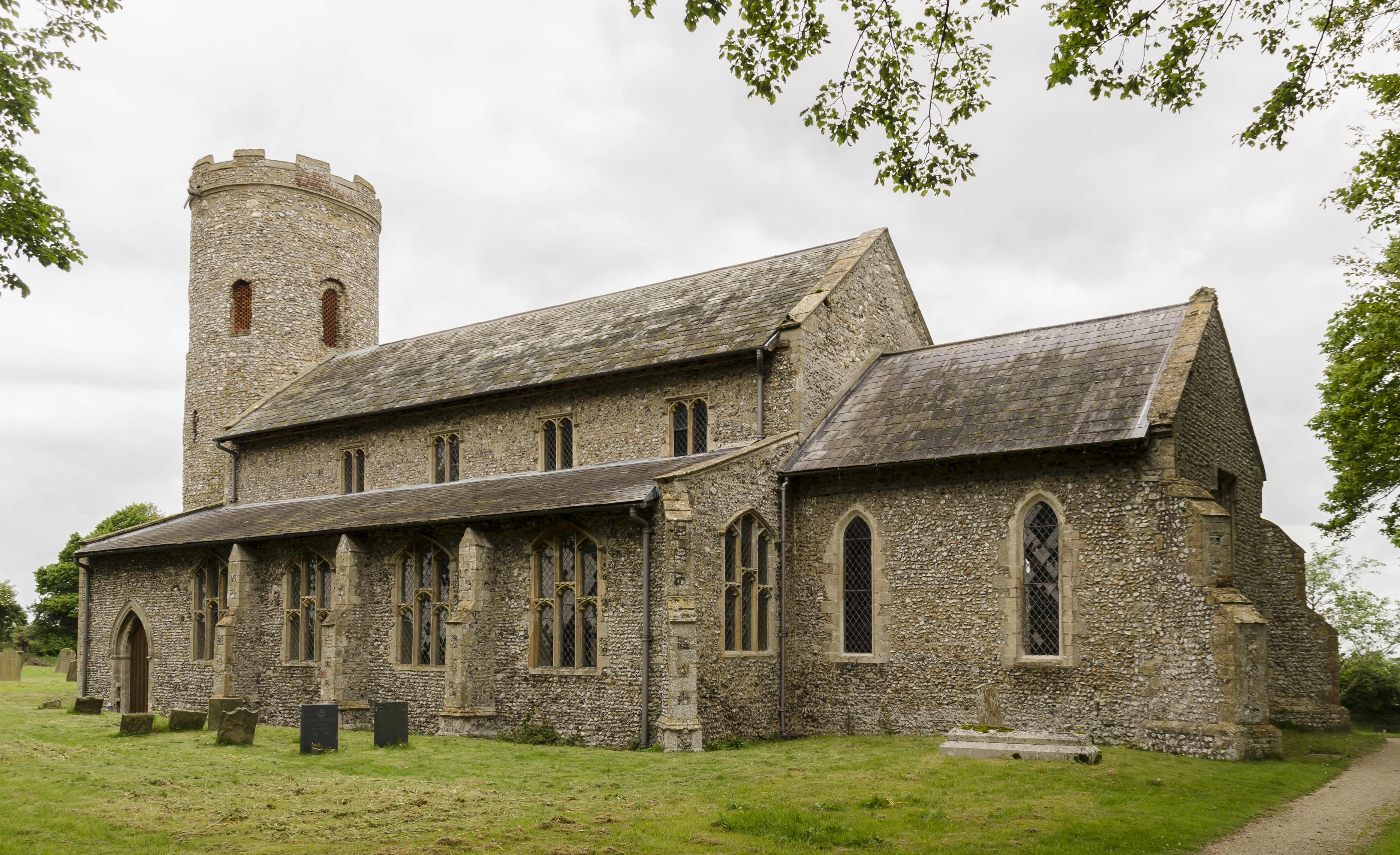
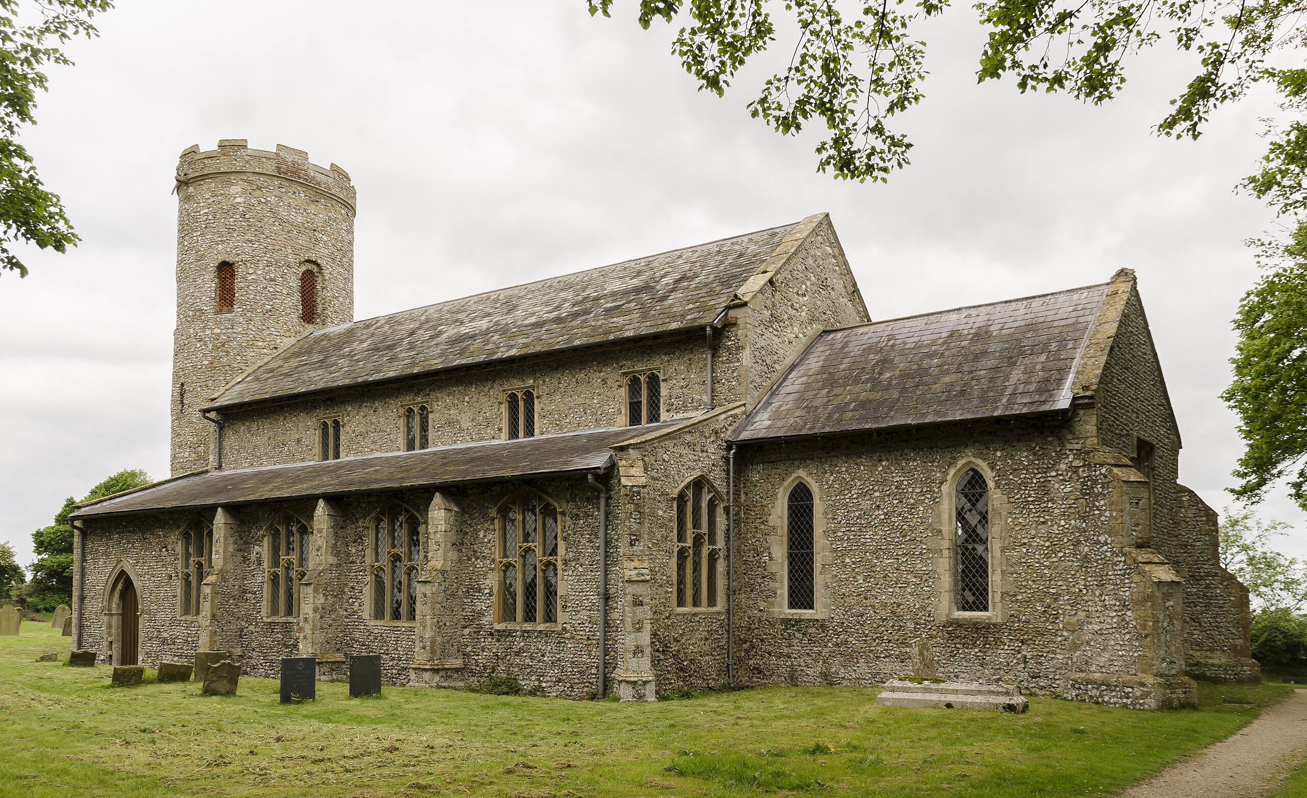
Grade I listed The oldest part of the church probably dates from the 11th century, that is the tower. The nave and aisles are from the 13th century, chancel 14th century, and clerestory added in the 15th century. There is a round west tower, nave with north and south aisles, clerestory, chancel, and north porch. The church is built in flint with stone dressings, and slate roofs. The interior is whitewashed. The doorway into the tower may be Anglo-Saxon, the upper part having honeycomb brick windows to the belfry, and there is an embattled parapet. The nave has a 13th century five bay arcade on the north aisle with short circular piers, the south aisle is slightly later, the western end is 14th century with octagonal piers. The eastern arches have a parclose screen which crosses the nave about halfway. The Rood screen has date of 1458. The Rood stairs are to the north There are fragments of wall painting above the chancel arch. The chancel has 13th C. lancets, the only stained-glass window in the church is a two light east window depicting Saint Margaret of Antioch and Saint Margaret of Scotland. There is an excellent 15th century painted wineglass pulpit depicting the Latin Doctors of the church and portraits of the donors. There is also an early 17th century single decker pulpit with a tester. The Norman font has a rectangular bowl and is on five piers. It has arches and diamond patterns. By the north door there is an opening which is probably an old wafer oven. There is a small modern organ by Pulham. |
| Date | |
| Source | Burnham Norton, St Margaret's church from south east |
| Author | Jules & Jenny from Lincoln, UK |
| Camera location | | View this and other nearby images on: OpenStreetMap |
|---|
.jpg¶ms=052.950887_N_0000.729925_E_globe:Earth_type:camera_source:Flickr_&language=en)
Licensing
[edit].jpg&action=edit§ion=2)
- You are free:
- to share – to copy, distribute and transmit the work
- to remix – to adapt the work
- Under the following conditions:
- attribution – You must give appropriate credit, provide a link to the license, and indicate if changes were made. You may do so in any reasonable manner, but not in any way that suggests the licensor endorses you or your use.
| This image was originally posted to Flickr by Jules & Jenny at https://flickr.com/photos/78914786@N06/28930022120 (archive). It was reviewed on 6 August 2018 by FlickreviewR 2 and was confirmed to be licensed under the terms of the cc-by-2.0. |
File history
Click on a date/time to view the file as it appeared at that time.
| Date/Time | Thumbnail | Dimensions | User | Comment | |
|---|---|---|---|---|---|
| current | 22:46, 6 August 2018 | | 4,665 × 2,847 (5.83 MB) | Tm (talk | contribs) | Transferred from Flickr via #flickr2commons |
You cannot overwrite this file.
File usage on Commons
There are no pages that use this file.
.jpg&oldid=877752575)