File:C-130E “Hercules” (49870817288).jpg

Original file (6,000 × 4,000 pixels, file size: 11.71 MB, MIME type: image/jpeg)
Captions
Captions
Summary
[edit].jpg&action=edit§ion=1)
| Description |
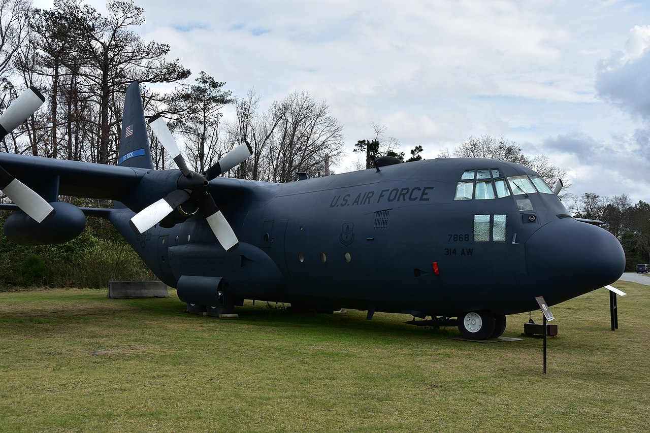
From the museum website: BY LOCKHEED Introduced in August 1962, the C-130E conducted critical United States Air Force (USAF) missions during the Vietnam War through the wars in Afghanistan and Iraq. It also supported countless USAF humanitarian efforts around the globe and in all climates. Originally designed by Lockheed as an assault transport capable of operating from unpaved airstrips, the C-130 Hercules made its first flight in August 1954. Over the next half century, the USAF used various versions of this versatile aircraft for aeromedical evacuation, mid-air refueling of helicopters, mid-air space capsule recovery, search and rescue, reconnaissance, as a gunship, and for many other missions. The C-130E (serial number 63-7868) on display entered service in April 1964. It had a long career, including extensive service in Southeast Asia during the Vietnam War for both the USAF and Air America. Before the Vietnam War, 7868 participated in Operation Red Dragon, the deployment of Belgian paratroopers and the rescue of hostages in the Congo in November 1964. The aircraft’s last assignment was to Little Rock Air Force Base, Arkansas, where it was used for aircrew training. This aircraft was retired in September 2011 after being in service for 47 years. SPECIFICATIONS: Span: 132 ft. 7 in. Length: 97 ft. 9 in. Height: 38 ft. 10 in. Weight: 155,000 lbs. max. Maximum load: Six pallets or 74 litters or 16 container delivery system bundles or 92 combat troops or 64 paratroopers or any combination of these up to 42,000 lbs. Engines: Four Allison T-56-A-7 turboprops of 4,200 hp. ea. Cost: $2,159,474 Crew: 4 Serial Number: 63-7868 PERFORMANCE: Speed: 345 mph. at 20,000 ft. Range: 1,438 miles with 35,000 lbs. of payload Service ceiling: 19,000 ft. with 42,000 lbs. of payload Photo by Eric Friedebach |
| Date | |
| Source | C-130E “Hercules” |
| Author | Eric Friedebach |
| Camera location | | View this and other nearby images on: OpenStreetMap |
|---|
.jpg¶ms=032.593572_N_-083.585631_E_globe:Earth_type:camera_source:Flickr_&language=en)
Licensing
[edit].jpg&action=edit§ion=2)
- You are free:
- to share – to copy, distribute and transmit the work
- to remix – to adapt the work
- Under the following conditions:
- attribution – You must give appropriate credit, provide a link to the license, and indicate if changes were made. You may do so in any reasonable manner, but not in any way that suggests the licensor endorses you or your use.
| This image was originally posted to Flickr by Eric Friedebach at https://flickr.com/photos/146295701@N02/49870817288. It was reviewed on 10 May 2020 by FlickreviewR 2 and was confirmed to be licensed under the terms of the cc-by-2.0. |
File history
Click on a date/time to view the file as it appeared at that time.
| Date/Time | Thumbnail | Dimensions | User | Comment | |
|---|---|---|---|---|---|
| current | 14:35, 10 May 2020 | | 6,000 × 4,000 (11.71 MB) | Tm (talk | contribs) | Transferred from Flickr via #flickr2commons |
You cannot overwrite this file.
File usage on Commons
There are no pages that use this file.
.jpg&oldid=921867477)