File:Caerphilly UK location map.svg
Aller à la navigation
Aller à la recherche

Taille de cet aperçu PNG pour ce fichier SVG : 423 × 599 pixels. Autres résolutions : 169 × 240 pixels | 339 × 480 pixels | 542 × 768 pixels | 723 × 1 024 pixels | 1 446 × 2 048 pixels | 894 × 1 266 pixels.
Fichier d’origine (Fichier SVG, nominalement de 894 × 1 266 pixels, taille : 625 kio)
Légendes
Légendes
Ajoutez en une ligne la description de ce que représente ce fichier
| Description |
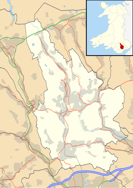
Blank map of Caerphilly, UK with the following information shown:
Equirectangular map projection on WGS 84 datum, with N/S stretched 160% Geographic limits:
|
| Date | |
| Source |
|
| Auteur | Nilfanion, created using Ordnance Survey data |
| Autorisation (Réutilisation de ce fichier) |
Ce fichier est disponible selon les termes de la licence Creative Commons Attribution – Partage dans les Mêmes Conditions 3.0 (non transposée). Attribution: Contains Ordnance Survey data © Crown copyright and database right
|
| Autres versions | File:Caerphilly UK map.svg - Blank map |
Historique du fichier
Cliquer sur une date et heure pour voir le fichier tel qu'il était à ce moment-là.
| Date et heure | Vignette | Dimensions | Utilisateur | Commentaire | |
|---|---|---|---|---|---|
| actuel | 26 septembre 2010 à 19:28 | | 894 × 1 266 (625 kio) | Nilfanion (d | contributions) | {{Information |Description=Blank map of Caerphilly, UK with the following information shown: *Administrative borders *Coastline, lakes and rivers *Roads and railways *Urban areas Equirectangular map projection on WGS 84 datum, with N/S st |
Vous ne pouvez pas remplacer ce fichier.
Utilisations locales du fichier
La page suivante utilise ce fichier :
Utilisations du fichier sur d’autres wikis
Les autres wikis suivants utilisent ce fichier :
- Utilisation sur ar.wikipedia.org
- Utilisation sur ceb.wikipedia.org
- Utilisation sur cy.wikipedia.org
- Utilisation sur en.wikipedia.org
- Abercarn
- Caerphilly
- Welsh Football League Division Two
- Bargoed
- Caerphilly County Borough
- Rhymney
- Risca
- Caerphilly District Miners Hospital
- Crumlin, Caerphilly
- Cwmcarn
- Ystrad Mynach
- Trethomas
- Bedwas
- Machen
- Newbridge, Caerphilly
- Blackwood, Caerphilly
- Aberbargoed
- Abertysswg
- Hengoed
- Pengam
- Van, Caerphilly
- Cefn Mably House
- New Tredegar
- Pontllanfraith
- Nelson, Caerphilly
- Maesycwmmer
- Fochriw
- Aberbargoed Hospital
- Oakdale Hospital
- Redwood Memorial Hospital
- Ystrad Mynach Hospital
- Oakdale, Caerphilly
- Penmaen, Caerphilly
- Llanbradach
- Hafodyrynys
- Senghenydd
- Argoed, Caerphilly
- Markham, Caerphilly
- Penallta Colliery
- Ynysddu
- Darran Valley
- Module:Location map/data/Wales Caerphilly/doc
- Deri, Caerphilly
- Tir-Phil
- Cefn Fforest
- Morgraig Castle
- List of Sites of Special Scientific Interest in Caerphilly County Borough
Voir davantage sur l’utilisation globale de ce fichier.