File:Camargue map.png
跳至導覽
跳至搜尋
無更高解析度可提供。
Camargue_map.png (718 × 396 像素,檔案大小:42 KB,MIME 類型:image/png)
說明
說明
添加單行說明來描述出檔案所代表的內容
摘要[編輯]
| 描述 | ||||
| 日期 | ||||
| 來源 | Combination of CIA World Factbook map (Image:Fr-map.png) and Demis Map Server (http://www2.demis.nl/mapserver/mapper.asp) data with additional annotations and modifications by self. | |||
| 作者 | ChrisO | |||
| 其他版本 |
File:Camargue, Petite Caramgue et Parc naturel reg.png (relaunched and actualized)
|

檔案歷史
點選日期/時間以檢視該時間的檔案版本。
| 日期/時間 | 縮圖 | 尺寸 | 使用者 | 備註 | |
|---|---|---|---|---|---|
| 目前 | 2016年4月29日 (五) 21:34 | | 718 × 396(42 KB) | Rsuessbr(留言 | 貢獻) | Writing of Petite-Camargue corrected |
| 2015年8月10日 (一) 17:15 |  | 718 × 396(42 KB) | Rsuessrb(留言 | 貢獻) | Added: limits of the natural park (according to a map published by snpn (Société Nationale de Protection de la Nature), 2015 | |
| 2012年3月20日 (二) 01:23 |  | 718 × 396(38 KB) | Ras67(留言 | 貢獻) | cropped | |
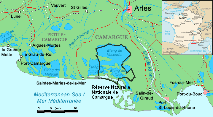
| 2006年8月16日 (三) 20:52 |  | 720 × 398(41 KB) | ChrisO(留言 | 貢獻) | Map of the Camargue region, southern France By ~~~, derived from open source mapping | |
| 2006年8月16日 (三) 20:46 |  | 720 × 398(40 KB) | ChrisO(留言 | 貢獻) | Map of the Camargue region, southern France By ~~~, derived from open source mapping |
無法覆蓋此檔案。
檔案用途
下列4個頁面有用到此檔案:
全域檔案使用狀況
以下其他 wiki 使用了這個檔案:
- af.wikipedia.org 的使用狀況
- ar.wikipedia.org 的使用狀況
- az.wikipedia.org 的使用狀況
- br.wikipedia.org 的使用狀況
- co.wikipedia.org 的使用狀況
- cs.wikipedia.org 的使用狀況
- cy.wikipedia.org 的使用狀況
- de.wikipedia.org 的使用狀況
- en.wikipedia.org 的使用狀況
- eo.wikipedia.org 的使用狀況
- es.wikipedia.org 的使用狀況
- fi.wikipedia.org 的使用狀況
- fr.wikipedia.org 的使用狀況
- gl.wikipedia.org 的使用狀況
- hu.wikipedia.org 的使用狀況
- id.wikipedia.org 的使用狀況
- it.wikipedia.org 的使用狀況
- ja.wikipedia.org 的使用狀況
- ko.wikipedia.org 的使用狀況
- lt.wikipedia.org 的使用狀況
- nl.wikipedia.org 的使用狀況
- nn.wikipedia.org 的使用狀況
- no.wikipedia.org 的使用狀況
- oc.wikipedia.org 的使用狀況
檢視此檔案的更多全域使用狀況。