File:Cameroun 1901-1916.png
(Redirected from File:Cameroun 1901-1916.gif)

Size of this preview: 800 × 509 pixels. Other resolutions: 320 × 204 pixels | 640 × 407 pixels | 1,024 × 652 pixels | 1,332 × 848 pixels.
Original file (1,332 × 848 pixels, file size: 77 KB, MIME type: image/png)
Captions
Captions
Add a one-line explanation of what this file represents

Summary
[edit]
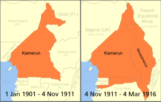
| Description | Boundary changes in w:Cameroon |
| Date | |
| Source | Commons |
| Author | User:Roke |
| Permission (Reusing this file) |
self made based on public domain CIA map Image:Cameroon Map.jpg, original svg file located here |
Licensing
[edit]

|
Permission is granted to copy, distribute and/or modify this document under the terms of the GNU Free Documentation License, Version 1.2 or any later version published by the Free Software Foundation; with no Invariant Sections, no Front-Cover Texts, and no Back-Cover Texts. A copy of the license is included in the section entitled GNU Free Documentation License. |
| This file is licensed under the Creative Commons Attribution-Share Alike 3.0 Unported license. | ||
| ||
| This licensing tag was added to this file as part of the GFDL licensing update. |
Original upload log
[edit]
| Date/Time | Dimensions | User | Comment |
|---|---|---|---|
| 15 June 2008, 18:16:56 | 1332 × 848 (72831 bytes) | Octave.H (talk · contribs) | {{Information |Description=Boundary changes in w:Cameroon |Source=Commons |Date=15 juin 2008 |Author=[[User:Roke]] |Permission=self made based on public domain CIA map [[:Image:Cameroon Map.jpg]], original svg file located [[:Image:Cameroon border changes |
File history
Click on a date/time to view the file as it appeared at that time.
| Date/Time | Thumbnail | Dimensions | User | Comment | |
|---|---|---|---|---|---|
| current | 07:18, 29 August 2014 | | 1,332 × 848 (77 KB) | GifTagger (talk | contribs) | Bot: Converting file to superior PNG file. (Source: Cameroun_1901-1916.gif). This GIF was problematic due to non-greyscale color table. |
You cannot overwrite this file.
File usage on Commons
The following page uses this file:
- File:Cameroun 1901-1916.gif (file redirect)
File usage on other wikis
The following other wikis use this file:
- Usage on da.wikipedia.org
- Usage on es.wikipedia.org
- Usage on eu.wikipedia.org
- Usage on fr.wikipedia.org
- Usage on gl.wikipedia.org
- Usage on no.wikipedia.org
- Usage on ru.wikipedia.org