File:Cape Reinga 14 April 2007 (5796244406).jpg
Jump to navigation
Jump to search

Size of this preview: 799 × 599 pixels. Other resolutions: 320 × 240 pixels | 640 × 480 pixels | 965 × 724 pixels.
Original file (965 × 724 pixels, file size: 119 KB, MIME type: image/jpeg)
Captions
Captions
Add a one-line explanation of what this file represents
Summary
[edit].jpg&action=edit§ion=1)
| Description |
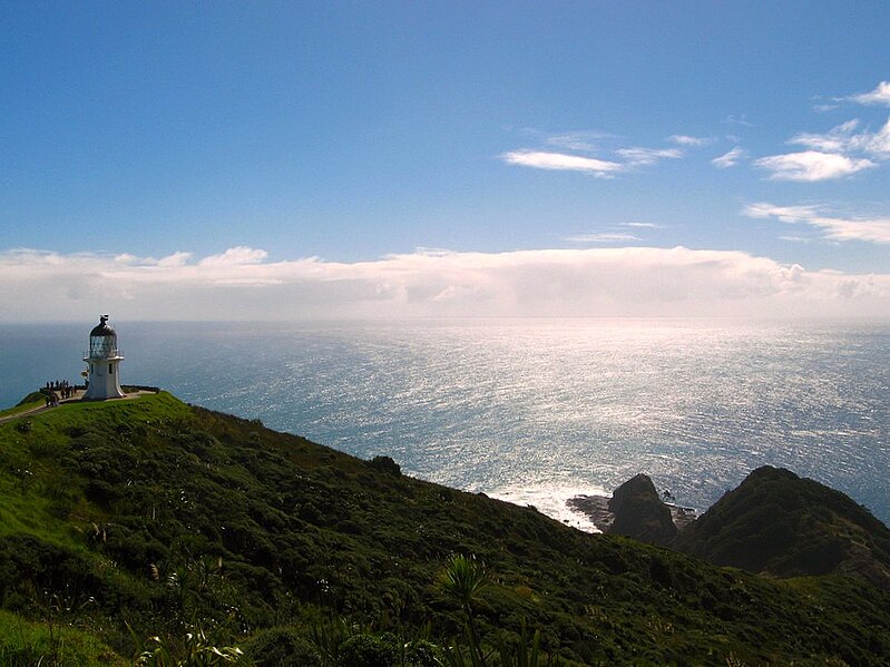
Cape Reinga (Te Reinga or Te Rerenga Wairua in Māori) is the northwesternmost tip of the Aupouri Peninsula, at the northern end of the North Island of New Zealand. Cape Reinga is located over 100 km north of the nearest small town of Kaitaia. State Highway 1 extends all the way to the Cape, but until 2010 was unsealed gravel road for the last 19km. Suitable vehicles can also travel much of the way via Ninety Mile Beach and Te Paki stream bed. The name of the cape comes from the Māori word 'Reinga', meaning the 'Underworld'. Another Māori name is 'Te Rerenga Wairua', meaning the leaping-off place of spirits. Both refer to the Māori belief that the cape is the point where the spirits of the dead enter the underworld. |
| Date | |
| Source | Cape Regina 14 April 2007 |
| Author | Mark in New Zealand |
| Camera location | | View this and other nearby images on: OpenStreetMap |
|---|
.jpg¶ms=-34.447688_N_0172.700500_E_globe:Earth_type:camera_source:Flickr_&language=en)
Licensing
[edit].jpg&action=edit§ion=2)
This file is licensed under the Creative Commons Attribution-Share Alike 2.0 Generic license.
- You are free:
- to share – to copy, distribute and transmit the work
- to remix – to adapt the work
- Under the following conditions:
- attribution – You must give appropriate credit, provide a link to the license, and indicate if changes were made. You may do so in any reasonable manner, but not in any way that suggests the licensor endorses you or your use.
- share alike – If you remix, transform, or build upon the material, you must distribute your contributions under the same or compatible license as the original.
| This image was originally posted to Flickr by Mark in New Zealand at https://flickr.com/photos/43346777@N06/5796244406. It was reviewed on 4 November 2020 by FlickreviewR 2 and was confirmed to be licensed under the terms of the cc-by-sa-2.0. |
File history
Click on a date/time to view the file as it appeared at that time.
| Date/Time | Thumbnail | Dimensions | User | Comment | |
|---|---|---|---|---|---|
| current | 07:18, 4 November 2020 | | 965 × 724 (119 KB) | JotaCartas (talk | contribs) | Transferred from Flickr via #flickr2commons |
You cannot overwrite this file.
File usage on Commons
The following page uses this file:
- File:Cape Regina 14 April 2007 (5796244406).jpg (file redirect)
.jpg&redirect=no)
.jpg&oldid=847678730)