File:Cardiff UK relief location map.jpg
跳至導覽
跳至搜尋

預覽大小:561 × 599 像素。 其他解析度:225 × 240 像素 | 450 × 480 像素 | 719 × 768 像素 | 959 × 1,024 像素 | 2,010 × 2,146 像素。
原始檔案 (2,010 × 2,146 像素,檔案大小:254 KB,MIME 類型:image/jpeg)
說明
說明
添加單行說明來描述出檔案所代表的內容
| 描述 |
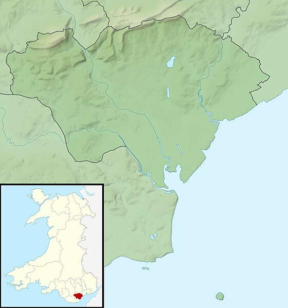
Relief map of Cardiff, UK. Equirectangular map projection on WGS 84 datum, with N/S stretched 160% Geographic limits:
|
| 日期 | |
| 來源 |
|
| 作者 | Nilfanion, created using Ordnance Survey data |
| 授權許可 (重用此檔案) |
此檔案採用創用CC 姓名標示-相同方式分享 3.0 未在地化版本授權條款。 姓名標示: Contains Ordnance Survey data © Crown copyright and database right
|
| 其他版本 | File:Cardiff UK map.svg - Blank map |
檔案歷史
點選日期/時間以檢視該時間的檔案版本。
| 日期/時間 | 縮圖 | 尺寸 | 使用者 | 備註 | |
|---|---|---|---|---|---|
| 目前 | 2011年11月30日 (三) 00:56 | | 2,010 × 2,146(254 KB) | Nilfanion(留言 | 貢獻) | {{Information |Description=Relief map of Cardiff, UK. Equirectangular map projection on WGS 84 datum, with N/S stretched 160% Geographic limits: *West: 3.35W *East: 3.05W *North: 51.57N *South: 51.37N |Source=[[w:Ordnance Survey|Ordnance S |
無法覆蓋此檔案。
檔案用途
下列35個頁面有用到此檔案:
- Cardiff / Caerdydd
- Category:Births in Cardiff
- Category:Bridges in Cardiff
- Category:Cardiff
- Category:Cardiff in the 1940s
- Category:Cardiff in the 1950s
- Category:Cardiff in the 1960s
- Category:Cardiff in the 1970s
- Category:Cardiff in the 1980s
- Category:Cardiff in the 1990s
- Category:Cardiff in the 19th century
- Category:Cardiff in the 2000s
- Category:Cardiff in the 2010s
- Category:Cardiff in the 2020s
- Category:Cardiff in the 20th century
- Category:Cardiff in the 21st century
- Category:Castles in Cardiff
- Category:Cemeteries in Cardiff
- Category:Deaths in Cardiff
- Category:Disused railway stations in Cardiff
- Category:Education in Cardiff
- Category:Festivals in Cardiff
- Category:Hospitals in Cardiff
- Category:Maps of Cardiff
- Category:Parks in Cardiff
- Category:Populated places in Cardiff
- Category:Primary schools in Cardiff
- Category:Railway stations in Cardiff
- Category:Religion in Cardiff
- Category:Rivers of Cardiff
- Category:Roads in Cardiff
- Category:Sports venues in Cardiff
- Category:Streets in Cardiff
- Category:Views of Cardiff
- Category:Villages in Cardiff
全域檔案使用狀況
以下其他 wiki 使用了這個檔案:
- ar.wikipedia.org 的使用狀況
- ceb.wikipedia.org 的使用狀況
- de.wikipedia.org 的使用狀況
- el.wikipedia.org 的使用狀況
- en.wikipedia.org 的使用狀況
- St Padarn's Institute
- St Fagans Castle
- Animal Wall
- Llanishen Reservoir
- Module:Location map/data/Wales Cardiff/doc
- Lisvane Reservoir
- Bishop's Palace, Llandaff
- Wenallt Camp
- Jackson Hall, Cardiff
- Shah Jalal Mosque, Cardiff
- 6 High Street, Llandaff
- Module:Location map/data/Wales Cardiff
- Ty Bronna
- Craig-y-parc House
- Hayes Island Snack Bar
- Twmpath Castle
- Morganstown Castle Mound
- Caer Castell Camp
- St Andrew, Llandaff
- St Cross, Llandaff
- 19 High Street, Llandaff
- 2-4 High Street, Llandaff
- es.wikipedia.org 的使用狀況
- fr.wikipedia.org 的使用狀況
- he.wikipedia.org 的使用狀況
- hu.wikipedia.org 的使用狀況
- ja.wikipedia.org 的使用狀況
- kn.wikipedia.org 的使用狀況
- ko.wikipedia.org 的使用狀況
- pl.wikipedia.org 的使用狀況
- pl.wikibooks.org 的使用狀況
- sh.wikipedia.org 的使用狀況
- si.wikipedia.org 的使用狀況
- tr.wikipedia.org 的使用狀況
檢視此檔案的更多全域使用狀況。