File:Carte d l'île de Saint Domingue LOC 73695996.jpg
Jump to navigation
Jump to search
Size of this preview: 779 × 599 pixels. Other resolutions: 312 × 240 pixels | 624 × 480 pixels | 998 × 768 pixels | 1,280 × 985 pixels | 2,560 × 1,970 pixels | 7,501 × 5,772 pixels.
Original file (7,501 × 5,772 pixels, file size: 5.64 MB, MIME type: image/jpeg)
Captions
Captions
Add a one-line explanation of what this file represents
Summary
[edit]| Description |
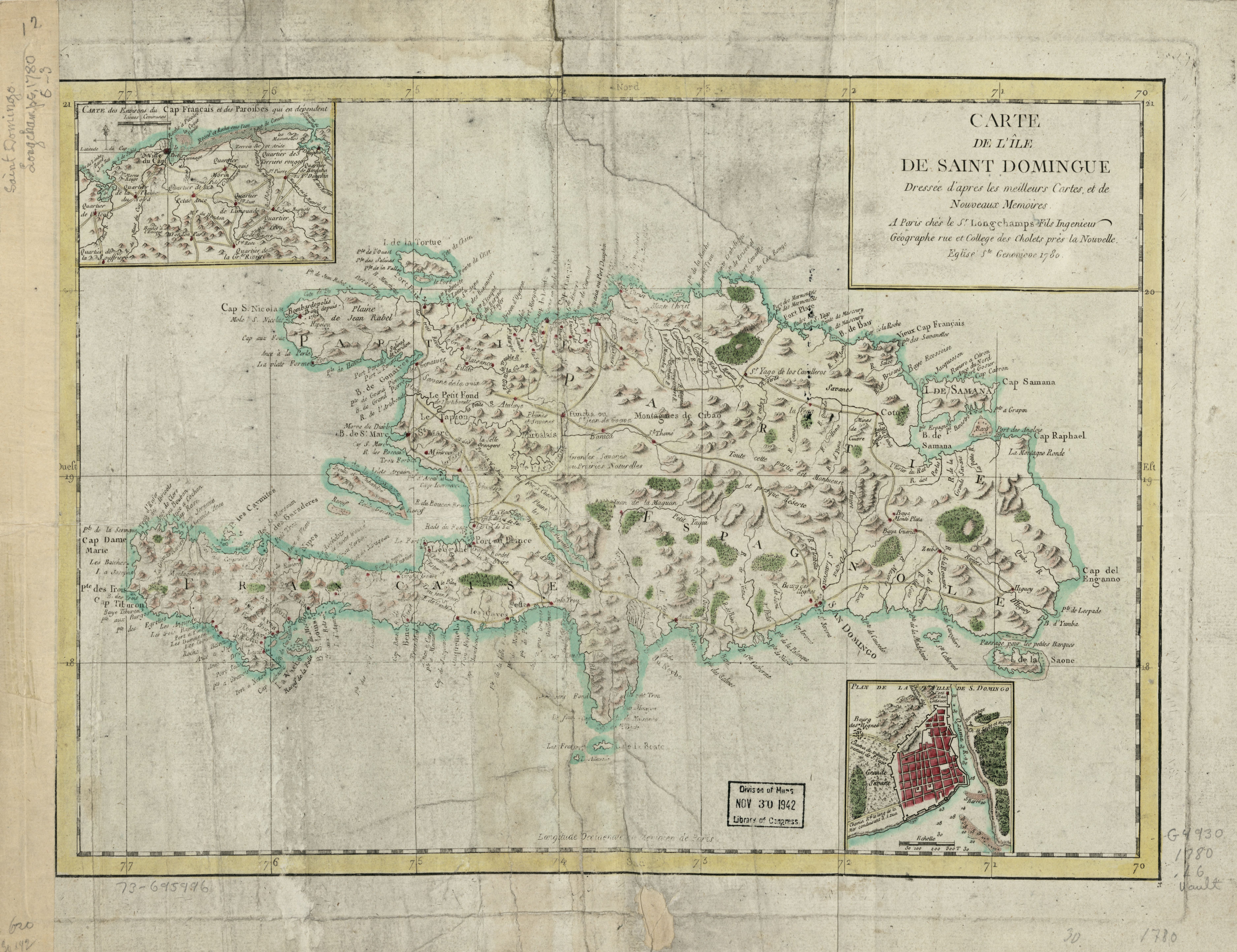
English: Scale ca. 1:1,550,000. Hand colored. Relief shown pictorially. LC Maps of North America, 1750-1789, 1859 Available also through the Library of Congress Web site as a raster image. "Longitude occidentale du méridien de Paris." Insets: Carte des environs du Cap Français et des paroisses qui en dépendent.--Plan de la ville de S. Domingo. Vault |
||
| Title | Carte d l'île de Saint Domingue | ||
| Shelf ID | G4930 1780 .L6 | ||
| Date | |||
| Source | https://www.loc.gov/item/73695996/ | ||
| Author | Des Longchamps, Jacques Francois | ||
| Permission (Reusing this file) |
|
||
| Other versions |
|
||
| Location | Hispaniola | ||
| Part of | Military Battles And Campaigns · American Memory · Catalog · Geography And Map Division · American Revolution And Its Era: Maps And Charts Of North America And The West Indies, 1750-1789 | ||
| Subject | Early Maps · Maps · Hispaniola · Early Works To 1800 |


Licensing
[edit]
|
This is a faithful photographic reproduction of a two-dimensional, public domain work of art. The work of art itself is in the public domain for the following reason:
The official position taken by the Wikimedia Foundation is that "faithful reproductions of two-dimensional public domain works of art are public domain".
This photographic reproduction is therefore also considered to be in the public domain in the United States. In other jurisdictions, re-use of this content may be restricted; see Reuse of PD-Art photographs for details. | ||||
File history
Click on a date/time to view the file as it appeared at that time.
| Date/Time | Thumbnail | Dimensions | User | Comment | |
|---|---|---|---|---|---|
| current | 11:23, 20 May 2018 | | 7,501 × 5,772 (5.64 MB) | Fæ (talk | contribs) | LOC Maps https://www.loc.gov/item/73695996/ #199 |
You cannot overwrite this file.
File usage on Commons
The following page uses this file: