File:Carte topographique des environs de Maestricht et de Bilsen avec une partie de ceux de Tongres et Faucquemont (L E Demarne, 1748), détail 8 Sint-Geertruid.jpg
Jump to navigation
Jump to search

Size of this preview: 757 × 600 pixels. Other resolutions: 303 × 240 pixels | 606 × 480 pixels | 970 × 768 pixels | 1,280 × 1,014 pixels | 2,560 × 2,027 pixels | 2,711 × 2,147 pixels.
Original file (2,711 × 2,147 pixels, file size: 996 KB, MIME type: image/jpeg)
Captions
Captions
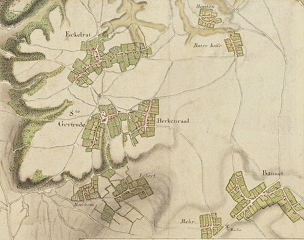
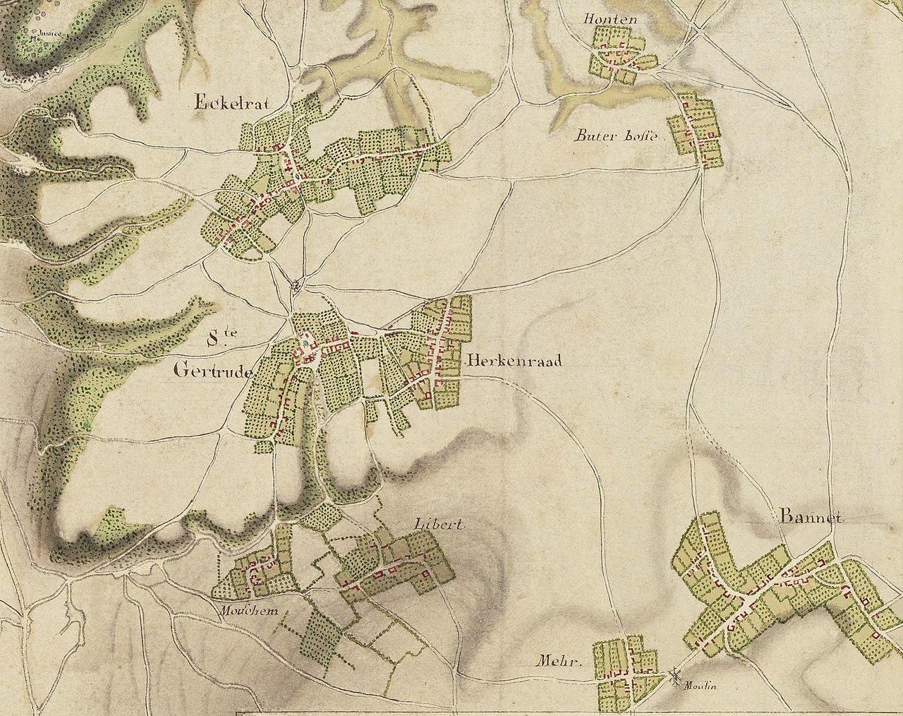
Detail of a French map of the area around Maastricht, the Netherlands, during the siege of 1748.
Summary
[edit]| Description |
Nederlands: Detail van een Franse militaire kaart van het Beleg van Maastricht van 1673. Hier het gebied ten zuidoosten van Maastricht met o.a. Eckelrade, Sint-Geertruid en Balholt. |
| Date | |
| Source | https://gallica.bnf.fr/ark:/12148/btv1b52507004j/f1.item.r=Maestricht.zoom |
| Author | L.E. Demarne |
| Other versions |
.jpg)
,_d%C3%A9tail_8_Sint-Geertruid.jpg&action=edit§ion=1)
Licensing
[edit],_d%C3%A9tail_8_Sint-Geertruid.jpg&action=edit§ion=2)
|
This work is in the public domain in its country of origin and other countries and areas where the copyright term is the author's life plus 70 years or fewer. This work is in the public domain in the United States because it was published (or registered with the U.S. Copyright Office) before January 1, 1929. | |
| This file has been identified as being free of known restrictions under copyright law, including all related and neighboring rights. | |
File history
Click on a date/time to view the file as it appeared at that time.
| Date/Time | Thumbnail | Dimensions | User | Comment | |
|---|---|---|---|---|---|
| current | 12:17, 25 October 2021 | | 2,711 × 2,147 (996 KB) | Kleon3 (talk | contribs) | Uploaded a work by L.E. Demarne from https://gallica.bnf.fr/ark:/12148/btv1b52507004j/f1.item.r=Maestricht.zoom with UploadWizard |
You cannot overwrite this file.
File usage on Commons
The following page uses this file:
File usage on other wikis
The following other wikis use this file:
- Usage on nl.wikipedia.org
,_détail_8_Sint-Geertruid.jpg&oldid=849350387)