File:Caucasus-political ca.svg
Jump to navigation
Jump to search

Size of this PNG preview of this SVG file: 632 × 599 pixels. Other resolutions: 253 × 240 pixels | 506 × 480 pixels | 810 × 768 pixels | 1,080 × 1,024 pixels | 2,159 × 2,048 pixels | 972 × 922 pixels.
Original file (SVG file, nominally 972 × 922 pixels, file size: 369 KB)
Captions
Captions
Add a one-line explanation of what this file represents
Summary[edit]
| Description |
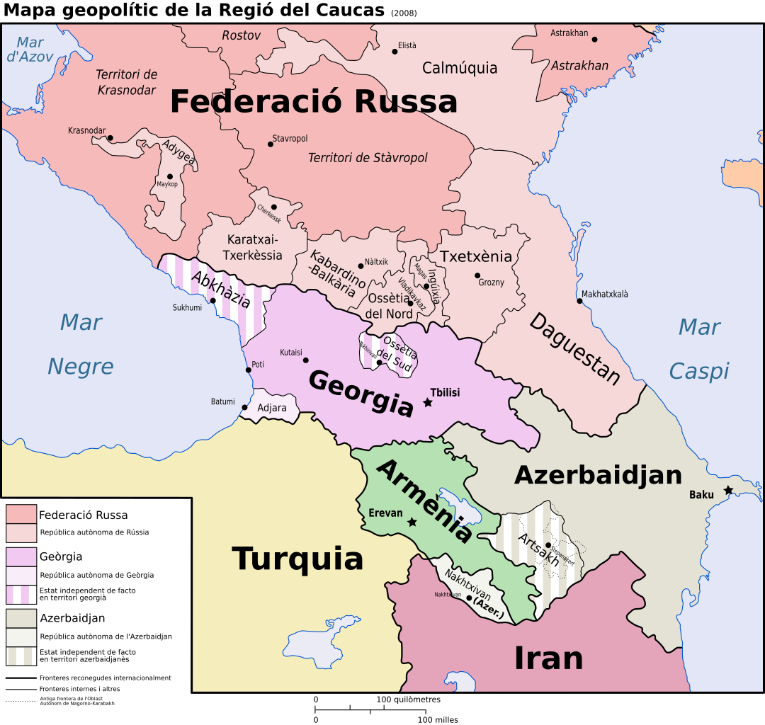
Català: Mapa geopolític de la regió del Caucas
English: Geopolitical map of the Caucasus Region |
| Date | |
| Source | |
| Author | Jeroencommons |
| Permission (Reusing this file) |
GFDL && CC-BY |
| Other versions |
[]
|


.png)


|
This SVG file contains embedded text that can be translated into your language, using any capable SVG editor, text editor or the SVG Translate tool. For more information see: About translating SVG files. |
This W3C-unspecified vector image was created with Inkscape .
Licensing[edit]
This file is licensed under the Creative Commons Attribution-Share Alike 2.5 Generic license.
- You are free:
- to share – to copy, distribute and transmit the work
- to remix – to adapt the work
- Under the following conditions:
- attribution – You must give appropriate credit, provide a link to the license, and indicate if changes were made. You may do so in any reasonable manner, but not in any way that suggests the licensor endorses you or your use.
- share alike – If you remix, transform, or build upon the material, you must distribute your contributions under the same or compatible license as the original.
File history
Click on a date/time to view the file as it appeared at that time.
| Date/Time | Thumbnail | Dimensions | User | Comment | |
|---|---|---|---|---|---|
| current | 17:44, 12 December 2020 | | 972 × 922 (369 KB) | Jordi picart (talk | contribs) | Uploaded a work by Jeroencommons from {{Ef|Caucasus-political nl.svg}} with UploadWizard |
You cannot overwrite this file.
File usage on Commons
The following 21 pages use this file:
- User:Magog the Ogre/Multilingual legend/2020 December 11-20
- File:Caucasus-political-fr.svg
- File:Caucasus-political-krc.svg
- File:Caucasus-political-ru.svg
- File:Caucasus-political-tr.svg
- File:Caucasus-political (hy).png
- File:Caucasus-political Fa.svg
- File:Caucasus-political ca.svg
- File:Caucasus-political cs.svg
- File:Caucasus-political de.svg
- File:Caucasus-political en.svg
- File:Caucasus-political es.svg
- File:Caucasus-political ja.svg
- File:Caucasus-political mk.svg
- File:Caucasus-political mzn.svg
- File:Caucasus-political nl.svg
- File:Caucasus-political pl.svg
- File:Caucasus-political pt.svg
- File:Caucasus-political vi.svg
- File:Kaukasian geopoliittinen kartta.svg
- Template:Other versions/Caucasus-political