File:Caucasus 1000 map de.png
ナビゲーションに移動
検索に移動

このプレビューのサイズ: 771 × 599 ピクセル。 その他の解像度: 309 × 240 ピクセル | 618 × 480 ピクセル | 988 × 768 ピクセル | 1,280 × 995 ピクセル | 2,560 × 1,990 ピクセル | 2,990 × 2,324 ピクセル。
元のファイル (2,990 × 2,324 ピクセル、ファイルサイズ: 3.74メガバイト、MIME タイプ: image/png)
キャプション
キャプション
このファイルの内容を1行で記述してください
|
概要[編集]
| 解説 |
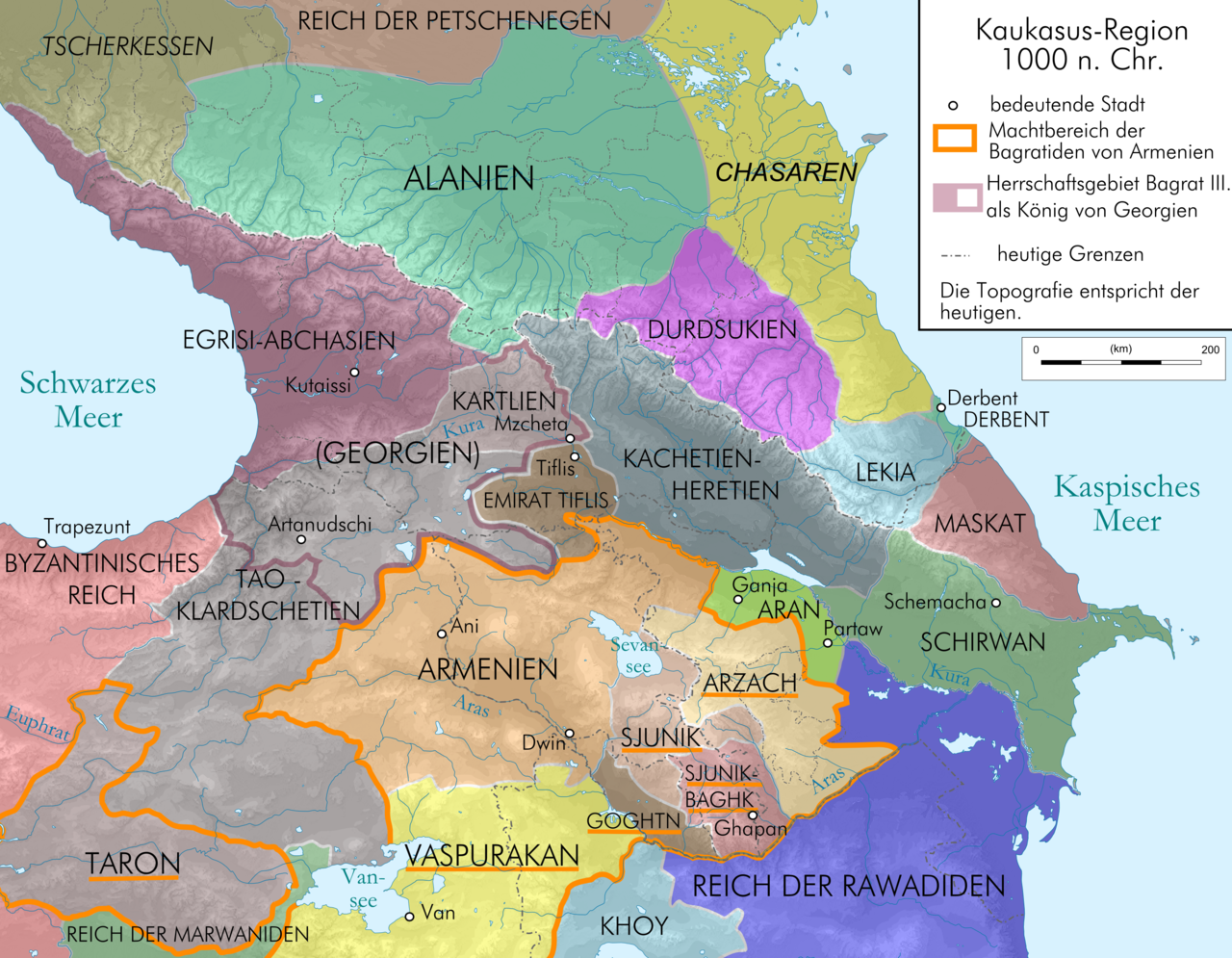
English: Map of Caucasus Region at 1000 AD before death of Dawit III., in German.
Deutsch: Kaukasus-Region 1000 n. Chr. vor dem Tod Dawits III.; Quellen sind Putzger historischer Weltatlas Ausgabe 2005, Heinz Fähnrich: Geschichte Georgiens von den Anfängen bis zur Mongolenherrschaft. Shaker, Aachen 1993, ISBN 3-86111-683-9, File:Georgia map 830-1020.gif , File:Arcax.jpg , File:Vaspurakan kingdom 908-1021 map-fr.svg , http://www.armenica.org/cgi-bin/armenica.cgi?178711717323498=1=3==Armenia==1=3=AAA , File:Alania 10 12.png |
| 日付 | |
| 原典 | Own work by uploaderderivate of File:Caucasus topographic map-fr.svg |
| 作者 | Don-kun |
| その他のバージョン |
   |
ライセンス[編集]
この作品の著作権者である私は、この作品を以下のライセンスで提供します。
このファイルはクリエイティブ・コモンズ 表示-継承 3.0 非移植ライセンスのもとに利用を許諾されています。
- あなたは以下の条件に従う場合に限り、自由に
- 共有 – 本作品を複製、頒布、展示、実演できます。
- 再構成 – 二次的著作物を作成できます。
- あなたの従うべき条件は以下の通りです。
- 表示 – あなたは適切なクレジットを表示し、ライセンスへのリンクを提供し、変更があったらその旨を示さなければなりません。これらは合理的であればどのような方法で行っても構いませんが、許諾者があなたやあなたの利用行為を支持していると示唆するような方法は除きます。
- 継承 – もしあなたがこの作品をリミックスしたり、改変したり、加工した場合には、あなたはあなたの貢献部分を元の作品とこれと同一または互換性があるライセンスの下に頒布しなければなりません。

|
この文書は、フリーソフトウェア財団発行のGNUフリー文書利用許諾書 (GNU Free Documentation License) 1.2またはそれ以降のバージョンの規約に基づき、複製や再配布、改変が許可されます。不可変更部分、表紙、背表紙はありません。このライセンスの複製は、GNUフリー文書利用許諾書という章に含まれています。 |
あなたは上記のライセンスから、どれか一つ以上を選択できます。
ファイルの履歴
過去の版のファイルを表示するには、その版の日時をクリックしてください。
| 日付と時刻 | サムネイル | 寸法 | 利用者 | コメント | |
|---|---|---|---|---|---|
| 現在の版 | 2010年1月13日 (水) 23:02 | | 2,990 × 2,324 (3.74メガバイト) | Don-kun (トーク | 投稿記録) | correction, new sources |
| 2009年6月19日 (金) 15:10 |  | 3,000 × 2,332 (3.69メガバイト) | Don-kun (トーク | 投稿記録) | k | |
| 2009年6月19日 (金) 15:01 |  | 3,000 × 2,332 (3.69メガバイト) | Don-kun (トーク | 投稿記録) | small cor | |
| 2009年6月19日 (金) 11:32 |  | 3,000 × 2,332 (3.69メガバイト) | Don-kun (トーク | 投稿記録) | change colors | |
| 2009年6月18日 (木) 17:20 |  | 3,000 × 2,332 (3.83メガバイト) | Don-kun (トーク | 投稿記録) | change text | |
| 2009年6月18日 (木) 09:20 |  | 3,000 × 2,332 (3.83メガバイト) | Don-kun (トーク | 投稿記録) | small changes | |
| 2009年6月11日 (木) 15:53 |  | 3,000 × 2,348 (3.81メガバイト) | Don-kun (トーク | 投稿記録) | some small corrections | |
| 2009年6月10日 (水) 12:55 |  | 3,000 × 2,348 (3.81メガバイト) | Don-kun (トーク | 投稿記録) | k | |
| 2009年6月9日 (火) 19:19 |  | 3,000 × 2,348 (3.82メガバイト) | Don-kun (トーク | 投稿記録) | {{Information |Description={{en|1=Map of Caucasus Region at 1000 AD before death of Dawit III., in German.}} {{de|1=Kaukasus-Region 1000 n. Chr. vor dem Tod Dawits III.; Quellen sind Putzger historischer Weltatlas Ausgabe 2005, Heinz Fähnrich: Geschichte |
このファイルは上書きできません。
ファイルの使用状況
以下の 9 ページがこのファイルを使用しています:
グローバルなファイル使用状況
以下に挙げる他のウィキがこの画像を使っています:
- az.wikipedia.org での使用状況
- be-tarask.wikipedia.org での使用状況
- bs.wikipedia.org での使用状況
- ckb.wikipedia.org での使用状況
- cs.wikipedia.org での使用状況
- de.wikipedia.org での使用状況
- Kumyken
- Abchasien
- Tao-Klardschetien
- Königreich Georgien
- Wikipedia:Exzellente Bilder/Karten und Satellitenbilder
- Benutzer Diskussion:René Mettke
- Königreich Arzach
- Benutzer:Mikullovci11/Work/Karten
- Wikipedia:Kandidaten für exzellente Bilder/Archiv2009/10
- Datei:Caucasus 1000 map de.png
- Benutzer Diskussion:Don-kun/Archiv4
- Wikipedia:Kandidaten für exzellente Bilder/Archiv2010/1
- Königreich Abchasien
- Benutzer:Don-kun/Kartenserie Kaukasus
- Gurandukt von Abchasien
- en.wikipedia.org での使用状況
- es.wikipedia.org での使用状況
- eu.wikipedia.org での使用状況
- fr.wikipedia.org での使用状況
- hr.wikipedia.org での使用状況
- hy.wikipedia.org での使用状況
- it.wikipedia.org での使用状況
- ja.wikipedia.org での使用状況
- ka.wikipedia.org での使用状況
- kbd.wikipedia.org での使用状況
- ko.wikipedia.org での使用状況
- ku.wikipedia.org での使用状況
- lt.wikipedia.org での使用状況
- lv.wikipedia.org での使用状況
- mt.wikipedia.org での使用状況
- nl.wikipedia.org での使用状況
- pl.wikipedia.org での使用状況
- ru.wikipedia.org での使用状況
このファイルのグローバル使用状況を表示する。
メタデータ
カテゴリ:
- Maps of the history of Georgia
- Maps of the Bagratuni Kingdom of Armenia
- PNG maps of the history of Azerbaijan
- Maps of the history of the Caucasus
- Maps of the history of Abkhazia
- Maps of the history of South Ossetia
- Maps of the history of the south Caucasus region
- Maps of the history of Naxçıvan
- Maps of Alania
- Maps of the Khazars
- Maps of Circassia
- Maps of the history of Adygea
- Maps of the history of Karachay-Cherkessia
- Maps of the history of Kabardino-Balkaria
- Maps of the history of North Ossetia – Alania
- Maps of the history of Dagestan
- Derivative maps of Putzgers Historischer Schul-Atlas
- Maps of the Caucasus by user Don-kun