File:Caucasus 1490 map de alt-es.svg
Ir a la navegación
Ir a la búsqueda

Tamaño de esta previsualización PNG del archivo SVG: 771 × 599 píxeles. Otras resoluciones: 309 × 240 píxeles | 618 × 480 píxeles | 988 × 768 píxeles | 1280 × 995 píxeles | 2560 × 1990 píxeles | 1155 × 898 píxeles.
Archivo original (archivo SVG, nominalmente 1155 × 898 píxeles, tamaño de archivo: 4,27 MB)
Leyendas
Leyendas
Añade una explicación corta acerca de lo que representa este archivo
Resumen
[editar]
| Descripción |
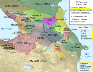
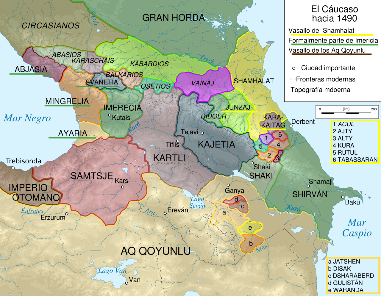
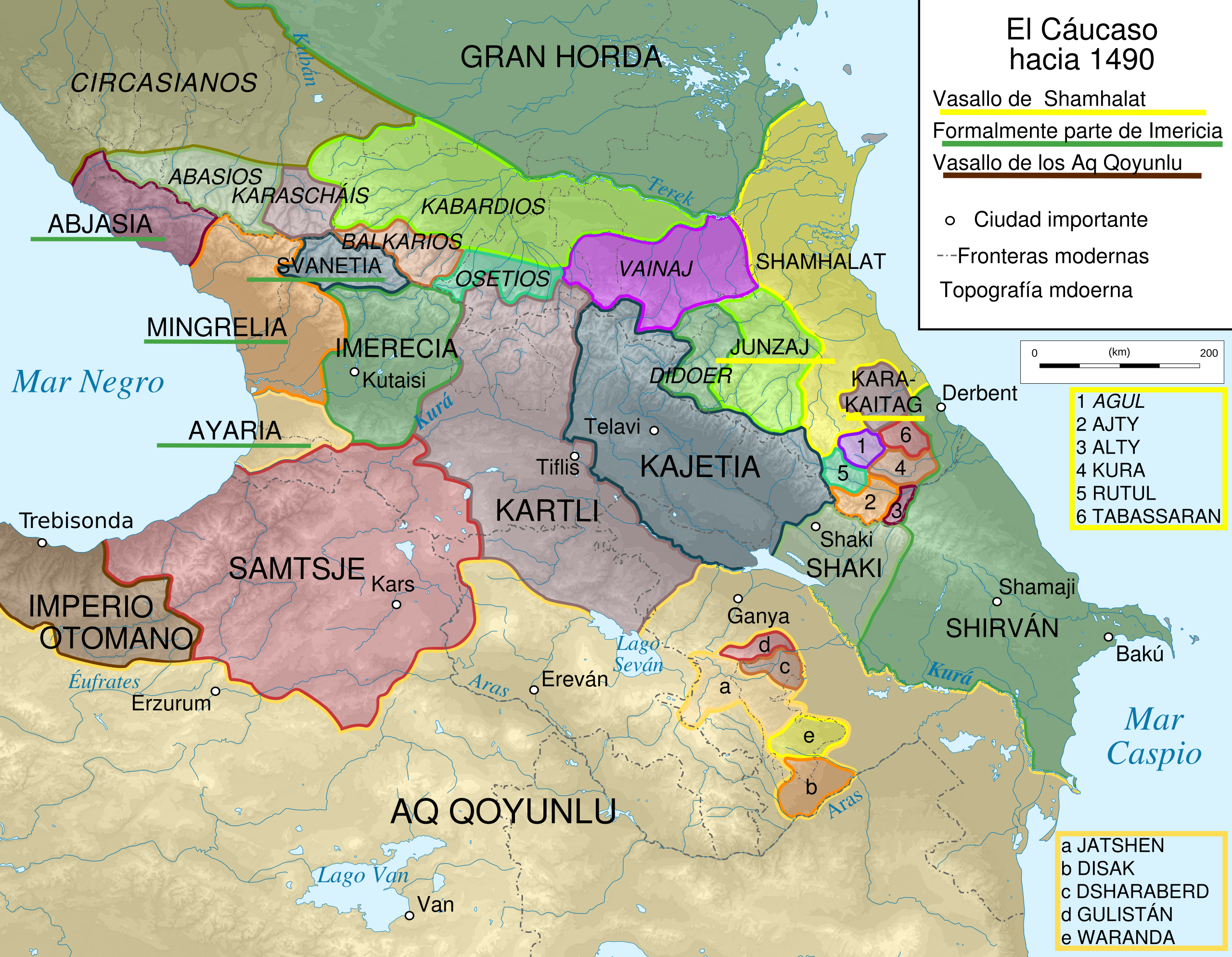
English: Map of Caucasus Region around 1490 |
| Fuente |
Este archivo deriva de: Caucasus 1490 map de alt.svg |
| Autor | Don-kun & WajWohu |
| Permiso (Reutilización de este archivo) |
Caucasus_1490_map_de_alt.svg |
Licencia
[editar]
Este archivo se encuentra bajo la licencia Creative Commons Genérica de Atribución/Compartir-Igual 3.0.
- Eres libre:
- de compartir – de copiar, distribuir y transmitir el trabajo
- de remezclar – de adaptar el trabajo
- Bajo las siguientes condiciones:
- atribución – Debes otorgar el crédito correspondiente, proporcionar un enlace a la licencia e indicar si realizaste algún cambio. Puedes hacerlo de cualquier manera razonable pero no de manera que sugiera que el licenciante te respalda a ti o al uso que hagas del trabajo.
- compartir igual – En caso de mezclar, transformar o modificar este trabajo, deberás distribuir el trabajo resultante bajo la misma licencia o una compatible como el original.
Historial del archivo
Haz clic sobre una fecha y hora para ver el archivo tal como apareció en ese momento.
| Fecha y hora | Miniatura | Dimensiones | Usuario | Comentario | |
|---|---|---|---|---|---|
| actual | 14:55 25 feb 2020 | | 1155 × 898 (4,27 MB) | Don-kun (discusión | contribs.) | Reverted to version as of 08:43, 13 April 2019 (UTC) |
| 22:04 18 feb 2020 |  | 1155 × 898 (4,26 MB) | Takhirgeran Umar (discusión | contribs.) | об | |
| 08:43 13 abr 2019 |  | 1155 × 898 (4,27 MB) | Rowanwindwhistler (discusión | contribs.) | Uploading a file from a free published source using File Upload Wizard |
No puedes sobrescribir este archivo.
Usos del archivo
Las siguientes páginas usan este archivo:
Uso global del archivo
Las wikis siguientes utilizan este archivo:
- Uso en es.wikipedia.org
Metadatos
Categorías:
- Maps of the history of the Caucasus
- SVG maps of the history of Georgia
- SVG maps of the history of Armenia
- SVG maps of the history of Azerbaijan
- Maps of the history of the south Caucasus region
- Maps of the history of Adygea
- Maps of the history of Karachay-Cherkessia
- Maps of the history of Kabardino-Balkaria
- Maps of the history of North Ossetia – Alania
- Maps of the Caucasus by some users
- Maps of the history of Dagestan
- Maps showing the 1490s
- Maps of the history of Şəki
- Spanish-language SVG maps showing history