File:Census Bureau map of Fort Lee, New Jersey (2).gif
پرش به ناوبری
پرش به جستجو
اندازهٔ این پیشنمایش: ۷۵۲ × ۶۰۰ پیکسل. کیفیتهای دیگر: ۳۰۱ × ۲۴۰ پیکسل | ۶۰۲ × ۴۸۰ پیکسل | ۹۶۳ × ۷۶۸ پیکسل | ۱٬۱۸۱ × ۹۴۲ پیکسل.
پروندهٔ اصلی (۱٬۱۸۱ × ۹۴۲ پیکسل، اندازهٔ پرونده: ۷۵۱ کیلوبایت، نوع MIME پرونده: image/gif، ۰٫۱ ثانیه)
گزینهها
عنوان
شرحی یکخطی از محتوای این فایل اضافه کنید
خلاصه[ویرایش]
.gif&action=edit§ion=1)
| توضیح |
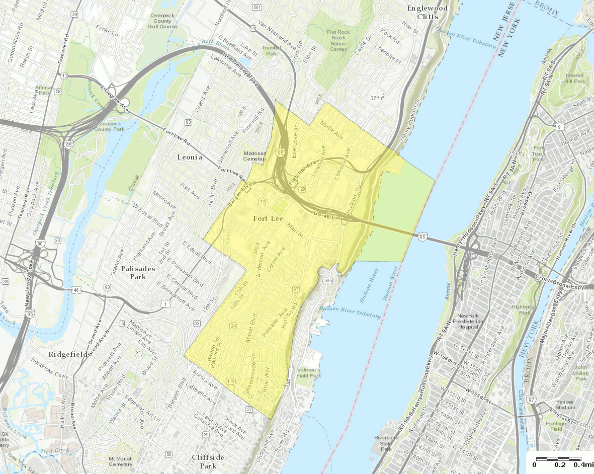
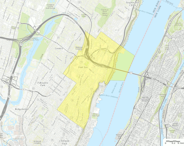
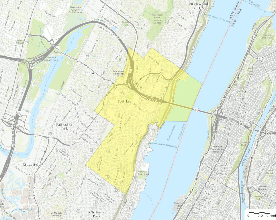
English: U.S. Census Bureau map of Fort Lee, New Jersey |
| تاریخ | |
| منبع | http://factfinder.census.gov |
| پدیدآور | United States Census Bureau |
| دیگر نسخهها |
 |
اجازهنامه[ویرایش]
.gif&action=edit§ion=2)
This image or file is a work of a United States Census Bureau employee, taken or made as part of that person's official duties. As a work of the U.S. federal government, the image is in the public domain.
|
 |
تاریخچهٔ پرونده
روی تاریخ/زمانها کلیک کنید تا نسخهٔ مربوط به آن هنگام را ببینید.
| تاریخ/زمان | بندانگشتی | ابعاد | کاربر | توضیح | |
|---|---|---|---|---|---|
| کنونی | ۱۳ اکتبر ۲۰۱۶، ساعت ۲۰:۵۸ | | ۱٬۱۸۱ در ۹۴۲ (۷۵۱ کیلوبایت) | BurritoBazooka (بحث | مشارکتها) | a tad smaller, now that I can see it in the articles |
| ۱۳ اکتبر ۲۰۱۶، ساعت ۲۰:۴۹ |  | ۱٬۷۸۷ در ۱٬۳۰۰ (۱٫۶۱ مگابایت) | BurritoBazooka (بحث | مشارکتها) | larger map (but showing about the same surrounding boroughs), with roads labelled and important roads more clearly visible. Primary reason for new upload: to show importance of I-95. |
شما نمیتوانید این پرونده را رونویسی کنید.
کاربرد پرونده
صفحهٔ زیر از این تصویر استفاده میکند:
کاربرد سراسری پرونده
ویکیهای دیگر زیر از این پرونده استفاده میکنند:
- کاربرد در en.wikipedia.org
- کاربرد در fa.wikipedia.org
- کاربرد در fr.wikipedia.org
- کاربرد در ja.wikipedia.org
- کاربرد در sh.wikipedia.org
- کاربرد در ur.wikipedia.org
.gif&oldid=852444512)