File:Central europe 1683.png
পরিভ্রমণে চলুন
অনুসন্ধানে চলুন

এই প্রাকদর্শনের আকার: ৭৯০ × ৫৯৯ পিক্সেল। অন্যান্য আকারসমূহ: ৩১৭ × ২৪০ পিক্সেল | ৬৩৩ × ৪৮০ পিক্সেল | ১,০১৩ × ৭৬৮ পিক্সেল | ১,২৮০ × ৯৭১ পিক্সেল।
মূল ফাইল (১,২৮০ × ৯৭১ পিক্সেল, ফাইলের আকার: ৪০৬ কিলোবাইট, এমআইএমই ধরন: image/png)
ক্যাপশনসমূহ
ক্যাপশন
এই ফাইল কি প্রতিনিধিত্ব করছে তার এক লাইন ব্যাখ্যা যোগ করুন
সারাংশ[সম্পাদনা]
| বিবরণ |
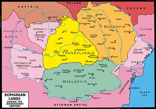
English: Central Europe during the short-term existence of Imre Thököly's Principality of Upper Hungary. - Habsburg and Ottoman territories, including Habsburg Kingdom of Hungary (Royal Hungary) and Habsburg Croatia, Ottoman vassal states (Wallachia, Moldavia, Transylvania, Principality of Upper Hungary (existed between 1682-1685), Montenegro, Ragusa) and Ottoman eyalets. The Ottoman expansion was asked by prince Imre Thököly in Upper Hungary (centered in present-day Slovakia) against the Habsburgs. The Ottoman Rule in Upper Hungary lasted only for 3 years. |
| তারিখ | |
| উৎস | নিজের কাজ |
| লেখক | PANONIAN |
| অন্যান্য সংস্করণ |
এই ফাইলের উপজাত কর্মসমূহ:
|
লাইসেন্স প্রদান[সম্পাদনা]
আমি, এই কাজের স্বত্বাধিকারী, এতদ্দ্বারা আমি এই কাজকে নিম্ন বর্ণিত লাইসেন্সের আওতায় প্রকাশ করলাম:
| এই ফাইলটি ক্রিয়েটিভ কমন্স সিসি০ ১.০ সার্বজনীন পাবলিক ডোমেইন উৎসর্গীকরণের আওতায় রয়েছে। | |
| যেই ব্যক্তিটি এই কাজটির সাথে সংশ্লিষ্ট তিনি এই কাজটি পাবলিক ডোমেইনে মুক্ত করার মাধ্যমে তাঁর সকল স্বত্ত্ব বিশ্বের সকল কপিরাইট আইনের আওতায় ত্যাগ করেছেন। যার মধ্যে নেইবারিং অধিকার, ও আইনের মাধ্যমে এক্সটেন্টও অন্তর্গত। আপনি এই কাজটি কোন অনুমতি চাওয়া ছাড়াই মুক্তভাবে অনুলিপি, পরিবর্তন, বিতরণ করতে পারেন, এবং এমন কি কোনো বাণিজ্যিক কাজেও ব্যবহার করতে পারেন।
|
References[সম্পাদনা]
- The Times History of Europe, Times Books, London, 2002.
- Peter Rokai - Zoltan Đere - Tibor Pal - Aleksandar Kasaš, Istorija Mađara, Beograd, 2002.
- Dr Dušan J. Popović, Srbi u Vojvodini, knjiga 1, Novi Sad, 1990.
- Dr D. J. Popović, Vojvodina u tursko doba, Zbornik "Vojvodina", knjiga I, Fototipsko izdanje, PROMETEJ, Novi Sad, 2008.
- Halil Inaldžik, Osmansko carstvo, Beograd, 2003.
- Petrit Imami, Srbi i Albanci kroz vekove, Beograd, 2000.
- File:Magyar- és Erdélyország 1629-ben (Pallas).jpg
- http://www.sulinet.hu/oroksegtar/data/telepulesek_ertekei/Erd/pages/images/221.jpg
- http://www.zum.de/whkmla/region/balkans/xsilistra.html
- http://www.euratlas.net/history/europe/1600/index.html
- http://www.freeweb.hu/csodaszarvas/galeria/galeria09/001/large_terkep12.jpg
- http://mek.niif.hu/01800/01885/html/cd5m/kepek/tortenelem/to212pe94185.jpg
- http://www.tortenelemklub.hu/galeries/6/Wesselényi%20legújabb.JPG[dead link]
- http://farm4.static.flickr.com/3361/3657063110_1532418eb3.jpg
- http://www.camo.ch/Images/bpasaluk06.jpg আর্কাইভকৃত অনুলিপি at the Wayback Machine
- http://medlem.spray.se/zelenika/sandzak.jpg[dead link]
- http://img375.imageshack.us/img375/7287/pasaluk2.png
- http://www.camo.ch/Images3/bhpasaluk.jpg আর্কাইভকৃত অনুলিপি at the Wayback Machine
- http://xxlworld.xx.ohost.de/povijest/slike/mape/1606.jpg
- http://www.hic.hr/books/pavlicev/images/s05.gif আর্কাইভকৃত অনুলিপি at the Wayback Machine
- http://api.wb21.net/images/a-torok-hodoltsag-kora-magyar-tortenelem/dr-blaskovics-jozsef,az-ujvari-ejalet-torok-adoosszeirasai.jpg আর্কাইভকৃত অনুলিপি at the Wayback Machine
.jpg)
ফাইলের ইতিহাস
যেকোনো তারিখ/সময়ে ক্লিক করে দেখুন ফাইলটি তখন কী অবস্থায় ছিল।
| তারিখ/সময় | সংক্ষেপচিত্র | মাত্রা | ব্যবহারকারী | মন্তব্য | |
|---|---|---|---|---|---|
| বর্তমান | ১২:৪৮, ৩১ জানুয়ারি ২০২০ | | ১,২৮০ × ৯৭১ (৪০৬ কিলোবাইট) | Claude Zygiel (আলোচনা | অবদান) | Belergad eyalet cited in: Artin Hindoğlu's "Kurzwörterbuch Türkisch-Deutsch / Dictionnaire abrégé Turc-Français", Wien 1838, p. 125. |
| ২১:৩৫, ৮ এপ্রিল ২০১৮ |  | ১,২৮০ × ৯৭১ (৩৯০ কিলোবাইট) | Filederchest (আলোচনা | অবদান) | info | |
| ১৯:০৬, ৮ এপ্রিল ২০১৮ |  | ১,২৮০ × ৯৭১ (৩৭৮ কিলোবাইট) | Filederchest (আলোচনা | অবদান) | Principality of Upper Hungary | |
| ১৫:১৯, ২৮ জানুয়ারি ২০১৭ |  | ১,৫৪৩ × ১,১৭০ (১৪৬ কিলোবাইট) | PANONIAN (আলোচনা | অবদান) | Reverted to version as of 20:47, 8 September 2011 (UTC) - this shows vassal principalities as separate states which they were not | |
| ২০:৫২, ২৫ জানুয়ারি ২০১৭ |  | ১,৫৪৩ × ১,১৭০ (১৩৫ কিলোবাইট) | Mélomène (আলোচনা | অবদান) | Contrast | |
| ২০:৪৭, ৮ সেপ্টেম্বর ২০১১ |  | ১,৫৪৩ × ১,১৭০ (১৪৬ কিলোবাইট) | PANONIAN (আলোচনা | অবদান) | corrected version | |
| ১৬:৫৯, ৫ সেপ্টেম্বর ২০১১ |  | ১,৫৪৩ × ১,১৭০ (১৪৩ কিলোবাইট) | PANONIAN (আলোচনা | অবদান) | {{Information |Description ={{en|1=Central Europe in 1683.}} |Source ={{own}} |Author =PANONIAN |Date =2011 |Permission = |other_versions = }} |
আপনি এই ফাইলটি প্রতিস্থাপন করতে পারবেন না।
ফাইলের ব্যবহার
নিম্নলিখিত 13টি পাতা এই ফাইল ব্যবহার করে:
- Atlas of Bosnia and Herzegovina
- Atlas of Croatia
- Atlas of Hungary
- Atlas of Moldova
- Atlas of Romania
- Atlas of Slovakia
- Atlas of Transylvania
- Atlas of Vojvodina
- User:J budissin/Uploads/BiH/2017 January 21-31
- User:J budissin/Uploads/BiH/2018 April 1-10
- User:J budissin/Uploads/BiH/2020 January 21-31
- Commons:Graphic Lab/Map workshop/Archive/2014
- Category:Budin Province, Ottoman Empire
ফাইলের বৈশ্বিক ব্যবহার
নিচের অন্যান্য উইকিগুলো এই ফাইলটি ব্যবহার করে:
- an.wikipedia.org-এ ব্যবহার
- ar.wikipedia.org-এ ব্যবহার
- arz.wikipedia.org-এ ব্যবহার
- azb.wikipedia.org-এ ব্যবহার
- az.wikipedia.org-এ ব্যবহার
- ba.wikipedia.org-এ ব্যবহার
- be-tarask.wikipedia.org-এ ব্যবহার
- be.wikipedia.org-এ ব্যবহার
- bg.wikipedia.org-এ ব্যবহার
- bn.wikipedia.org-এ ব্যবহার
- bs.wikipedia.org-এ ব্যবহার
- ca.wikipedia.org-এ ব্যবহার
- cs.wikipedia.org-এ ব্যবহার
- de.wikipedia.org-এ ব্যবহার
- el.wikipedia.org-এ ব্যবহার
- en.wikipedia.org-এ ব্যবহার
এই ফাইলের অন্যান্য বৈশ্বিক ব্যবহার দেখুন।
অধি-উপাত্ত
বিষয়শ্রেণীসমূহ:
- Maps of the history of Central Europe
- Maps of the Habsburg Monarchy
- Maps of eyalets of the Ottoman Empire
- Maps of vassal states of the Ottoman Empire
- Maps of the history of the Ottoman Empire in the 1680s
- Maps of the history of Hungary (1526–1700)
- Maps of the history of Slovakia
- Maps of the history of Croatia (1526–1918)
- Maps of the history of Bosnia and Herzegovina under Ottoman Empire
- Maps of the Ottoman period in the history of Serbia
- Maps of the history of Vojvodina
- Maps of the history of Banat
- Maps of the history of Early Modern Romania
- Maps of the history of Transylvania
- Maps of the history of Moldova
- Kingdom of Hungary (1526–1867)
- Principality of Upper Hungary
- Eyalet of Bosnia
- Budin Province, Ottoman Empire
- Kanije Province, Ottoman Empire
- Eğri Province, Ottoman Empire
- Maps of Temeşvar Province, Ottoman Empire
- Varat Province, Ottoman Empire
- Uyvar Province, Ottoman Empire
- Principality of Transylvania
- Maps of Wallachia
- Maps of the Principality of Moldavia
- Romania in the 17th century
- 1683
- 1683 in Europe
- 1683 in Romania