File:Chalk Group map.jpg
Jump to navigation
Jump to search

Size of this preview: 800 × 495 pixels. Other resolutions: 320 × 198 pixels | 640 × 396 pixels | 1,024 × 634 pixels | 1,280 × 793 pixels | 1,973 × 1,222 pixels.
Original file (1,973 × 1,222 pixels, file size: 1.05 MB, MIME type: image/jpeg)
Captions
Captions
Add a one-line explanation of what this file represents
Summary[edit]
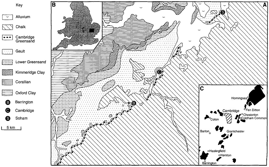
| Description | A. Simplified geological map of eastern England showing the distribution of the Cambridge Greensand. B. Location of main map. C. Cambridge Greensand workings in the vicinity of Cambridge that have yielded pterosaurs Adapted from Grove(1976) and Worssam and Taylor (1969). |
| Date | |
| Source | https://fr.copernicus.org/articles/4/189/2001/fr-4-189-2001.html |
| Author | David M. Unwin |
Licensing[edit]
This file is licensed under the Creative Commons Attribution 3.0 Unported license.
- You are free:
- to share – to copy, distribute and transmit the work
- to remix – to adapt the work
- Under the following conditions:
- attribution – You must give appropriate credit, provide a link to the license, and indicate if changes were made. You may do so in any reasonable manner, but not in any way that suggests the licensor endorses you or your use.
File history
Click on a date/time to view the file as it appeared at that time.
| Date/Time | Thumbnail | Dimensions | User | Comment | |
|---|---|---|---|---|---|
| current | 03:32, 6 February 2021 | | 1,973 × 1,222 (1.05 MB) | FunkMonk (talk | contribs) | {{Information |Description=A. Simplified geological map of eastern England showing the distribution of the Cambridge Greensand. B. Location of main map. C. Cambridge Greensand workings in the vicinity of Cambridge that have yielded pterosaurs Adapted from Grove(1976) and Worssam and Taylor (1969). |Source=https://fr.copernicus.org/articles/4/189/2001/fr-4-189-2001.html |Date=2001 |Author=David M. Unwin |Permission= |other_versions= }} |
You cannot overwrite this file.
File usage on Commons
There are no pages that use this file.