File:Champ1632 82.jpg
Jump to navigation
Jump to search
Size of this preview: 800 × 438 pixels. Other resolutions: 320 × 175 pixels | 640 × 350 pixels | 1,024 × 560 pixels | 1,845 × 1,009 pixels.
Original file (1,845 × 1,009 pixels, file size: 936 KB, MIME type: image/jpeg)
Captions
Captions
Add a one-line explanation of what this file represents
| Description |
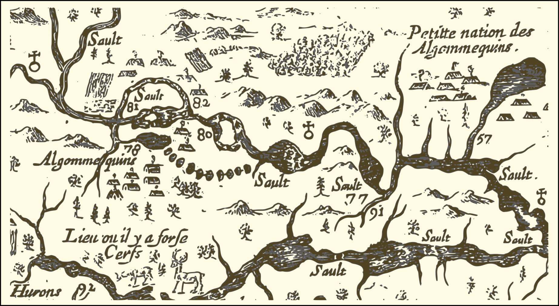
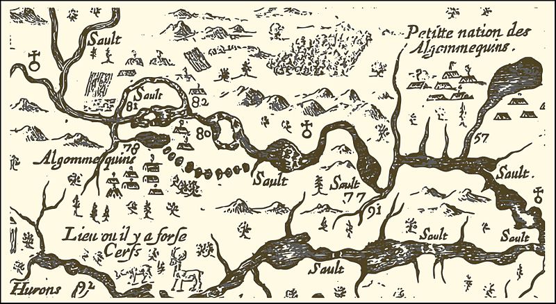
English: An extract from a map of the eastern reaches of New France, showing a portion of the Ottawa River. The map was created in 1632 by Samuel de Champlain to show the route he took in 1616, with numbers used to indicate sites he visisted, significant rapids and aboriginal encampments. In particular,
Français : Carte de l'est de la Nouvelle-France par Samuel de Champlain (1632) - extrait de la portion de la rivière des Outaouais. Champlain fait graver en France en 1632 une carte de son trajet réalisé en 1616 sur laquelle il indique à l'aide de chiffres, certains sites visités, des saults (rapides) importants ou des campements indiens.
|
||||
| Date | |||||
| Source | http://gallica.bnf.fr/ark:/12148/btv1b6700076h/ | ||||
| Author | Samuel de Champlain | ||||
| Permission (Reusing this file) |
|
File history
Click on a date/time to view the file as it appeared at that time.
| Date/Time | Thumbnail | Dimensions | User | Comment | |
|---|---|---|---|---|---|
| current | 04:20, 31 August 2016 | | 1,845 × 1,009 (936 KB) | Pierre5018 (talk | contribs) | vectorisation et conversion png |
| 03:07, 31 August 2016 |  | 888 × 482 (152 KB) | Pierre5018 (talk | contribs) | nouvelle source: Gallica ark:/12148/btv1b6700076h | |
| 01:21, 7 January 2007 |  | 1,006 × 497 (170 KB) | Jljmt (talk | contribs) | Carte de l'est de la Nouvelle-France par Samuel de Champlain 1632 extrait de la portion de la rivière des Outaouais | |
| 23:50, 6 January 2007 |  | 1,006 × 497 (171 KB) | Jljmt (talk | contribs) | Carte de l'est de la Nouvelle-France par Samuel de Champlain 1632 extrait de la portion de la rivière des Outaouais |
You cannot overwrite this file.
File usage on Commons
There are no pages that use this file.
File usage on other wikis
The following other wikis use this file:
- Usage on ca.wikipedia.org
- Usage on en.wikipedia.org
- Usage on fr.wikipedia.org
- Usage on it.wikipedia.org
- Usage on zh.wikipedia.org