File:Chicago Road 19-07-19 390.jpg

Original file (3,072 × 4,608 pixels, file size: 3.7 MB, MIME type: image/jpeg)
Captions
Captions
Summary
[edit]
| Description |
English: Bronson Roadside Park, Michigan |
| Date | |
| Source | Own work |
| Author | Chris Light |
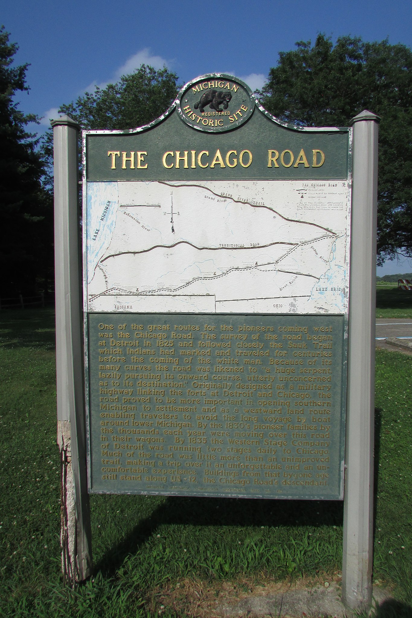
One of the great routes for the pioneers coming west was the Chicago Road. The survey of the road began at Detroit in 1825 and followed closely the Sauk Trail which Indians had marked and traveled for centuries before the coming of the white man. Because of its many curves the road was likened to "a huge serpent, lazily pursuing its onward course, utterly unconcerned as to its destination." Originally designed as a military highway linking the forts of Detroit and Chicago, the road proved to be more important in opening southern Michigan to settlement and as a westward land route enabling travelers to avoid the long voyage by boat around lower Michigan. By the 1830's pioneer families by the thousands each year were moving over this road in their wagons. By 1835 the western Stage Company of Detroit was running two stages daily to Chicago. Much of the road was little more than an unimproved trail, making a trip over it an unforgettable and an uncomfortable experience. Buildings from that bygone age still stand along US - 12, The Chicago Road's descendant
Licensing
[edit]
- You are free:
- to share – to copy, distribute and transmit the work
- to remix – to adapt the work
- Under the following conditions:
- attribution – You must give appropriate credit, provide a link to the license, and indicate if changes were made. You may do so in any reasonable manner, but not in any way that suggests the licensor endorses you or your use.
- share alike – If you remix, transform, or build upon the material, you must distribute your contributions under the same or compatible license as the original.
File history
Click on a date/time to view the file as it appeared at that time.
| Date/Time | Thumbnail | Dimensions | User | Comment | |
|---|---|---|---|---|---|
| current | 14:32, 22 July 2019 | | 3,072 × 4,608 (3.7 MB) | Chris Light (talk | contribs) | User created page with UploadWizard |
You cannot overwrite this file.
File usage on Commons
There are no pages that use this file.
File usage on other wikis
The following other wikis use this file:
- Usage on en.wikipedia.org