File:China Fujian2 location map.svg
跳至導覽
跳至搜尋

此 SVG 檔案的 PNG 預覽的大小:572 × 600 像素。 其他解析度:229 × 240 像素 | 458 × 480 像素 | 732 × 768 像素 | 976 × 1,024 像素 | 1,953 × 2,048 像素 | 780 × 818 像素。
原始檔案 (SVG 檔案,表面大小:780 × 818 像素,檔案大小:277 KB)
說明
說明
添加單行說明來描述出檔案所代表的內容
摘要
[編輯]| 描述 |
Quadratische Plattkarte, N-S-Streckung 111 %. Geographische Begrenzung der Karte:
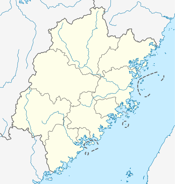
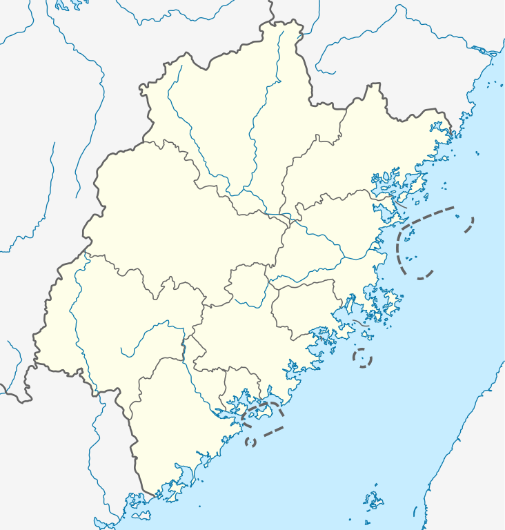
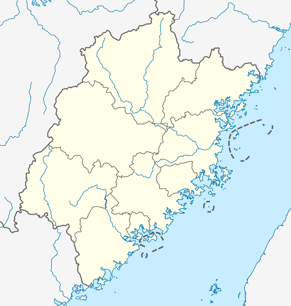
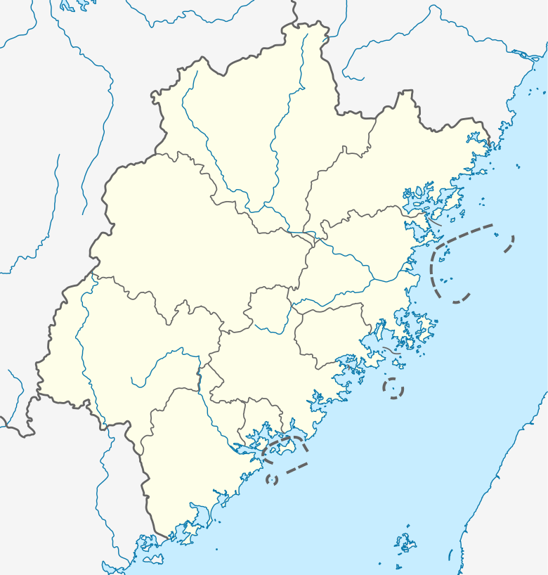
English: Location map of Fujian, People's Republic of China
(Note: the insular counties of Kinmen (Quemoy) and Lienchiang (Matsu Islands), Taiwan (ROC), are shown with dashed lines.) Equirectangular projection, N/S stretching 111 %. Geographic limits of the map:
|
|
| 日期 | ||
| 來源 |
自己的作品, using
|
|
| 作者 | NordNordWest | |
| 授權許可 (重用此檔案) |
此檔案採用創用CC 姓名標示-相同方式分享 3.0 德國授權條款。
 此檔案採用共享創意 姓名標示-相同方式分享 3.0 未在地化版本授權條款。
|


|
|
檔案歷史
點選日期/時間以檢視該時間的檔案版本。
| 日期/時間 | 縮圖 | 尺寸 | 用戶 | 備註 | |
|---|---|---|---|---|---|
| 目前 | 2020年10月14日 (三) 17:21 | | 780 × 818(277 KB) | NordNordWest(對話 | 貢獻) | upd |
| 2011年6月20日 (一) 12:18 |  | 780 × 818(282 KB) | NordNordWest(對話 | 貢獻) | =={{int:filedesc}}== {{Information |Description= {{de|Positionskarte von Fujian, Volksrepublik China}} Quadratische Plattkarte, N-S-Streckung 111 %. Geographische Begrenzung der Karte: * N: 28.5° N * S: 23.3° N |
無法覆蓋此檔案。
檔案用途
沒有使用此檔案的頁面。
全域檔案使用狀況
以下其他 wiki 使用了這個檔案:
- ar.wikipedia.org 的使用狀況
- bg.wikipedia.org 的使用狀況
- bn.wikipedia.org 的使用狀況
- cdo.wikipedia.org 的使用狀況
- ceb.wikipedia.org 的使用狀況
- cs.wikipedia.org 的使用狀況
- fa.wikipedia.org 的使用狀況
檢視此檔案的更多全域使用狀況。