File:China Hong Kong location map.svg
Spring til navigation
Spring til søgning

Size of this PNG preview of this SVG file: 766 × 600 pixels. Andre opløsninger: 307 × 240 pixels | 613 × 480 pixels | 981 × 768 pixels | 1.280 × 1.002 pixels | 2.560 × 2.004 pixels | 1.298 × 1.016 pixels.
Oprindelig fil (SVG fil, basisstørrelse 1.298 × 1.016 pixels, filstørrelse: 244 KB)
Captions
Captions
Tilføj en kort forklaring på en enkelt linje om hvad filen viser
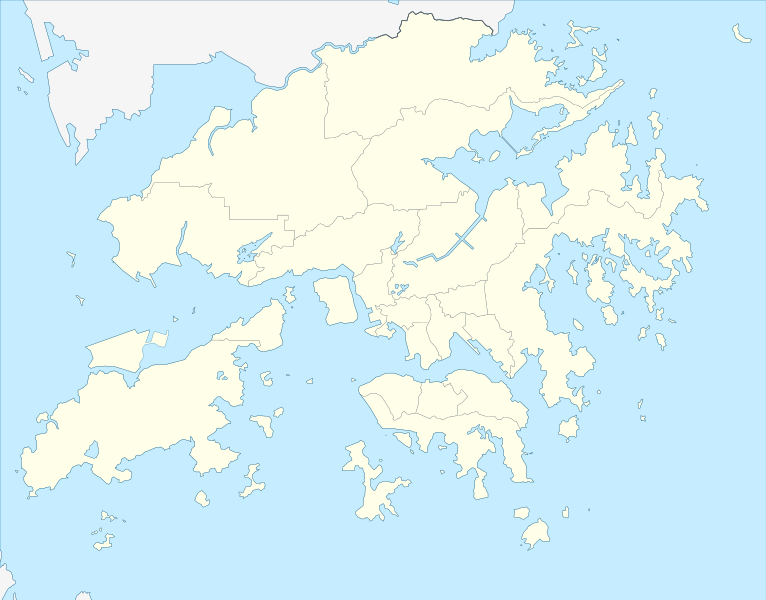
Location map of Hong Kong
Beskrivelse
[redigér]| Beskrivelse |
Deutsch: Postionskarte von Hong Kong
Quadratische Plattkarte. Geographische Begrenzung der Karte:
English: Location map of Hong Kong
Equirectangular projection. Geographic limits of the map:
|
||
| Dato | |||
| Kilde | own work, using this file by Moddlyg | ||
| Forfatter | Maximilian Dörrbecker (Chumwa) | ||
| Tilladelse (Genbrug af denne fil) |
Jeg, dette værks ophavsretsindehaver, udgiver hermed værket under den følgende licens:
Denne fil er udgivet under Creative Commons Kreditering-Del på samme vilkår 3.0 Ikke-porteret-licensen.
Du kan vælge den licens du foretrækker. |


|
This map has been made or improved in the German Kartenwerkstatt (Map Lab). You can propose maps to improve as well.
|
Filhistorik
Klik på en dato/tid for at se filen som den så ud på det tidspunkt.
| Dato/tid | Miniaturebillede | Dimensioner | Bruger | Kommentar | |
|---|---|---|---|---|---|
| nuværende | 13. apr. 2024, 04:25 | | 1.298 × 1.016 (244 KB) | TanoDano (diskussion | bidrag) | Added HZMB HK Port Artificial Island |
| 13. dec. 2022, 23:56 |  | 1.298 × 1.016 (245 KB) | Turbo Slayer 2021 (diskussion | bidrag) | Reverted to version as of 02:34, 15 March 2022 (UTC) | |
| 15. mar. 2022, 02:35 |  | 1.298 × 1.016 (244 KB) | Turbo Slayer 2021 (diskussion | bidrag) | Reverted to version as of 15:10, 16 May 2021 (UTC) | |
| 15. mar. 2022, 02:34 |  | 1.298 × 1.016 (245 KB) | Turbo Slayer 2021 (diskussion | bidrag) | Reverted to version as of 07:02, 4 May 2021 (UTC) | |
| 16. maj 2021, 15:10 |  | 1.298 × 1.016 (244 KB) | 瑞丽江的河水 (diskussion | bidrag) | Reverted to version as of 16:40, 12 September 2018 (UTC) | |
| 4. maj 2021, 07:02 |  | 1.298 × 1.016 (245 KB) | Turbo Slayer 2021 (diskussion | bidrag) | Reverted to version as of 05:09, 29 March 2021 (UTC) | |
| 29. mar. 2021, 12:37 |  | 1.298 × 1.016 (244 KB) | 瑞丽江的河水 (diskussion | bidrag) | Reverted to version as of 16:40, 12 September 2018 (UTC), new coastline after the Hong Kong Zhuhai Macau Bridge Islands built, it is correct, please check with satellite imagery | |
| 29. mar. 2021, 05:09 |  | 1.298 × 1.016 (245 KB) | Turbo Slayer 2021 (diskussion | bidrag) | This is a actual map of Hong Kong due to the Hong Kong Zhuhai Macau Bridge Islands is not that size, Don't worry It will upload a new map until the third runway is finished, Please, wiki is a equal place that Mainland Chinese users are not allowed in this edit, because the firewall. if I found it, I will report to the wiki centre. Thank you. P.S. I am a Hong Konger | |
| 28. mar. 2021, 14:13 |  | 1.298 × 1.016 (244 KB) | 瑞丽江的河水 (diskussion | bidrag) | Reverted to version as of 16:40, 12 September 2018 (UTC) | |
| 25. mar. 2021, 12:56 |  | 1.298 × 1.016 (245 KB) | Turbo Slayer 2021 (diskussion | bidrag) | Reverted to version as of 09:39, 11 September 2011 (UTC) |
Du kan ikke overskrive denne fil.
Filanvendelse
De følgende 24 sider bruger denne fil:
- 香港
- User:Chumwa/Gallery
- Commons:Graphic Lab/Map workshop/Archive/2020
- File:Hong Kong Central and Western District locator map.svg
- File:Hong Kong Eastern District locator map.svg
- File:Hong Kong Islands District locator map.svg
- File:Hong Kong Kowloon City District locator map.svg
- File:Hong Kong Kwai Tsing District locator map.svg
- File:Hong Kong Kwun Tong District locator map.svg
- File:Hong Kong North District locator map.svg
- File:Hong Kong Sai Kung District locator map.svg
- File:Hong Kong Sha Tin District locator map.svg
- File:Hong Kong Sham Shui Po District locator map.svg
- File:Hong Kong Southern District locator map.svg
- File:Hong Kong Tai Po District locator map.svg
- File:Hong Kong Tsuen Wan District locator map.svg
- File:Hong Kong Tuen Mun District locator map.svg
- File:Hong Kong Wan Chai District locator map.svg
- File:Hong Kong Wikivoyage locator maps - Kowloon and sorrounding region.png
- File:Hong Kong Wikivoyage locator maps - Lantau.png
- File:Hong Kong Wong Tai Sin District locator map.svg
- File:Hong Kong Yau Tsim Mong District locator map.svg
- File:Hong Kong Yuen Long District locator map.svg
- File:Location map of Cheung Chau.svg
Global filanvendelse
Følgende andre wikier anvender denne fil:
- Anvendelser på af.wikipedia.org
- Anvendelser på an.wikipedia.org
- Anvendelser på ar.wikipedia.org
- Anvendelser på ast.wikipedia.org
- Anvendelser på azb.wikipedia.org
- Anvendelser på az.wikipedia.org
- Anvendelser på ba.wikipedia.org
- Anvendelser på bcl.wikipedia.org
- Anvendelser på bg.wikipedia.org
- Anvendelser på bn.wikipedia.org
- Anvendelser på ceb.wikipedia.org
Vis flere globale anvendelser af denne fil.