File:Clark St IRT td (2019-07-04) 05.jpg
Jump to navigation
Jump to search
Size of this preview: 800 × 533 pixels. Other resolutions: 320 × 213 pixels | 640 × 427 pixels | 1,024 × 683 pixels | 1,280 × 853 pixels | 2,560 × 1,707 pixels | 5,472 × 3,648 pixels.
Original file (5,472 × 3,648 pixels, file size: 5.18 MB, MIME type: image/jpeg)
Captions
Captions
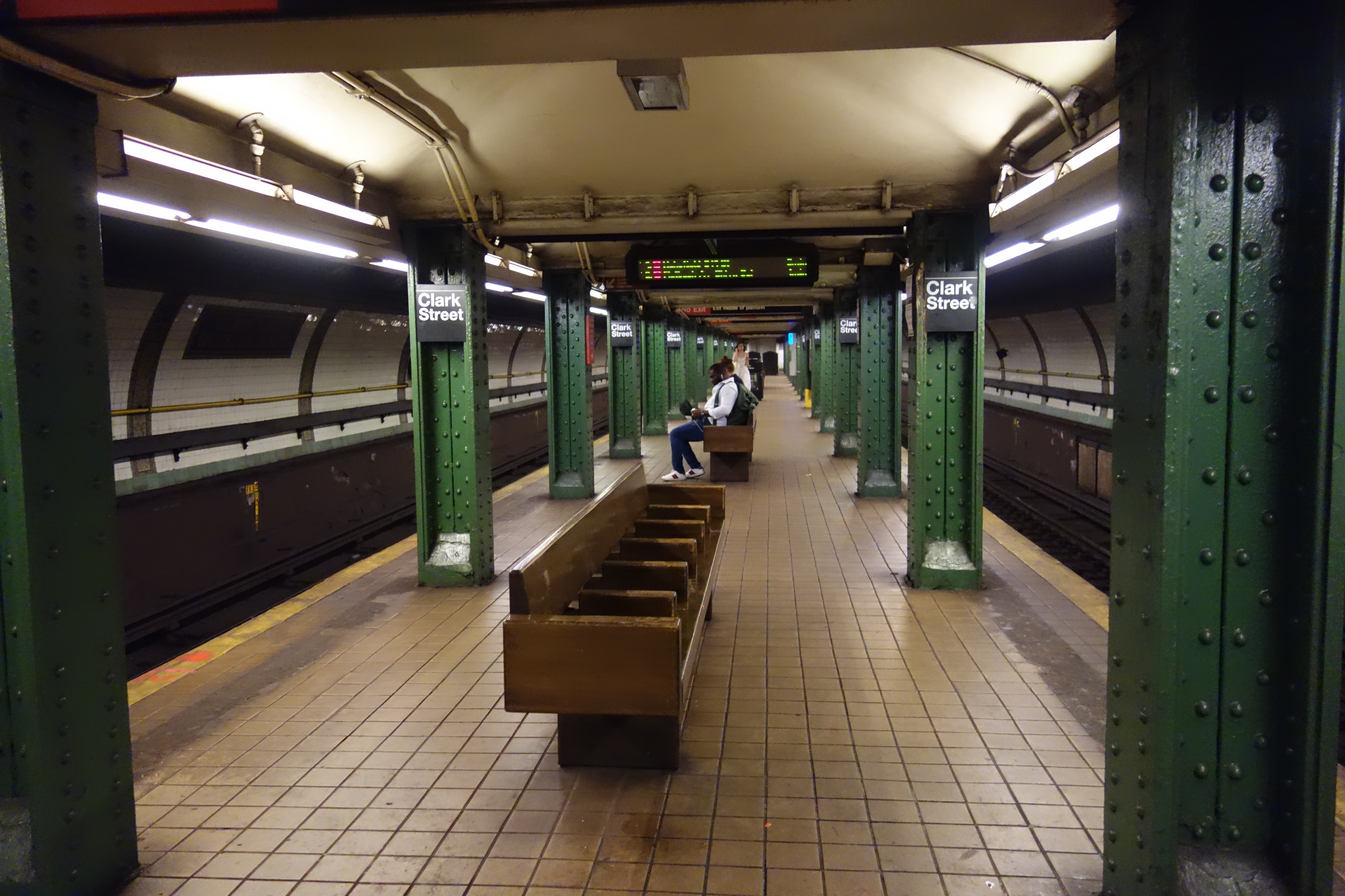
Clark Street–Brooklyn Heights IRT station, Brooklyn Heights, Brooklyn.
Summary[edit]
_05.jpg&action=edit§ion=1)
| Description |
English: Looking east down the platform of the Clark Street–Brooklyn Heights IRT station, under Clark Street and Henry Street in Brooklyn Heights, Brooklyn. The station features curved walls and a low ceiling due to its proximity to the Clark Street Tunnel under the East River to Manhattan. |
| Date | |
| Source | Own work |
| Author | Tdorante10 |
| Camera location | | View this and other nearby images on: OpenStreetMap |
|---|
_05.jpg¶ms=040.697400_N_-073.993100_E_globe:Earth_type:camera__&language=en)
Licensing[edit]
_05.jpg&action=edit§ion=2)
I, the copyright holder of this work, hereby publish it under the following license:
This file is licensed under the Creative Commons Attribution-Share Alike 4.0 International license.
- You are free:
- to share – to copy, distribute and transmit the work
- to remix – to adapt the work
- Under the following conditions:
- attribution – You must give appropriate credit, provide a link to the license, and indicate if changes were made. You may do so in any reasonable manner, but not in any way that suggests the licensor endorses you or your use.
- share alike – If you remix, transform, or build upon the material, you must distribute your contributions under the same or compatible license as the original.
File history
Click on a date/time to view the file as it appeared at that time.
| Date/Time | Thumbnail | Dimensions | User | Comment | |
|---|---|---|---|---|---|
| current | 02:52, 28 December 2021 | | 5,472 × 3,648 (5.18 MB) | Tdorante10 (talk | contribs) | Uploaded own work with UploadWizard |
You cannot overwrite this file.
File usage on Commons
The following 3 pages use this file:
_05.jpg&oldid=861709774)