File:Cloud Bank over the Gran Chaco (MODIS).jpg

Original file (5,515 × 4,149 pixels, file size: 2.68 MB, MIME type: image/jpeg)
Captions
Captions
Summary[edit]
.jpg&action=edit§ion=1)
| Description |
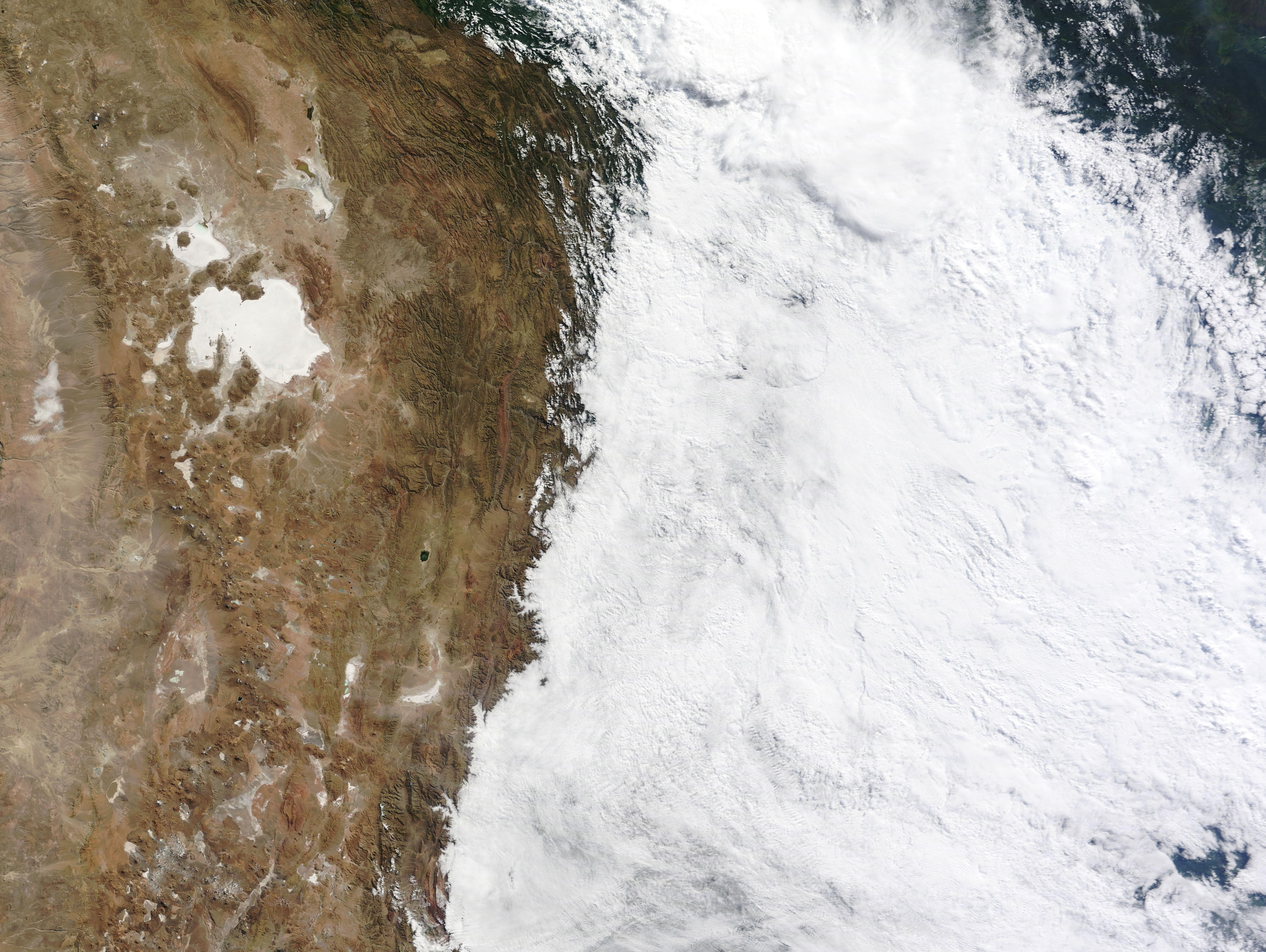
English: On June 11, 2023, a large bank of thick cloud hugged the eastern slope of the Andes Mountains, blanketing the Gran Chaco of southern Bolivia, western Paraguay, and northern Argentina. The Moderate Resolution Imaging Spectroradiometer (MODIS) on NASA's Terra satellite acquired a true-color image of the scene on that same day.
The winter-time cloud spanned an area of roughly 990,000 square kilometers (382,240 square miles), as measured with the tools available on the NASA Worldview App—an area only slightly smaller than the country of Egypt. By June 12, the clouded area expanded dramatically to cover more than 2,500,000 square kilometers (965,2500 square miles) of South America, hugging the eastern side of the Andes Mountains in the west and reaching across Argentina and Paraguay to reach the South Atlantic Ocean. Once over the ocean, a band of cloud continued southeast to reach Antarctica. Wintertime in the lands east of the Andes, particularly the Gran Chaco, can often bring cloud-filled skies and gusty winds. Despite the impressive appearance, such clouds don’t always mean rain. Rain was not reported in any of the major cities underneath the clouds on June 11 or 12. The tall peaks of the Andes Mountains act as a barrier to the western movement of clouds and precipitation, which is why clouds pile up over the eastern slope while the sky over the higher elevations and west of the Andes are clear. While the Gran Chaco is considered a hot, semi-arid lowland, the southern portion of the high plateau (Altiplano) visible in this image is cold and dry, especially in winter. The world’s largest and highest salt flat, the Salar de Uyuni receives less than 5 inches (127 mm) of rain each year, with almost all of that falling between December and April. |
||
| Date | Taken on 11 June 2023 | ||
| Source |
Cloud Bank over the Gran Chaco (direct link)
|
||
| Author | MODIS Land Rapid Response Team, NASA GSFC |
| This media is a product of the Terra mission Credit and attribution belongs to the mission team, if not already specified in the "author" row |
Licensing[edit]
.jpg&action=edit§ion=2)
| This file is in the public domain in the United States because it was solely created by NASA. NASA copyright policy states that "NASA material is not protected by copyright unless noted". (See Template:PD-USGov, NASA copyright policy page or JPL Image Use Policy.) | ||
 |
Warnings:
|
File history
Click on a date/time to view the file as it appeared at that time.
| Date/Time | Thumbnail | Dimensions | User | Comment | |
|---|---|---|---|---|---|
| current | 18:55, 31 July 2023 | | 5,515 × 4,149 (2.68 MB) | OptimusPrimeBot (talk | contribs) | #Spacemedia - Upload of http://modis.gsfc.nasa.gov/gallery/images/image06132023_250m.jpg via Commons:Spacemedia |
You cannot overwrite this file.
File usage on Commons
There are no pages that use this file.
.jpg&oldid=788767632)