File:Coedydd ac Ogofâu Elwy a Meirchion SSSI ger Llanelwy (St Asaph) 30.jpg
Jump to navigation
Jump to search

Size of this preview: 800 × 450 pixels. Other resolutions: 320 × 180 pixels | 640 × 360 pixels | 1,024 × 576 pixels | 1,280 × 720 pixels | 2,560 × 1,440 pixels | 3,840 × 2,160 pixels.
Original file (3,840 × 2,160 pixels, file size: 3.89 MB, MIME type: image/jpeg)
Captions
Captions
Coedydd ac Ogofâu Elwy a Meirchion SSSI
Summary
[edit]_30.jpg&action=edit§ion=1)
| Description |
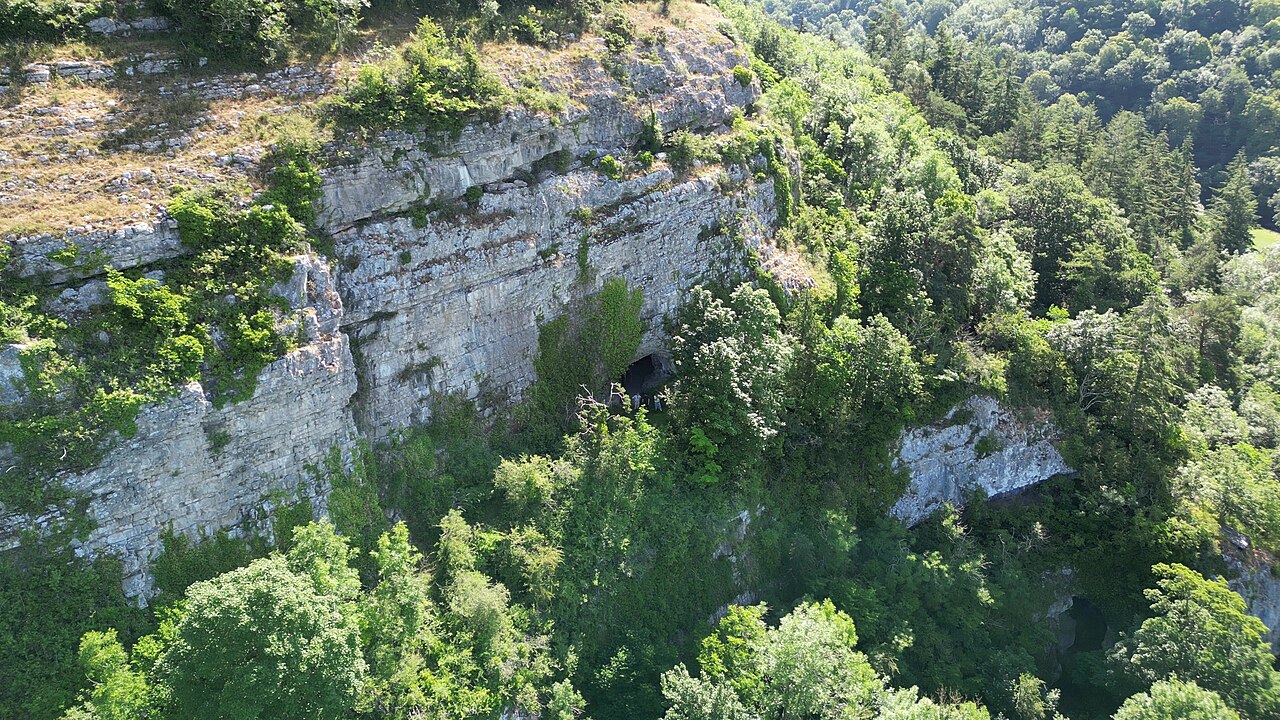
Cymraeg: Safle o Ddiddordeb Gwyddonol Arbennig yng Nghymru (SoDdGA neu SSSI) ers 01 Ionawr 1977 a leolir ger Llanelwy, Sir Ddinbych. Mae ei arwynebedd yn 82.69 hectar. Cyfoeth Naturiol Cymru yw'r corff sy'n gyfrifol am y safle. O fewn y safle ceir nifer o ogofâ eithriadol bwysig oherwydd y darganfuwyd ynddynt olion dyn ac offer o'r cyfnod cynhanes e.e. Ogof Bontnewydd, Cefn ac Ogof Galltfaenan.
English: A Site of Special Scientific Interest in Wales (SSSI or SSSI) since 01 January 1977 located near St Asaph, Denbighshire. Its area is 82.69 hectares. Natural Resources Wales is the body responsible for the site. Within the site there are a number of extremely important caves because the remains of man and tools from prehistoric times were found in them e.g. Bontnewydd Cave, Cefn and Galltfaenan Cave. |
| Date | |
| Source | Own work |
| Author | Llywelyn2000 |
| Camera location | | View this and other nearby images on: OpenStreetMap |
|---|
_30.jpg¶ms=053.210110_N_-003.467691_E_globe:Earth_type:camera__&language=en)
Licensing
[edit]_30.jpg&action=edit§ion=2)
I, the copyright holder of this work, hereby publish it under the following license:
This file is licensed under the Creative Commons Attribution-Share Alike 4.0 International license.
- You are free:
- to share – to copy, distribute and transmit the work
- to remix – to adapt the work
- Under the following conditions:
- attribution – You must give appropriate credit, provide a link to the license, and indicate if changes were made. You may do so in any reasonable manner, but not in any way that suggests the licensor endorses you or your use.
- share alike – If you remix, transform, or build upon the material, you must distribute your contributions under the same or compatible license as the original.
This image was uploaded as part of Wiki Loves Earth 2023.
|
 |
File history
Click on a date/time to view the file as it appeared at that time.
| Date/Time | Thumbnail | Dimensions | User | Comment | |
|---|---|---|---|---|---|
| current | 05:14, 26 June 2023 | | 3,840 × 2,160 (3.89 MB) | Llywelyn2000 (talk | contribs) | Uploaded own work with UploadWizard |
You cannot overwrite this file.
File usage on Commons
There are no pages that use this file.
File usage on other wikis
The following other wikis use this file:
- Usage on cy.wikipedia.org
- Usage on www.wikidata.org
_30.jpg&oldid=863027012)