File:Colombia continental relief location map.jpg
Jump to navigation
Jump to search

Size of this preview: 443 × 599 pixels. Other resolutions: 177 × 240 pixels | 355 × 480 pixels | 568 × 768 pixels | 757 × 1,024 pixels | 1,378 × 1,864 pixels.
Original file (1,378 × 1,864 pixels, file size: 653 KB, MIME type: image/jpeg)
Captions
Captions
Add a one-line explanation of what this file represents
Summary
[edit]| Description |
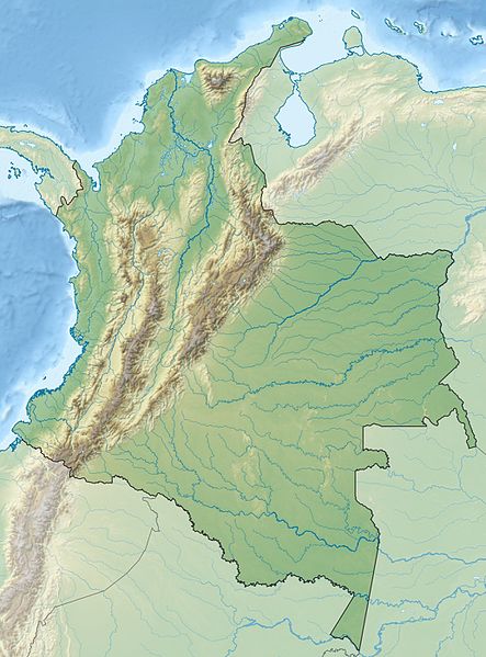
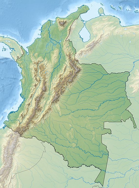
English: Physical Location map of Colombia Equirectangular projection. Geographic limits of the map:
Equirectangular projection. Geographic limits of the map:
|
| Date | |
| Source | Own work |
| Author | Milenioscuro |
| Other versions |
|


.svg)
Licensing
[edit]
I, the copyright holder of this work, hereby publish it under the following license:
This file is licensed under the Creative Commons Attribution-Share Alike 4.0 International license.
- You are free:
- to share – to copy, distribute and transmit the work
- to remix – to adapt the work
- Under the following conditions:
- attribution – You must give appropriate credit, provide a link to the license, and indicate if changes were made. You may do so in any reasonable manner, but not in any way that suggests the licensor endorses you or your use.
- share alike – If you remix, transform, or build upon the material, you must distribute your contributions under the same or compatible license as the original.
File history
Click on a date/time to view the file as it appeared at that time.
| Date/Time | Thumbnail | Dimensions | User | Comment | |
|---|---|---|---|---|---|
| current | 17:15, 9 September 2015 | | 1,378 × 1,864 (653 KB) | Milenioscuro (talk | contribs) | same dimensions of continental location map |
| 16:53, 9 September 2015 |  | 1,420 × 1,896 (688 KB) | Milenioscuro (talk | contribs) | User created page with UploadWizard |
You cannot overwrite this file.
File usage on Commons
The following 4 pages use this file:
File usage on other wikis
The following other wikis use this file:
- Usage on es.wikipedia.org
- Valle de Aburrá
- Parque arqueológico de San Agustín
- Parque nacional natural Cueva de los Guácharos
- Nevado del Ruiz
- Cabo de la Vela
- Parque nacional natural El Tuparro
- Sierra Nevada de Santa Marta
- Altiplano cundiboyacense
- Macizo Colombiano
- Parque nacional natural El Cocuy
- Sierra de la Macarena
- Serranía del Perijá
- Laguna de Guatavita
- Volcán Galeras
- Desierto de la Tatacoa
- Pico Cristóbal Colón
- Laguna de la Cocha
- Cavernas del río Nus
- Sierra de Chiribiquete
- Río Sinú
- Ciénaga Grande de Santa Marta
- Cañón del Chicamocha
- Isla Gorgona
- El Abra
- Terremoto de Cúcuta de 1875
- Montes de María
- Ritacuba Blanco
- Nevado del Huila
- Nevado del Tolima
- Laguna de Iguaque
- Parque nacional natural Sumapaz
- Parque nacional natural Paramillo
- Nudo de Paramillo
- Parque nacional natural Munchique
- Parque nacional natural Las Orquídeas
- Parque nacional natural Los Nevados
- Parque nacional natural Las Hermosas
- Parque nacional natural Puracé
- Parque nacional natural Selva de Florencia
- Parque nacional natural Serranía de los Yariguíes
- Santuario de fauna y flora Otún Quimbaya
- Parque nacional natural Cordillera de los Picachos
- Parque nacional natural Chingaza
- Parque nacional natural Catatumbo Barí
- Parque nacional natural Pisba
- Parque nacional natural Tamá
- Área natural única Los Estoraques
- Santuario de fauna y flora Guanentá Alto Río Fonce
- Parque nacional natural Corales del Rosario y de San Bernardo
- Parque nacional natural Tayrona
View more global usage of this file.