File:ComputerHotline - Fort de Bourlemont (by) (11).jpg
Jump to navigation
Jump to search
Size of this preview: 800 × 545 pixels. Other resolutions: 320 × 218 pixels | 640 × 436 pixels | 1,024 × 698 pixels | 1,280 × 872 pixels | 2,560 × 1,744 pixels | 4,048 × 2,758 pixels.
Original file (4,048 × 2,758 pixels, file size: 12.36 MB, MIME type: image/jpeg)
Captions
Captions
Add a one-line explanation of what this file represents
Summary
[edit]| Description |
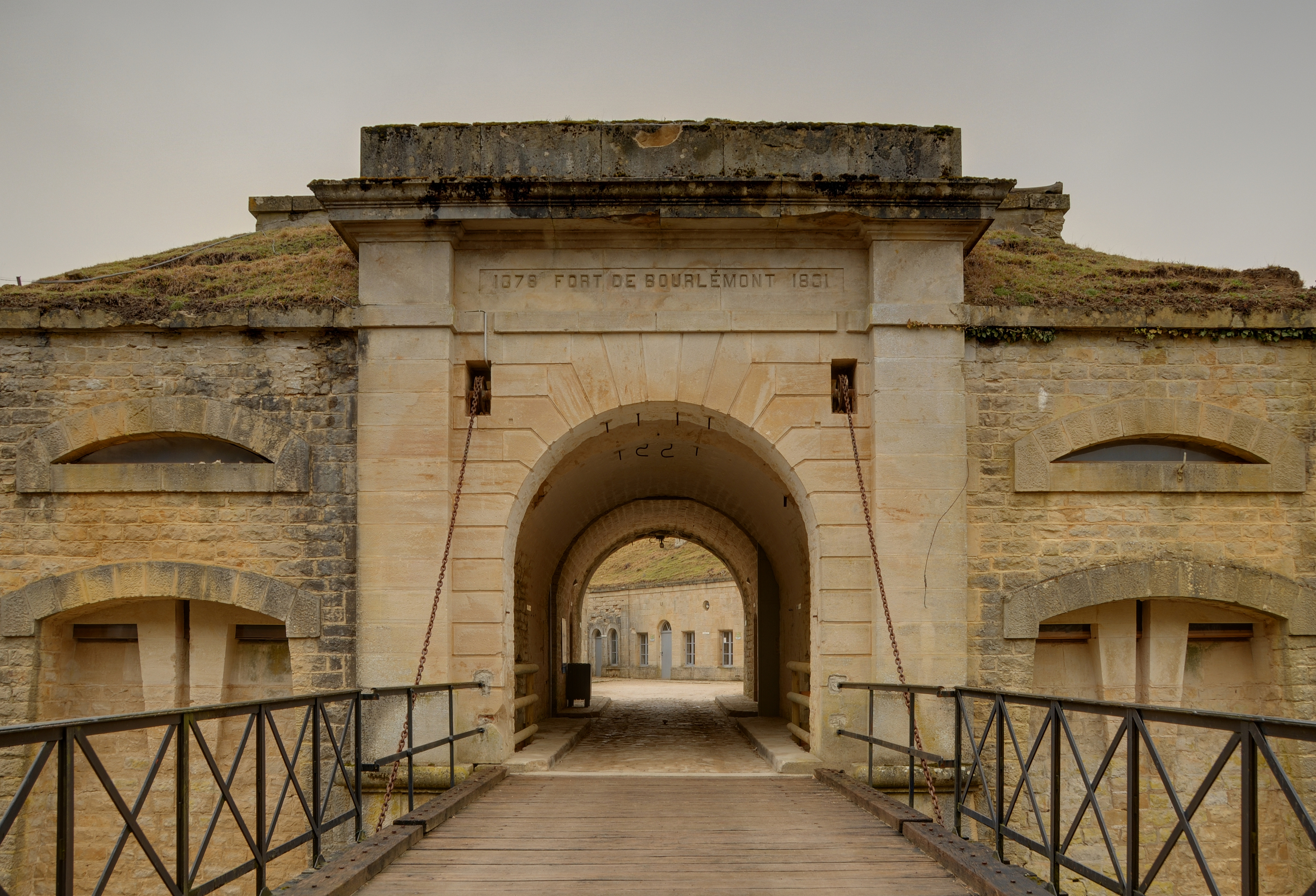
Entrée principale. Bourlémont Fortifications (HDR). |
||||||||||||||||||||||
| Date | |||||||||||||||||||||||
| Source |
|
||||||||||||||||||||||
| Author |
Thomas Bresson from Belfort, France
|
||||||||||||||||||||||

_(11).jpg&action=edit§ion=1)
| Camera location | | View this and other nearby images on: OpenStreetMap |
|---|
_(11).jpg¶ms=048.363733_N_0005.644119_E_globe:Earth_type:camera_source:Flickr_&language=en)
Licensing
[edit]_(11).jpg&action=edit§ion=2)
This file is licensed under the Creative Commons Attribution 2.0 Generic license.
- You are free:
- to share – to copy, distribute and transmit the work
- to remix – to adapt the work
- Under the following conditions:
- attribution – You must give appropriate credit, provide a link to the license, and indicate if changes were made. You may do so in any reasonable manner, but not in any way that suggests the licensor endorses you or your use.
| This image, originally posted to Flickr, was reviewed on March 31, 2010 by the administrator or reviewer File Upload Bot (Magnus Manske), who confirmed that it was available on Flickr under the stated license on that date. |
This image has been assessed using the Quality image guidelines and is considered a Quality image.
|
File history
Click on a date/time to view the file as it appeared at that time.
| Date/Time | Thumbnail | Dimensions | User | Comment | |
|---|---|---|---|---|---|
| current | 07:02, 31 March 2010 | | 4,048 × 2,758 (12.36 MB) | File Upload Bot (Magnus Manske) (talk | contribs) | {{Information |Description=Entr�e principale. Bourl�mont Fortifications (HDR). |Source=[http://www.flickr.com/photos/36519414@N00/4476744926/ Fort de Bourl�mont] * Uploaded by ComputerHotline |Date=2010-03-28 09:01 |Author= |
You cannot overwrite this file.
File usage on Commons
The following 8 pages use this file:
- User:ComputerHotline/Archive 1
- User:ComputerHotline/examples (3)
- Commons:Quality images/Subject/Places/Man made structures/Buildings, Exterior/Part 1a
- Commons:Quality images candidates/Archives April 2010
- Commons talk:Quality images/Subject/Places/Man made structures
- Category:Fort de Bourlémont
- Category:Maps of Mont-lès-Neufchâteau
- Category:Mont-lès-Neufchâteau
File usage on other wikis
The following other wikis use this file:
- Usage on ar.wikipedia.org
- Usage on arz.wikipedia.org
- Usage on ca.wikipedia.org
- Usage on ceb.wikipedia.org
- Usage on ce.wikipedia.org
- Usage on de.wikipedia.org
- Usage on diq.wikipedia.org
- Usage on en.wikipedia.org
- Usage on es.wikipedia.org
- Usage on eu.wikipedia.org
- Usage on fr.wikipedia.org
- Usage on hu.wikipedia.org
- Usage on it.wikipedia.org
- Usage on ku.wikipedia.org
- Usage on pl.wikipedia.org
- Usage on pt.wikipedia.org
- Usage on sk.wikipedia.org
- Usage on sv.wikipedia.org
- Usage on tt.wikipedia.org
- Usage on uk.wikipedia.org
- Usage on uz.wikipedia.org
- Usage on vec.wikipedia.org
- Usage on www.wikidata.org
- Usage on zh-min-nan.wikipedia.org
- Usage on zh.wikipedia.org
_(11).jpg&oldid=866853929)