File:Conglog 1919.JPG
Jump to navigation
Jump to search
Size of this preview: 656 × 600 pixels. Other resolutions: 262 × 240 pixels | 525 × 480 pixels | 820 × 750 pixels.
Original file (820 × 750 pixels, file size: 217 KB, MIME type: image/jpeg)
Captions
Captions
Add a one-line explanation of what this file represents
Summary
[edit]
| Description |
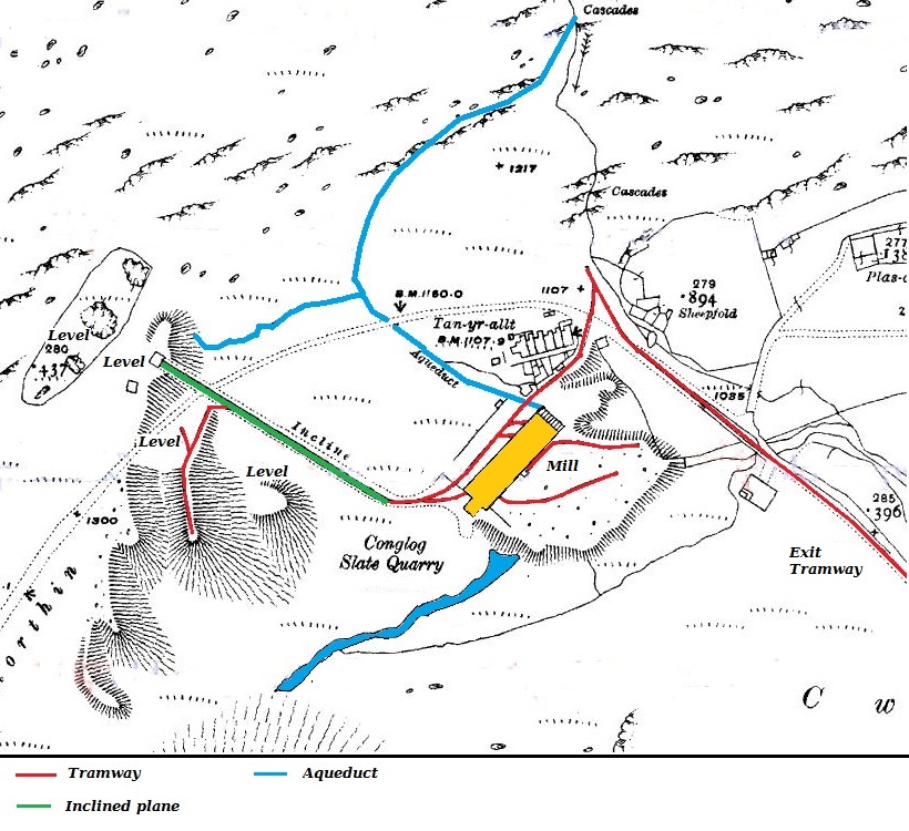
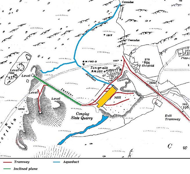
English: Map of Conglog Slate Quarry, Tanygrisiau, Wales, published in 1919, shortly after the quarry closed |
| Date | |
| Source | Ordnance Survey 1:2500 map 1919 |
| Author | Ordnance Survey |
Licensing
[edit]
This work created by the United Kingdom Government is in the public domain.
This is because it is one of the following:
HMSO has declared that the expiry of Crown Copyrights applies worldwide (ref: HMSO Email Reply)
|
 |
The work is in the public domain because it was published by the Ordnance Survey and is more than 50 years old.
File history
Click on a date/time to view the file as it appeared at that time.
| Date/Time | Thumbnail | Dimensions | User | Comment | |
|---|---|---|---|---|---|
| current | 13:23, 29 July 2016 | | 820 × 750 (217 KB) | Bob1960evens (talk | contribs) | Larger scale, coloured overlays added |
| 15:37, 24 March 2013 |  | 545 × 339 (44 KB) | Bob1960evens (talk | contribs) | User created page with UploadWizard |
You cannot overwrite this file.
File usage on Commons
The following page uses this file:
File usage on other wikis
The following other wikis use this file:
- Usage on en.wikipedia.org
- Usage on www.wikidata.org