File:Cook Islands location map.svg
跳至導覽
跳至搜尋

此 SVG 檔案的 PNG 預覽的大小:571 × 599 像素。 其他解析度:229 × 240 像素 | 457 × 480 像素 | 732 × 768 像素 | 976 × 1,024 像素 | 1,951 × 2,048 像素 | 827 × 868 像素。
原始檔案 (SVG 檔案,表面大小:827 × 868 像素,檔案大小:22 KB)
說明
說明
添加單行說明來描述出檔案所代表的內容
摘要
[編輯]
| 描述 |
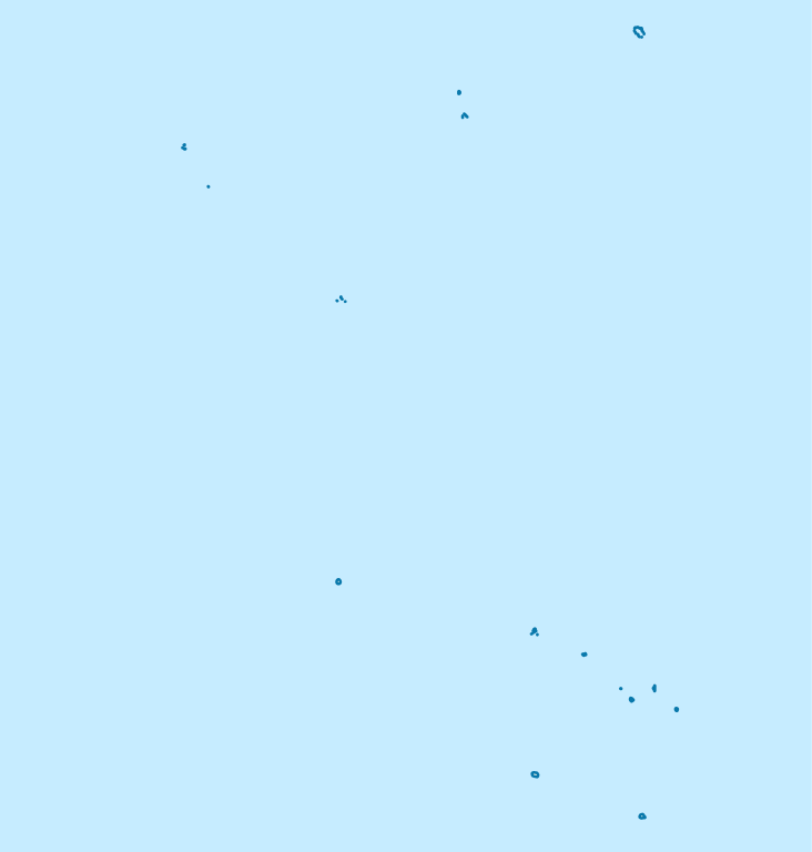
Deutsch: Positionskarte der Cookinseln
Quadratische Plattkarte, N-S-Streckung 105 %. Geographische Begrenzung der Karte:
English: Location map of the Cook Islands
Equirectangular projection, N/S stretching 105 %. Geographic limits of the map:
|
| 日期 | |
| 來源 | own work, using United States National Imagery and Mapping Agency data |
| 作者 | NordNordWest |

|
|
授權條款
[編輯]
我,本作品的著作權持有者,決定用以下授權條款發佈本作品:

|
已授權您依據自由軟體基金會發行的無固定段落、封面文字和封底文字GNU自由文件授權條款1.2版或任意後續版本,對本檔進行複製、傳播和/或修改。該協議的副本列在GNU自由文件授權條款中。 |
此檔案採用創用CC 姓名標示 3.0 未在地化版本授權條款。
- 您可以自由:
- 分享 – 複製、發佈和傳播本作品
- 重新修改 – 創作演繹作品
- 惟需遵照下列條件:
- 姓名標示 – 您必須指名出正確的製作者,和提供授權條款的連結,以及表示是否有對內容上做出變更。您可以用任何合理的方式來行動,但不得以任何方式表明授權條款是對您許可或是由您所使用。
您可以選擇您需要的授權條款。
檔案歷史
點選日期/時間以檢視該時間的檔案版本。
| 日期/時間 | 縮圖 | 尺寸 | 用戶 | 備註 | |
|---|---|---|---|---|---|
| 目前 | 2011年11月16日 (三) 19:02 | | 827 × 868(22 KB) | NordNordWest(對話 | 貢獻) | upd |
| 2009年4月16日 (四) 16:57 |  | 827 × 868(15 KB) | NordNordWest(對話 | 貢獻) | corr | |
| 2009年4月16日 (四) 09:14 |  | 591 × 868(15 KB) | NordNordWest(對話 | 貢獻) | {{Information |Description= {{de|Positionskarte der Cookinseln}} Quadratische Plattkarte, N-S-Streckung 105 %. Geographische Begrenzung der Karte: * N: 8.5° S * S: 22.5° S * W: 166.5° W * O: 156.5° W {{en|Location map of the [[:en:C |
無法覆蓋此檔案。
檔案用途
下列12個頁面有用到此檔案:
- User:NordNordWest/Gallery/Location maps
- File:Aitutaki in Cook Islands.svg
- File:Atiu in Cook Islands.svg
- File:Mangaia in Cook Islands.svg
- File:Manihiki in Cook Islands.svg
- File:Mauke in Cook Islands.svg
- File:Mitiaro in Cook Islands.svg
- File:Palmerston in Cook Islands.svg
- File:Penrhyn in Cook Islands.svg
- File:Pukapuka in Cook Islands.svg
- File:Rakahanga in Cook Islands.svg
- File:Rarotonga in Cook Islands.svg
全域檔案使用狀況
以下其他 wiki 使用了這個檔案:
- af.wikipedia.org 的使用狀況
- an.wikipedia.org 的使用狀況
- ar.wikipedia.org 的使用狀況
- ast.wikipedia.org 的使用狀況
- az.wikipedia.org 的使用狀況
- be.wikipedia.org 的使用狀況
- bg.wikipedia.org 的使用狀況
- bn.wikipedia.org 的使用狀況
- ceb.wikipedia.org 的使用狀況
- Plantilya:Location map Cook Islands
- Papua
- North Point
- Long Rock
- Black Rock
- North Rock
- Halfway Rock
- Papa (pagklaro)
- Patanga (pagklaro)
- Lahu
- Nicholson Island
- Danger Islands
- Anchorage Island
- Entrance Island
- High Island
- Whale Island
- One Tree Island
- San Pablo
- South Reef
- North Island
- Northwest Pass
- New Island
- Palmerston
- John Point
- North East Reef
- Palmerston Island
- Hervey Islands
檢視此檔案的更多全域使用狀況。