File:Cornwall UK location map.svg
Aller à la navigation
Aller à la recherche

Taille de cet aperçu PNG pour ce fichier SVG : 800 × 588 pixels. Autres résolutions : 320 × 235 pixels | 640 × 471 pixels | 1 024 × 753 pixels | 1 280 × 941 pixels | 2 560 × 1 883 pixels | 1 425 × 1 048 pixels.
Fichier d’origine (Fichier SVG, nominalement de 1 425 × 1 048 pixels, taille : 1,66 Mio)
Légendes
Légendes
Padstow
| Description |
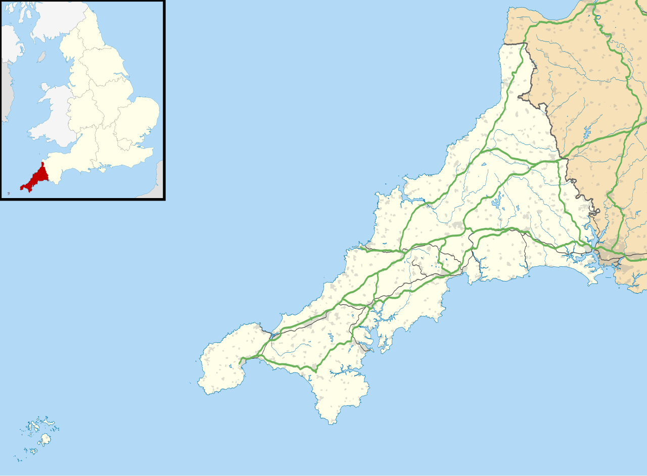
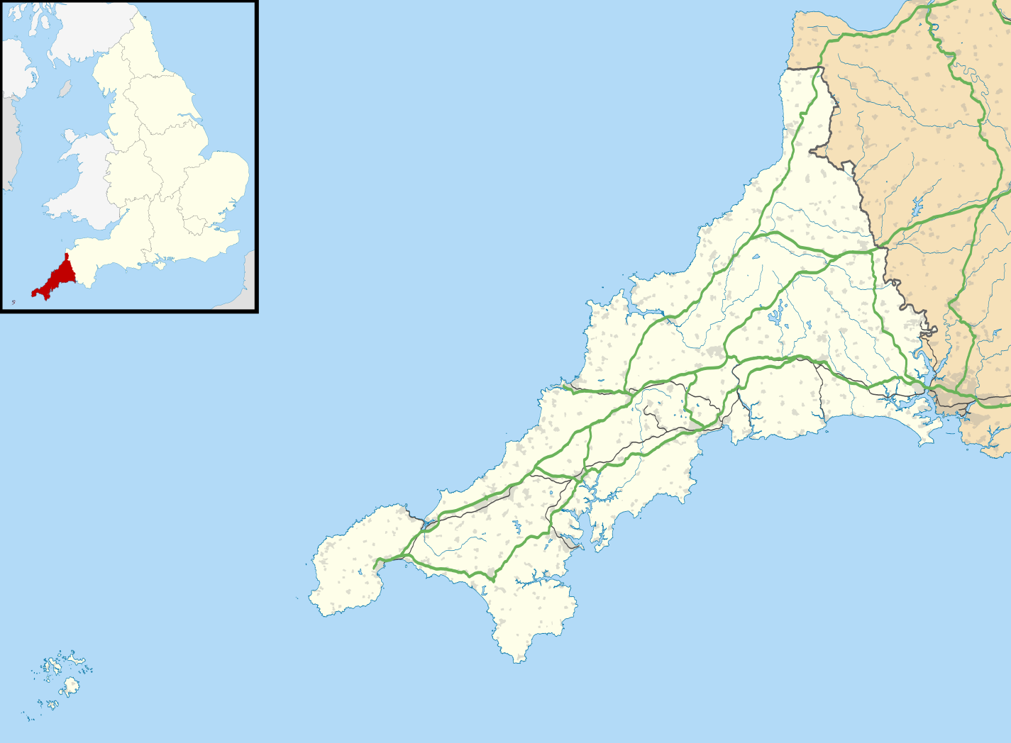
Map of Cornwall, UK with the following information shown:
Equirectangular map projection on WGS 84 datum, with N/S stretched 150% Geographic limits:
|
| Date | |
| Source |
|
| Auteur | Nilfanion, created using Ordnance Survey data |
| Autorisation (Réutilisation de ce fichier) |
Ce fichier est disponible selon les termes de la licence Creative Commons Attribution – Partage dans les Mêmes Conditions 3.0 (non transposée). Attribution: Contains Ordnance Survey data © Crown copyright and database right
|
| Autres versions |
File:Cornwall UK district map (blank).svg - Blank map File:Cornwall UK mainland location map.svg - Without Isles of Scilly |
.svg)
Historique du fichier
Cliquer sur une date et heure pour voir le fichier tel qu'il était à ce moment-là.
| Date et heure | Vignette | Dimensions | Utilisateur | Commentaire | |
|---|---|---|---|---|---|
| actuel | 26 septembre 2010 à 18:43 | | 1 425 × 1 048 (1,66 Mio) | Nilfanion (d | contributions) | {{Information |Description=Map of Cornwall, UK with the following information shown: *Administrative borders *Coastline, lakes and rivers *Roads and railways *Urban areas Equirectangular map projection on WGS 84 datum, with N/S stretched 1 |
Vous ne pouvez pas remplacer ce fichier.
Utilisations locales du fichier
La page suivante utilise ce fichier :
Utilisations du fichier sur d’autres wikis
Les autres wikis suivants utilisent ce fichier :
- Utilisation sur ar.wikipedia.org
- Utilisation sur bg.wikipedia.org
- Utilisation sur ceb.wikipedia.org
- Utilisation sur en.wikipedia.org
- List of lighthouses in England
- Tintagel Castle
- Chûn Castle
- Truro Cathedral
- Port Eliot
- Lanhydrock House
- Carn Brea, Redruth
- Runnel Stone
- RAF St Mawgan
- Jamaica Inn
- List of places in Cornwall
- Penryn Campus
- St German's Priory
- Rillaton Barrow
- Roseland Peninsula
- Pendennis Castle
- Tregenna Castle
- Tregothnan
- Picklecombe Fort
- Restormel Castle
- Redruth transmitting station
- St Bartholomew's Church, Lostwithiel
- Caradon Hill transmitting station
- Goldsithney
- Mount Wellington Tin Mine
- Brisons
- Penlee Battery
- Newquay Airport
- RNAS Culdrose (HMS Seahawk)
- Geevor Tin Mine
- Botallack Mine
- Camborne School of Mines
- Prideaux Place
- Cotehele
- Trerice
- The Hurlers (stone circles)
- Poldice mine
- Godolphin Estate
- RAF Davidstow Moor
- Levant Mine and Beam Engine
- Trelissick
- Antony House
- Mount Edgcumbe House
- Trengwainton Garden
- Trevenson
- St Ervan
- HMS Raleigh (shore establishment)
Voir davantage sur l’utilisation globale de ce fichier.