File:Corps practices for California Delta flood emergency (14890087000).jpg
Jump to navigation
Jump to search

Size of this preview: 800 × 534 pixels. Other resolutions: 320 × 214 pixels | 640 × 427 pixels | 1,024 × 683 pixels | 1,280 × 854 pixels | 2,560 × 1,708 pixels | 4,496 × 3,000 pixels.
Original file (4,496 × 3,000 pixels, file size: 8.1 MB, MIME type: image/jpeg)
Captions
Captions
Add a one-line explanation of what this file represents
Summary[edit]
.jpg&action=edit§ion=1)
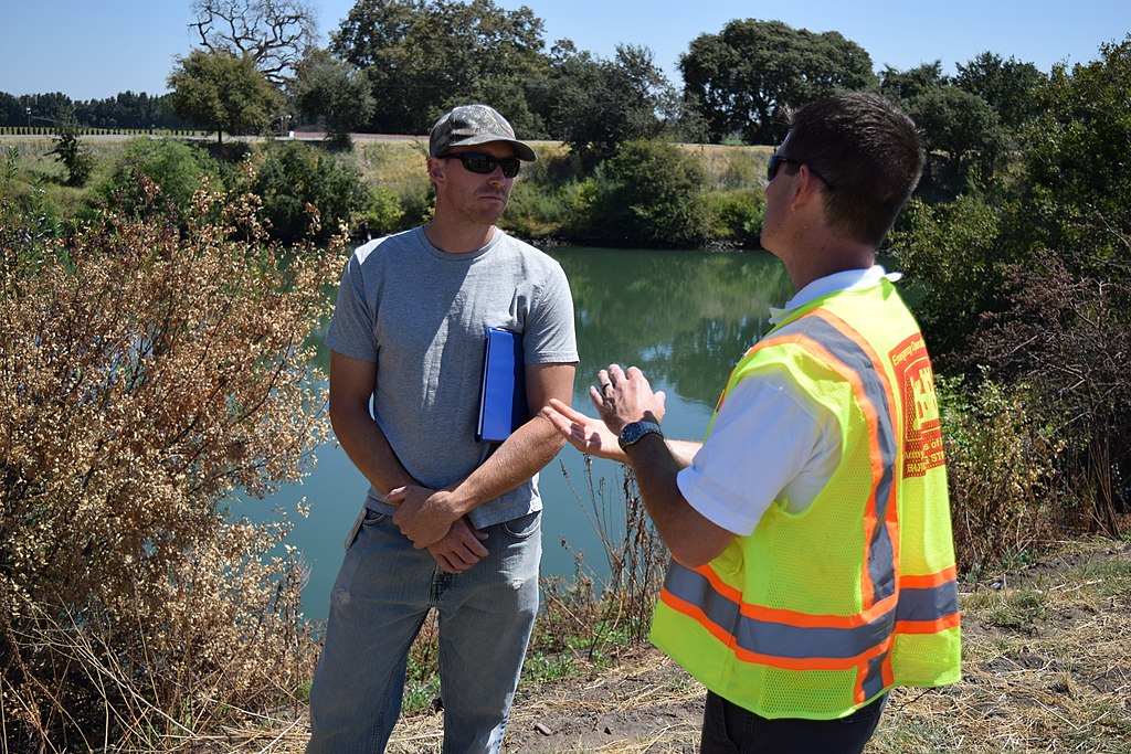
| Description | Josh Jimerfield (right), an emergency management specialist with the U.S. Army Corps of Engineers Sacramento District, coordinates with a California Department of Water Resources employee during a small-scale flood emergency response exercise in the Sacramento-San Joaquin River Delta near Walnut Grove, California, Aug. 27, 2014. The exercise provided the district an opportunity to evaluate current emergency response plans and capabilities and work alongside state partners to stay ready for a flood emergency. Photo cropped for emphasis. (U.S. Army photo by John Prettyman/Released) |
| Date | |
| Source | Corps practices for California Delta flood emergency |
| Author | U.S. Army Corps of Engineers Sacramento District |
| Camera location | | View this and other nearby images on: OpenStreetMap |
|---|
.jpg¶ms=038.307522_N_-121.598078_E_globe:Earth_type:camera_source:Flickr_&language=en)
Licensing[edit]
.jpg&action=edit§ion=2)
This image or file is a work of a U.S. Army Corps of Engineers soldier or employee, taken or made as part of that person's official duties. As a work of the U.S. federal government, the image is in the public domain.
|
| This image was originally posted to Flickr by USACE-Sacramento District at https://flickr.com/photos/52057813@N07/14890087000. It was reviewed on 12 October 2016 by FlickreviewR and was confirmed to be licensed under the terms of the United States Government Work. |
File history
Click on a date/time to view the file as it appeared at that time.
| Date/Time | Thumbnail | Dimensions | User | Comment | |
|---|---|---|---|---|---|
| current | 04:39, 12 October 2016 | | 4,496 × 3,000 (8.1 MB) | Vanished Account Byeznhpyxeuztibuo (talk | contribs) | Transferred from Flickr via Flickr2Commons |
You cannot overwrite this file.
File usage on Commons
There are no pages that use this file.
.jpg&oldid=809163592)