File:CountriesRecognizingKosovo.svg
跳至導覽
跳至搜尋

此 SVG 檔案的 PNG 預覽的大小:800 × 349 像素。 其他解析度:320 × 139 像素 | 640 × 279 像素 | 1,024 × 446 像素 | 1,280 × 558 像素 | 2,560 × 1,115 像素 | 2,754 × 1,200 像素。
原始檔案 (SVG 檔案,表面大小:2,754 × 1,200 像素,檔案大小:1.11 MB)
說明
說明
添加單行說明來描述出檔案所代表的內容

摘要[編輯]
授權條款[編輯]
| 此作品已由其作者,英文維基百科的Alethiareg,釋出至公有領域。此授權條款在全世界均適用。 這可能在某些國家不合法,如果是的話: Alethiareg授予任何人有權利使用此作品於任何用途,除受法律約束外,不受任何限制。 |
原始上傳日誌[編輯]
Transferred from en.wikipedia to Commons by EmilJ using CommonsHelper.
The original description page was here. All following user names refer to en.wikipedia.
- 14:22, 17 September 2008 940×415 (1.45 MB) EmilJ add Taiwan, omit circles for dependent territories
- 11:46, 16 September 2008 940×415 (1.45 MB) EmilJ Samoa recognized
- 14:20, 15 September 2008 940×415 (1.45 MB) EmilJ use CSS, add missing countries and territories
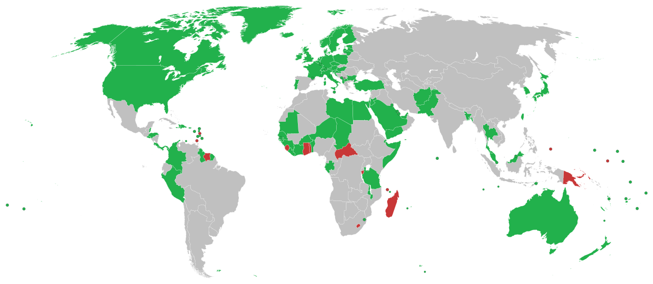
- 09:39, 15 September 2008 940×415 (1.49 MB) Alethiareg == Summary == {{Information |Description=This is a map of countries recognizing independence of Kosovo. |Author =User:Alethiareg, User:ArturM, User:Balfabio, [[User:Av
檔案歷史
點選日期/時間以檢視該時間的檔案版本。
| 日期/時間 | 縮圖 | 尺寸 | 使用者 | 備註 | |
|---|---|---|---|---|---|
| 目前 | 2022年1月1日 (六) 23:54 | | 2,754 × 1,200(1.11 MB) | Kwamikagami(留言 | 貢獻) | color integral constituents (Puerto Rico, New Caledonia, etc.) |
| 2021年4月26日 (一) 21:23 |  | 2,754 × 1,200(1.05 MB) | NordNordWest(留言 | 貢獻) | Reverted to version as of 06:02, 25 February 2021 (UTC) | |
| 2021年4月25日 (日) 16:58 |  | 512 × 223(805 KB) | ויקי4800(留言 | 貢獻) | תיקון גבולות מדינת ישראל | |
| 2021年2月25日 (四) 06:02 |  | 2,754 × 1,200(1.05 MB) | Liggliluff(留言 | 貢獻) | Replacing file with BlankMap-World.svg for a better look, countries coloured by the style-code, should be correct to the last map, the image is cropped and ocean hidden, micro-nations have circles, and hovering shows popups | |
| 2021年2月8日 (一) 23:55 |  | 1,650 × 750(918 KB) | Arianasmithy74(留言 | 貢獻) | Reverted to version as of 21:31, 29 December 2020 (UTC) | |
| 2021年2月7日 (日) 17:32 |  | 1,650 × 750(918 KB) | Arianasmithy74(留言 | 貢獻) | Comoros now sent a letter to Kosovo saying that they still recognise Kosovo | |
| 2020年12月29日 (二) 21:31 |  | 1,650 × 750(918 KB) | Arianasmithy74(留言 | 貢獻) | Brunei is green again. | |
| 2020年12月29日 (二) 21:18 |  | 1,650 × 750(918 KB) | Arianasmithy74(留言 | 貢獻) | Nauru is now red as it withdrew recognition. | |
| 2020年12月27日 (日) 15:41 |  | 1,650 × 750(918 KB) | Arianasmithy74(留言 | 貢獻) | Brunei is now green Also, 'nu' is Niue so it is not supposed to be red | |
| 2020年12月11日 (五) 11:05 |  | 1,650 × 750(918 KB) | Kwamikagami(留言 | 貢獻) | withdrawn recognition |
無法覆蓋此檔案。
檔案用途
下列頁面有用到此檔案:
全域檔案使用狀況
以下其他 wiki 使用了這個檔案:
- af.wikipedia.org 的使用狀況
- ar.wikipedia.org 的使用狀況
- arz.wikipedia.org 的使用狀況
- ast.wikipedia.org 的使用狀況
- bg.wikipedia.org 的使用狀況
- bn.wikipedia.org 的使用狀況
- ca.wikipedia.org 的使用狀況
- cs.wikipedia.org 的使用狀況
- de.wikipedia.org 的使用狀況
- Benutzer:Generator
- Geschichte des Kosovo
- Liste der Gebiete mit begrenzter Anerkennung als Staat
- Kosovo
- Portal:Kosovo/Artikel des Monats
- Diskussion:Kosovo/Archiv/005
- Internationale Anerkennung des Kosovo
- Diskussion:Kosovo/Archiv/006
- Diskussion:Internationale Anerkennung des Kosovo/Archiv
- Wikipedia:Kartenwerkstatt/Archiv/2018-03
- el.wikipedia.org 的使用狀況
- en.wikipedia.org 的使用狀況
- es.wikipedia.org 的使用狀況
- fa.wikipedia.org 的使用狀況
- fi.wikipedia.org 的使用狀況
- fr.wikipedia.org 的使用狀況
- gl.wikipedia.org 的使用狀況
- hr.wikipedia.org 的使用狀況
- hu.wikipedia.org 的使用狀況
- hy.wikipedia.org 的使用狀況
- id.wikipedia.org 的使用狀況
- incubator.wikimedia.org 的使用狀況
- it.wikipedia.org 的使用狀況
檢視此檔案的更多全域使用狀況。