File:Cuba municipalities.png
跳至導覽
跳至搜尋

預覽大小:800 × 548 像素。 其他解析度:320 × 219 像素 | 640 × 439 像素 | 1,024 × 702 像素 | 1,280 × 877 像素。
原始檔案 (1,280 × 877 像素,檔案大小:27 KB,MIME 類型:image/png)
說明
說明
添加單行說明來描述出檔案所代表的內容
摘要
[編輯]
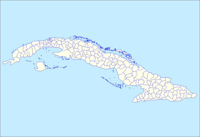
| 描述 | Map of the municipalities of Cuba. Created by Rarelibra 15:26, 11 April 2007 (UTC) for public domain use, using MapInfo Professional v8.5 and various mapping resources. |
| 日期 | 2007年4月11日 (原始上傳日期) |
| 來源 | 无法识别来源。根据版权声明推断为其自己的作品。 |
| 作者 | 无法识别作者。根据版权声明推断作者为Rarelibra。 |
授權條款
[編輯]
| 我,此作品的版權所有人,釋出此作品至公共領域。此授權條款在全世界均適用。 這可能在某些國家不合法,如果是的話: 我授予任何人有權利使用此作品於任何用途,除受法律約束外,不受任何限制。 |
檔案歷史
點選日期/時間以檢視該時間的檔案版本。
| 日期/時間 | 縮圖 | 尺寸 | 使用者 | 備註 | |
|---|---|---|---|---|---|
| 目前 | 2015年9月2日 (三) 19:13 | | 1,280 × 877(27 KB) | Milenioscuro(留言 | 貢獻) | color of the sea |
| 2013年6月9日 (日) 19:10 |  | 1,280 × 877(45 KB) | DerBorg(留言 | 貢獻) | added a different color to the sea (to distinguish from the land. note: if my add is redundant, feel free to revert) | |
| 2007年4月11日 (三) 15:26 |  | 1,281 × 878(24 KB) | Rarelibra(留言 | 貢獻) | Map of the municipalities of Cuba. Created by ~~~~ for public domain use, using MapInfo Professional v8.5 and various mapping resources. |
無法覆蓋此檔案。
檔案用途
下列頁面有用到此檔案:
全域檔案使用狀況
以下其他 wiki 使用了這個檔案:
- ar.wikipedia.org 的使用狀況
- da.wikipedia.org 的使用狀況
- en.wikipedia.org 的使用狀況
- fr.wikipedia.org 的使用狀況
- gl.wikipedia.org 的使用狀況
- ht.wikipedia.org 的使用狀況
- Esmeralda, Camagüey
- Florida, Camagüey
- Guáimaro, Camagüey
- Jimaguayú, Camagüey
- Minas, Camagüey
- Najasa, Camagüey
- Nuevitas, Camagüey
- Santa Cruz del Sur, Camagüey
- Sibanicú, Camagüey
- Sierra de Cubitas, Camagüey
- Baraguá, Ciego de Ávila
- Bolivia, Ciego de Ávila
- Chambas, Ciego de Ávila
- Florencia, Ciego de Ávila
- Majagua, Ciego de Ávila
- Primero de Enero, Ciego de Ávila
- Venezuela, Ciego de Ávila
- Abreus, Cienfuegos
- Aguada de Pasajeros, Cienfuegos
- Cienfuegos, Cienfuegos
- Cruces, Cienfuegos
- Cumanayagua, Cienfuegos
- Lajas, Cienfuegos
- Palmira, Cienfuegos
- Rodas, Cienfuegos
- Arroyo Naranjo, Habana
- Boyeros, Habana
- Cerro, Habana
- Diez de Octubre, Habana
- Plaza de la Revolución, Habana
- Regla, Habana
- Bartolomé Masó, Granma
- Bayamo, Granma
- Buey Arriba, Granma
- Campechuela, Granma
- Cauto Cristo, Granma
- Guisa, Granma
- Jiguaní, Granma
- Manzanillo, Granma
- Media Luna, Granma
- Niquero, Granma
- Pilón, Granma
- Río Cauto, Granma
檢視此檔案的更多全域使用狀況。