File:DEU Großrinderfeld COA.svg
Jump to navigation
Jump to search

Size of this PNG preview of this SVG file: 566 × 599 pixels. Other resolutions: 227 × 240 pixels | 453 × 480 pixels | 726 × 768 pixels | 967 × 1,024 pixels | 1,935 × 2,048 pixels | 701 × 742 pixels.
Original file (SVG file, nominally 701 × 742 pixels, file size: 39 KB)
Captions
Captions
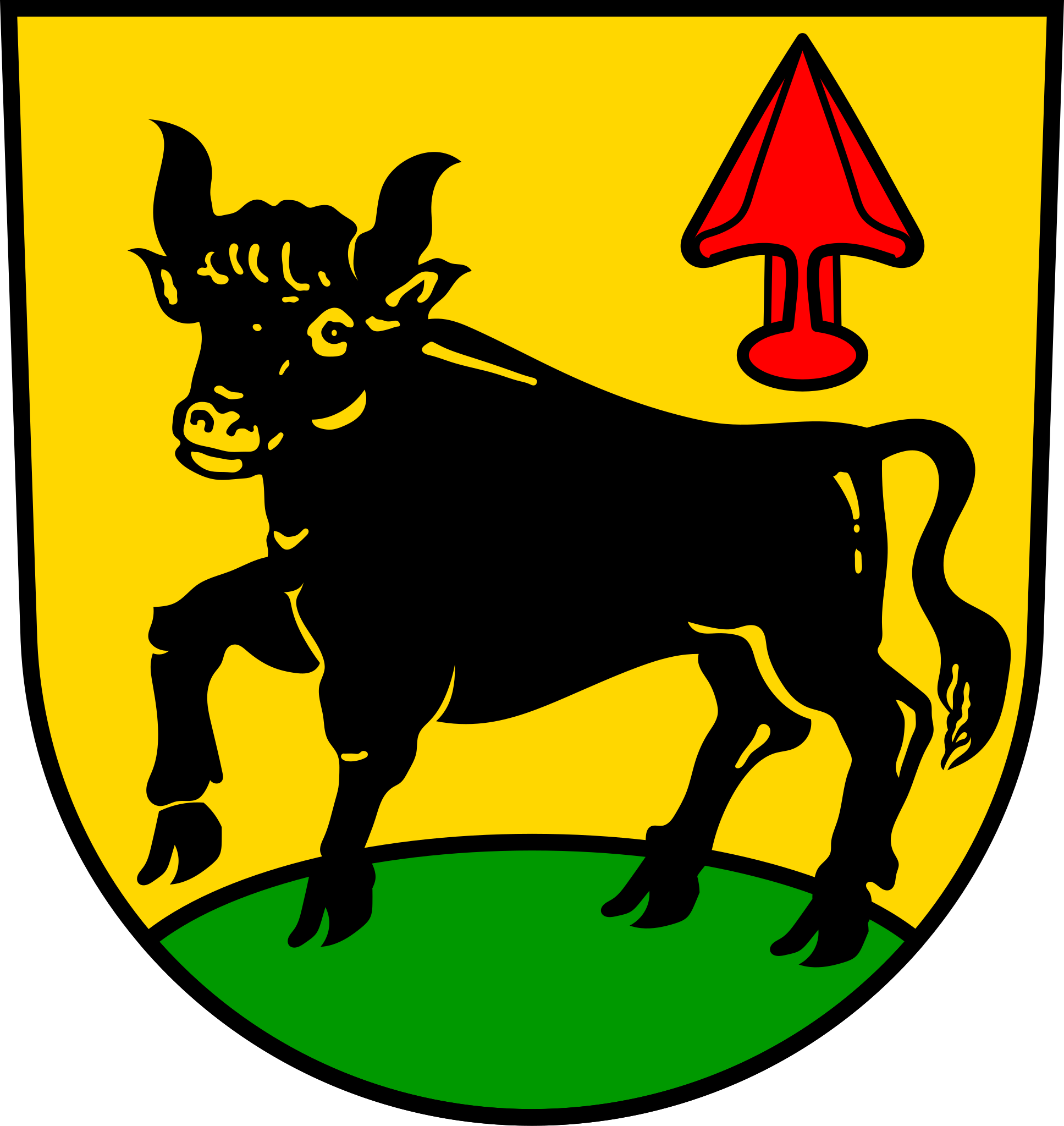
Coat of arms of the municipality of Großrinderfeld
Summary
[edit]| Coat of arms | Deutsch: von Großrinderfeld English: of the municipality of Großrinderfeld |
|||
| Blazon | Deutsch: In Gold auf grünem Boden ein schreitendes schwarzes Rind, links oben eine gestürzte rote Pflugschar. |
|||
| Blazon reference | [] | |||
| Tincture | gulesorsablevert |
|||
| Date | from 20 October 1978; SVG 25 June 2018 | |||
| Object history |
Deutsch: Die 1583 kurmainzisch gewordene frühere Gemeinde Großrinderfeld verwendete 1589 ein Siegel, das die „redende" Wappenfigur des Rindes unter dem Mainzer Rad aufwies. Seit 1901 zeigte das farbige Wappen im silbernen Schild auf grünem Boden ein schreitendes schwarzes Rind, darüber ein achtspeichiges rotes Rad. Nach Eingliederung von Ilmspan in Großrinderfeld und nach der am 1. Januar 1975 erfolgten Vereinigung des letzteren mit Gerchsheim und Schönfeld nahm die neue Gemeinde Großrinderfeld das jetzige Wappen an. Die Pflugschar und die geänderten Farben repräsentieren die hinzugekommenen Orte. Am 20. Oktober 1978 verlieh das Landratsamt das Wappen und die Flagge. |
|||
| Artist | Chris die Seele | |||
| Source | Own work based on: [1] | |||
| Permission (Reusing this file) |
|
|||
| Other versions |
 |
|||
| SVG development |

Licensing
[edit]
I, the copyright holder of this work, hereby publish it under the following license:
This file is licensed under the Creative Commons Attribution-Share Alike 4.0 International license.
- You are free:
- to share – to copy, distribute and transmit the work
- to remix – to adapt the work
- Under the following conditions:
- attribution – You must give appropriate credit, provide a link to the license, and indicate if changes were made. You may do so in any reasonable manner, but not in any way that suggests the licensor endorses you or your use.
- share alike – If you remix, transform, or build upon the material, you must distribute your contributions under the same or compatible license as the original.
File history
Click on a date/time to view the file as it appeared at that time.
| Date/Time | Thumbnail | Dimensions | User | Comment | |
|---|---|---|---|---|---|
| current | 19:04, 25 June 2018 | | 701 × 742 (39 KB) | Chris die Seele (talk | contribs) | User created page with UploadWizard |
You cannot overwrite this file.
File usage
More than 100 pages use this file. The following list shows the first 100 pages that use this file only. A full list is available.
- Großrinderfeld
- File:DEU Großrinderfeld COA.svg
- File:Wappen Grossrinderfeld.png
- Template:Centuries in Großrinderfeld
- Template:Districts of Großrinderfeld
- Template:GroßrinderfeldPhotographs
- Template:Großrinderfeldyear
- Category:1841 in Großrinderfeld
- Category:1866 in Großrinderfeld
- Category:1882 in Großrinderfeld
- Category:1899 in Großrinderfeld
- Category:1903 in Großrinderfeld
- Category:1909 in Großrinderfeld
- Category:1928 in Großrinderfeld
- Category:1932 in Großrinderfeld
- Category:1993 in Großrinderfeld
- Category:1993 photographs of Großrinderfeld
- Category:1996 in Großrinderfeld
- Category:1996 photographs of Großrinderfeld
- Category:2007 in Großrinderfeld
- Category:2008 in Großrinderfeld
- Category:2011 in Großrinderfeld
- Category:2011 photographs of Großrinderfeld
- Category:2013 in Großrinderfeld
- Category:2013 photographs of Großrinderfeld
- Category:2016 in Großrinderfeld
- Category:2017 in Großrinderfeld
- Category:2017 photographs of Großrinderfeld
- Category:2018 in Großrinderfeld
- Category:2018 photographs of Großrinderfeld
- Category:2019 in Großrinderfeld
- Category:2019 photographs of Großrinderfeld
- Category:2020 in Großrinderfeld
- Category:2020 photographs of Großrinderfeld
- Category:2021 in Großrinderfeld
- Category:2021 photographs of Großrinderfeld
- Category:Animals of Großrinderfeld
- Category:Boundary stones in Großrinderfeld
- Category:Buildings in Großrinderfeld
- Category:Christmas trees in Großrinderfeld
- Category:Cultural heritage monuments in Gerchsheim
- Category:Cultural heritage monuments in Großrinderfeld
- Category:Cultural heritage monuments in Großrinderfeld (Großrinderfeld)
- Category:Cultural heritage monuments in Ilmspan
- Category:Cultural heritage monuments in Schönfeld (Großrinderfeld)
- Category:Culture of Großrinderfeld
- Category:Districts of Großrinderfeld
- Category:Economy of Großrinderfeld
- Category:Folklore of Großrinderfeld
- Category:Franco-Prussian War memorials in Großrinderfeld
- Category:Geography of Großrinderfeld
- Category:Gerchsheim
- Category:Großrinderfeld
- Category:Großrinderfeld (Großrinderfeld)
- Category:Großrinderfeld by century
- Category:Großrinderfeld by year
- Category:Großrinderfeld diagrams
- Category:Großrinderfeld in the 1840s
- Category:Großrinderfeld in the 1860s
- Category:Großrinderfeld in the 1880s
- Category:Großrinderfeld in the 1890s
- Category:Großrinderfeld in the 1900s
- Category:Großrinderfeld in the 1920s
- Category:Großrinderfeld in the 1930s
- Category:Großrinderfeld in the 1990s
- Category:Großrinderfeld in the 19th century
- Category:Großrinderfeld in the 2000s
- Category:Großrinderfeld in the 2010s
- Category:Großrinderfeld in the 2020s
- Category:Großrinderfeld in the 20th century
- Category:Großrinderfeld in the 21st century
- Category:History of Gerchsheim
- Category:History of Großrinderfeld by district
- Category:Ilmspan
- Category:Ilmspan diagrams
- Category:Maps of Gerchsheim
- Category:Maps of Großrinderfeld
- Category:Maps of Großrinderfeld (Großrinderfeld)
- Category:Maps of Ilmspan
- Category:Maps of Schönfeld (Großrinderfeld)
- Category:Night in Großrinderfeld
- Category:OpenStreetMap maps of Großrinderfeld
- Category:Parts of a day in Großrinderfeld
- Category:Roads in Großrinderfeld
- Category:Schönfeld (Großrinderfeld)
- Category:Shops in Großrinderfeld
- Category:Snow in Großrinderfeld
- Category:Streets in Großrinderfeld
- Category:Things named after Gerchsheim
- Category:Things named after Großrinderfeld
- Category:Things named after Schönfeld (Großrinderfeld)
- Category:Transport in Großrinderfeld
- Category:Trees in Großrinderfeld
- Category:Views of Gerchsheim
- Category:Views of Großrinderfeld
- Category:Views of Großrinderfeld (Großrinderfeld)
- Category:Views of Ilmspan
- Category:Views of Schönfeld (Großrinderfeld)
- Category:War memorials in Großrinderfeld
- Category:Wayside crosses in Großrinderfeld
View more links to this file.
Global file usage
The following other wikis use this file:
- Usage on als.wikipedia.org
- Usage on ce.wikipedia.org
- Usage on de.wikipedia.org
- Main-Tauber-Kreis
- Großrinderfeld
- Tauberbischofsheim
- Gerchsheim
- Ilmspan
- Liste der Wappen im Main-Tauber-Kreis
- Schönfeld (Großrinderfeld)
- Liste der Orte im Main-Tauber-Kreis
- Vorlage:Navigationsleiste Ortsteile von Großrinderfeld
- Kategorie:Benutzer:aus Großrinderfeld
- Benutzer:Vorlage/aus Großrinderfeld
- St. Michael (Großrinderfeld)
- St. Vitus (Schönfeld)
- Friedhofskapelle (Großrinderfeld)
- Marienkapelle (Hof Baiertal)
- Benutzer:IJ300
- St. Johannes der Täufer (Gerchsheim)
- Hof Baiertal
- St. Laurentius (Ilmspan)
- Vorlage:Navigationsleiste Kirchen und Kapellen in Großrinderfeld
- Maria Königin des Friedens (Gerchsheim)
- Benutzer:LMMR
- Liste der Kulturdenkmale in Großrinderfeld
- Liste von Persönlichkeiten der Gemeinde Großrinderfeld
- Benutzer:Triplec85/Liste der Straßennamen von Großrinderfeld
- Benutzer:Triplec85/Amtlicher Gemeindeschlüssel
- Benutzer:Triplec85/Wikipedia:Main-Tauber-Kreis/Daten und Fakten
- Liste der Gemeinden im Main-Tauber-Kreis
- Liste der Wüstungen im Main-Tauber-Kreis
- Benutzer:Triplec85/Altertheimer Weg
- Gewerbegebiet Gerchsheim
- Benutzer:Triplec85/Beund (Großrinderfeld)
- Siedlung (Großrinderfeld)
- Friedhofskapelle (Ilmspan)
- Liste von Rathäusern im Main-Tauber-Kreis
- Usage on en.wikipedia.org
- Usage on eo.wikipedia.org
- Usage on es.wikipedia.org
- Usage on eu.wikipedia.org
- Usage on fa.wikipedia.org
- Usage on fr.wikipedia.org
- Usage on hu.wikipedia.org
- Usage on it.wikipedia.org
- Usage on ja.wikipedia.org
- Usage on kk.wikipedia.org
- Usage on ku.wikipedia.org
- Usage on lld.wikipedia.org
View more global usage of this file.