File:DJI 0072 (30871118653).jpg
Jump to navigation
Jump to search

Size of this preview: 800 × 600 pixels. Other resolutions: 320 × 240 pixels | 640 × 480 pixels | 1,024 × 768 pixels | 1,280 × 960 pixels | 2,560 × 1,920 pixels | 4,000 × 3,000 pixels.
Original file (4,000 × 3,000 pixels, file size: 5.05 MB, MIME type: image/jpeg)
Captions
Captions
Add a one-line explanation of what this file represents
Summary
[edit].jpg&action=edit§ion=1)
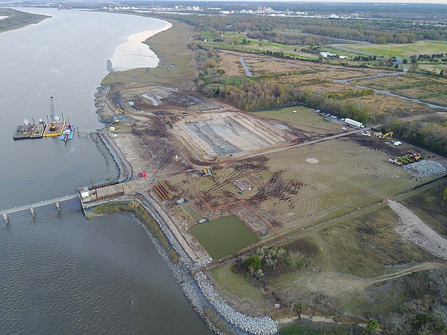
| Description | An aerial shot of the Sediment Basin / Tidegate removal portion of the Savannah Harbor Expansion Project. Photo: De Moya Continental JV. |
| Date | Taken on 15 December 2016, 17:25 |
| Source | DJI_0072 |
| Author | U.S. Army Corps of Engineers Savannah District |
| Camera location | | View this and other nearby images on: OpenStreetMap |
|---|
.jpg¶ms=032.097855_N_-081.082084_E_globe:Earth_type:camera_alt:26.621_source:exif_&language=en)
Licensing
[edit].jpg&action=edit§ion=2)
| This image was originally posted to Flickr by U.S. Army Corps of Engineers Savannah District at https://flickr.com/photos/45417428@N05/30871118653 (archive). It was reviewed on 7 September 2018 by FlickreviewR 2 and was confirmed to be licensed under the terms of the cc-by-2.0. |
This file is a work of a U.S. Army soldier or employee, taken or made as part of that person's official duties. As a work of the U.S. federal government, it is in the public domain in the United States.
|
 |
File history
Click on a date/time to view the file as it appeared at that time.
| Date/Time | Thumbnail | Dimensions | User | Comment | |
|---|---|---|---|---|---|
| current | 00:16, 7 September 2018 | | 4,000 × 3,000 (5.05 MB) | Tyler ser Noche (talk | contribs) | Transferred from Flickr via #flickr2commons |
You cannot overwrite this file.
File usage on Commons
There are no pages that use this file.
.jpg&oldid=822589469)