File:Dambrug Moerbeke (27315940636).jpg
Jump to navigation
Jump to search

Size of this preview: 800 × 600 pixels. Other resolutions: 320 × 240 pixels | 640 × 480 pixels | 1,024 × 768 pixels | 1,280 × 960 pixels | 2,560 × 1,920 pixels | 4,000 × 3,000 pixels.
Original file (4,000 × 3,000 pixels, file size: 6.29 MB, MIME type: image/jpeg)
Captions
Captions
Add a one-line explanation of what this file represents
Summary
[edit].jpg&action=edit§ion=1)
| Description |
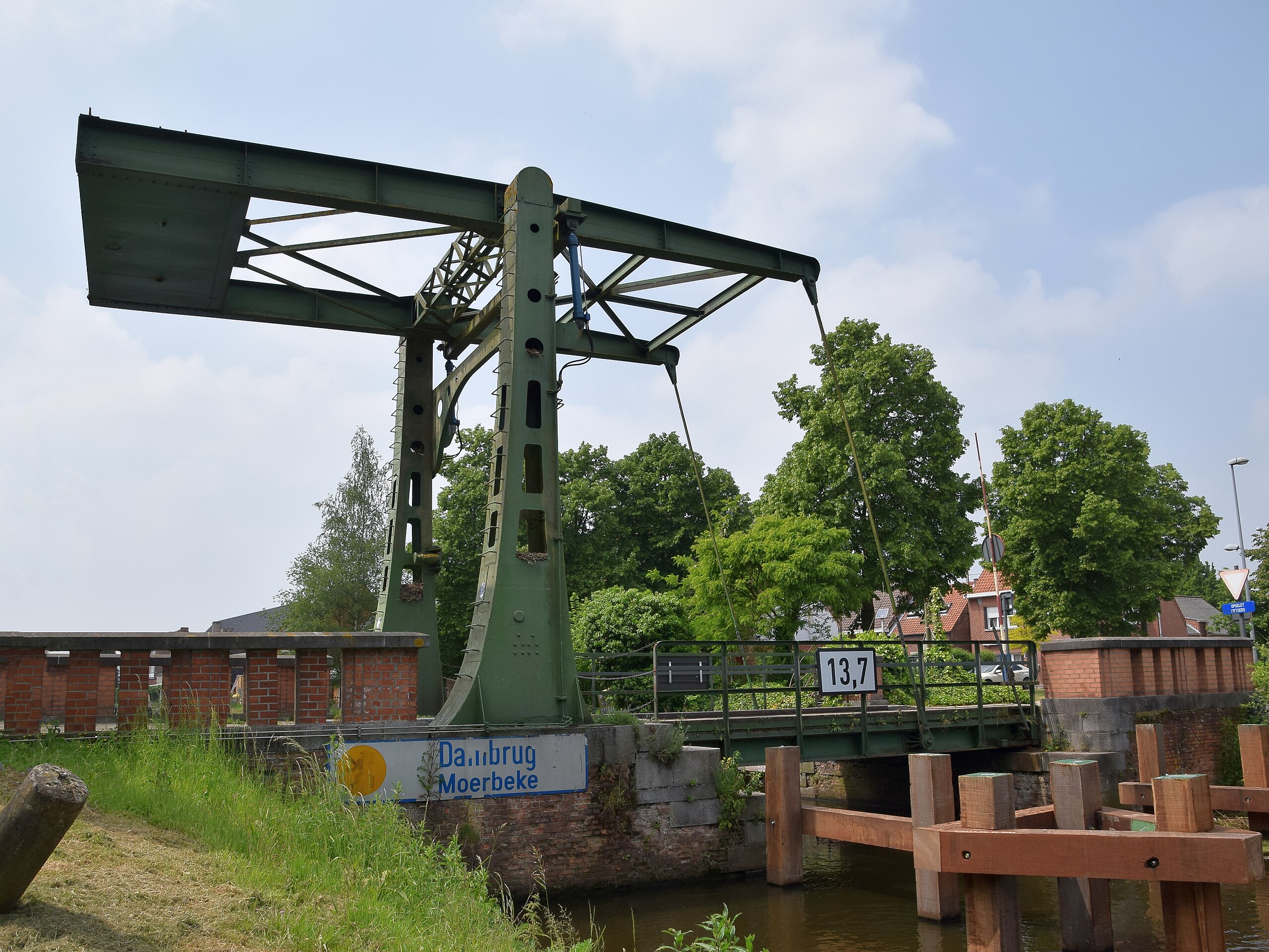
De Dambrug over de Moervaart te Moerbeke-Waas dateert uit het interbellum en werd hersteld en vernieuwd circa 1945 na oorlogsschade. De handbediening werd vervangen door hydraulische bediening. De brug wordt afgeschermd door houten dukdalven en geleiders. In 2001 werden de bruggen beschermd als monument. The Dambrug over the Moervaart at Moerbeke-Waas (Belgium) dates back to the interwar period. It was restored and renovated around 1945 from war damages. The manual operation was replaced by hydraulics. The bridge is protected by wooden dolphins and guides. In 2001, the bridge got the legal status of protected monument. |
| Date | |
| Source | Dambrug Moerbeke |
| Author | Luc.T from Buggenhout, België |
| Camera location | | View this and other nearby images on: OpenStreetMap |
|---|
.jpg¶ms=051.172166_N_0003.948400_E_globe:Earth_type:camera_source:Flickr_&language=en)
Licensing
[edit].jpg&action=edit§ion=2)
This file is licensed under the Creative Commons Attribution 2.0 Generic license.
- You are free:
- to share – to copy, distribute and transmit the work
- to remix – to adapt the work
- Under the following conditions:
- attribution – You must give appropriate credit, provide a link to the license, and indicate if changes were made. You may do so in any reasonable manner, but not in any way that suggests the licensor endorses you or your use.
| This image was originally posted to Flickr by Luc.T at https://flickr.com/photos/65015316@N07/27315940636. It was reviewed on 5 August 2021 by FlickreviewR 2 and was confirmed to be licensed under the terms of the cc-by-2.0. |
File history
Click on a date/time to view the file as it appeared at that time.
| Date/Time | Thumbnail | Dimensions | User | Comment | |
|---|---|---|---|---|---|
| current | 08:25, 5 August 2021 | | 4,000 × 3,000 (6.29 MB) | 1Veertje (talk | contribs) | Transferred from Flickr via #flickr2commons |
You cannot overwrite this file.
File usage on Commons
There are no pages that use this file.
.jpg&oldid=894740964)