File:Damshaeuser Kuppen vom Rimberg.jpg
Jump to navigation
Jump to search
Size of this preview: 800 × 339 pixels. Other resolutions: 320 × 136 pixels | 640 × 271 pixels | 1,024 × 434 pixels | 1,280 × 543 pixels | 3,292 × 1,396 pixels.
Original file (3,292 × 1,396 pixels, file size: 2.43 MB, MIME type: image/jpeg)
Captions
Captions
Add a one-line explanation of what this file represents
Summary
[edit]
| Description |
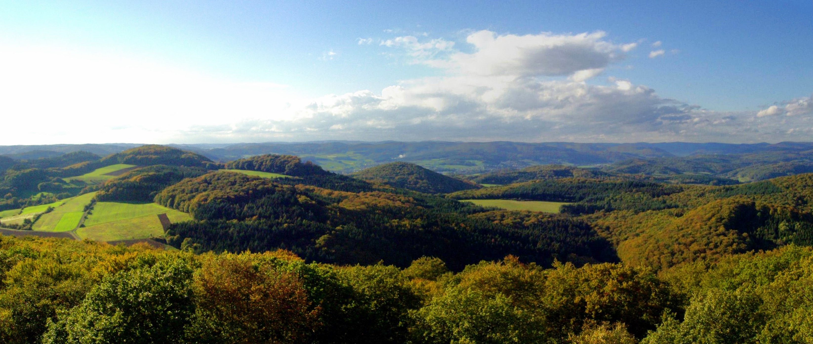
Deutsch: Blick vom 498 m hohen Rimberg auf die westlicheren Damshäuser Kuppen. In der linken Bildhälfte gut erkennbar: Der Sattel zwischen Bauerst (470m, linker Bildrand) und Hoher Höll (481m) mit dem dahinter liegenden Schweinskopf (473m), rechts davon Kappe (494m), Ehlenholz (ca. 470m) und Treisberg (437m, Bildmitte). Mittig im Hintergrund verschiedene Teile der Gemeinde Dautphetal und die dahinter liegenden, ebenfalls zum Gladenbacher Bergland zählenden Erhebungen des Breidenbacher Grundes. Rechts im Hintergrund die Stadt Biedenkopf und das Rothaargebirge. |
| Source | Own work |
| Author | Elop |
Licensing
[edit]
I, the copyright holder of this work, hereby publish it under the following license:
This file is licensed under the Creative Commons Attribution-Share Alike 2.5 Generic license.
- You are free:
- to share – to copy, distribute and transmit the work
- to remix – to adapt the work
- Under the following conditions:
- attribution – You must give appropriate credit, provide a link to the license, and indicate if changes were made. You may do so in any reasonable manner, but not in any way that suggests the licensor endorses you or your use.
- share alike – If you remix, transform, or build upon the material, you must distribute your contributions under the same or compatible license as the original.
File history
Click on a date/time to view the file as it appeared at that time.
| Date/Time | Thumbnail | Dimensions | User | Comment | |
|---|---|---|---|---|---|
| current | 13:08, 16 August 2008 | | 3,292 × 1,396 (2.43 MB) | Sir James (talk | contribs) | rotated, cropped, colours. |
| 19:37, 6 November 2006 |  | 3,340 × 1,497 (369 KB) | Elop (talk | contribs) | ||
| 17:46, 25 October 2006 |  | 3,147 × 1,520 (407 KB) | Elop (talk | contribs) | Blick vom 498 m hohen Rimberg im Gladenbacher Bergland auf das Rothaargebirge mit der Sackpfeife (674 m) und seinen ''Vorhöhen'' [[:de:A |
You cannot overwrite this file.
File usage on Commons
The following page uses this file:
File usage on other wikis
The following other wikis use this file:
- Usage on de.wikipedia.org
- Usage on en.wikipedia.org