File:David IV map-es.svg
Jump to navigation
Jump to search

Size of this PNG preview of this SVG file: 771 × 599 pixels. Other resolutions: 309 × 240 pixels | 618 × 480 pixels | 988 × 768 pixels | 1,280 × 995 pixels | 2,560 × 1,990 pixels | 1,155 × 898 pixels.
Original file (SVG file, nominally 1,155 × 898 pixels, file size: 1.32 MB)
Captions
Captions
Add a one-line explanation of what this file represents
Summary[edit]
| Description |
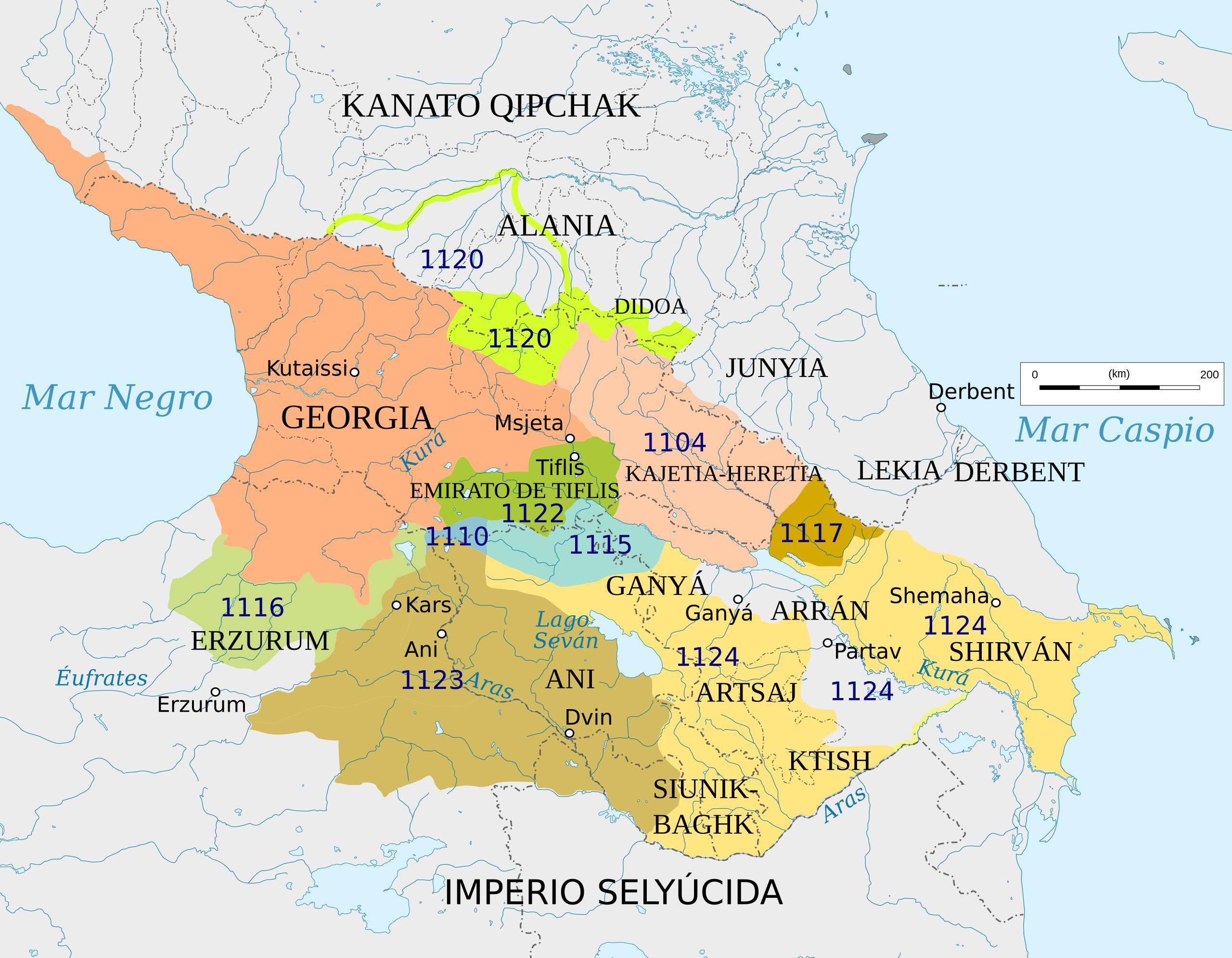
English: Map of Georgia under David IV
Español: Mapa de Georgia en tiempos del rey David IV.
Georgia en el año 1090
Territorios conquistados Las fechas son las de conquista: Kajetia
Erzurum
Ani
Emirato de Tiflis
Otros
Shake
Ganyá, Artsaj, Ktish, Siunik-Baghk y Shirván
vasallos |
| Source |
This file was derived from: Georgia grey topography (1089-1125)-de.svg |
| Author |
Georgia grey topography (1089-1125)-de.svg: Don-kun
|
| Permission (Reusing this file) |
File:Georgia_grey_topography_(1089-1125)-de.svg |
-de.svg)
Licensing[edit]
This file is licensed under the Creative Commons Attribution-Share Alike 4.0 International license.
- You are free:
- to share – to copy, distribute and transmit the work
- to remix – to adapt the work
- Under the following conditions:
- attribution – You must give appropriate credit, provide a link to the license, and indicate if changes were made. You may do so in any reasonable manner, but not in any way that suggests the licensor endorses you or your use.
- share alike – If you remix, transform, or build upon the material, you must distribute your contributions under the same or compatible license as the original.
File history
Click on a date/time to view the file as it appeared at that time.
| Date/Time | Thumbnail | Dimensions | User | Comment | |
|---|---|---|---|---|---|
| current | 18:46, 13 May 2020 | | 1,155 × 898 (1.32 MB) | Rowanwindwhistler (talk | contribs) | Uploading a file from a free published source using File Upload Wizard |
You cannot overwrite this file.
File usage on Commons
The following page uses this file:
File usage on other wikis
The following other wikis use this file:
- Usage on es.wikipedia.org
- Usage on it.wikipedia.org