File:Davis Mill.jpg
Jump to navigation
Jump to search

Size of this preview: 800 × 489 pixels. Other resolutions: 320 × 196 pixels | 640 × 391 pixels | 1,024 × 626 pixels | 1,280 × 783 pixels | 1,954 × 1,195 pixels.
Original file (1,954 × 1,195 pixels, file size: 987 KB, MIME type: image/jpeg)
Captions
Captions
Add a one-line explanation of what this file represents
|
This is an image of a place or building that is listed on the National Register of Historic Places in the United States of America. Its reference number is 80003028. |
| Camera location | | View this and other nearby images on: OpenStreetMap |
|---|
| Description |
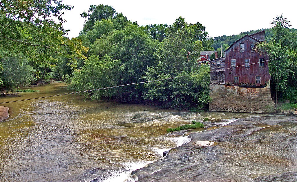
English: Water side of the Davis Mill, located along Raccoon Creek on Cora Mill Road in Perry Township, Gallia County, Ohio, United States. Built in 1845, it is listed on the National Register of Historic Places. |
| Date | Taken on 12 September 2009 |
| Source | Flickr |
| Author | dok1 |
| Permission (Reusing this file) |
This file is licensed under the Creative Commons Attribution 2.0 Generic license.
|
| This image was originally posted to Flickr by dok1 at https://www.flickr.com/photos/51096110@N00/2755943875. It was reviewed on 3 April 2010 by FlickreviewR and was confirmed to be licensed under the terms of the cc-by-2.0. |
File history
Click on a date/time to view the file as it appeared at that time.
| Date/Time | Thumbnail | Dimensions | User | Comment | |
|---|---|---|---|---|---|
| current | 17:44, 3 April 2010 | | 1,954 × 1,195 (987 KB) | Nyttend (talk | contribs) | {{Location|38|49|29|N|82|22|10|W}} {{Information |Description={{en|Water side of the {{w|Davis Mill}}, located along Raccoon Creek on Cora Mill Road in {{w|Perry Township, Gallia County, Ohio|Perry Township}}, {{w|Gallia County, Ohio|Gallia County}}, {{w| |
You cannot overwrite this file.
File usage on Commons
The following page uses this file:
File usage on other wikis
The following other wikis use this file:
- Usage on en.wikipedia.org
- Usage on es.wikipedia.org
- Usage on eu.wikipedia.org
- Usage on fa.wikipedia.org
- Usage on pt.wikipedia.org
- Usage on ur.wikipedia.org
- Usage on vi.wikipedia.org
- Usage on www.wikidata.org
- Usage on zh.wikipedia.org