File:Derbyshire UK locator map 2010.svg
Salta a la navegació
Salta a la cerca

Mida d'aquesta previsualització PNG del fitxer SVG: 494 × 600 píxels. Altres resolucions: 198 × 240 píxels | 395 × 480 píxels | 633 × 768 píxels | 843 × 1.024 píxels | 1.687 × 2.048 píxels | 1.108 × 1.345 píxels.
Fitxer original (fitxer SVG, nominalment 1.108 × 1.345 píxels, mida del fitxer: 302 Ko)
Llegendes
Llegendes
Afegeix una explicació d'una línia del que representa aquest fitxer
Resum[modifica]
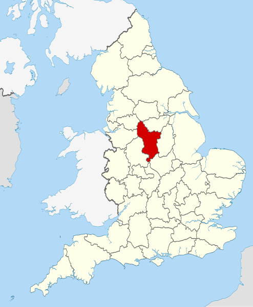
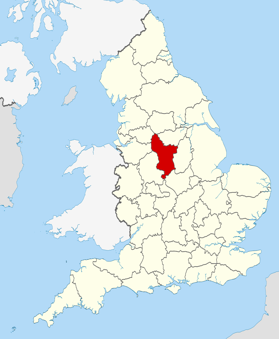
| Descripció | Location of the ceremonial county of Derbyshire within England. |
| Data | |
| Font |
National Geospatial-Intelligence Agency
|
| Autor | Nilfanion |
Llicència[modifica]
Jo, el titular dels drets d'autor d'aquest treball, el public sota les següents llicències:
Aquest fitxer està subjecte a la llicència de Creative Commons Reconeixement i Compartir Igual 3.0 No adaptada.
- Sou lliure de:
- compartir – copiar, distribuir i comunicar públicament l'obra
- adaptar – fer-ne obres derivades
- Amb les condicions següents:
- reconeixement – Heu de donar la informació adequada sobre l'autor, proporcionar un enllaç a la llicència i indicar si s'han realitzat canvis. Podeu fer-ho amb qualsevol mitjà raonable, però de cap manera no suggereixi que l'autor us dóna suport o aprova l'ús que en feu.
- compartir igual – Si modifiqueu, transformeu, o generareu amb el material, haureu de distribuir les vostres contribucions sota una llicència similar o una de compatible com l'original

|
S'autoritza la còpia, la distribució i la modificació d'aquest document sota els termes de la llicència de documentació lliure GNU versió 1.2 o qualsevol altra versió posterior que publiqui la Free Software Foundation; sense seccions invariants, ni textos de portada, ni textos de contraportada. S'inclou una còpia d'aquesta llicència en la secció titulada GNU Free Documentation License. |
Podeu seleccionar la llicència que vulgueu.

|
This is one of the images forming part of the Valued image set: Locator maps of the Ceremonial counties of England on Wikimedia Commons. The image set has been assessed under the valued image set criteria and is considered the most valued set on Commons within the scope:
Locator maps of the Ceremonial counties of England
You can see its nomination at Commons:Valued image candidates/Locator maps of English ceremonial counties. |
Historial del fitxer
Cliqueu una data/hora per veure el fitxer tal com era aleshores.
| Data/hora | Miniatura | Dimensions | Usuari/a | Comentari | |
|---|---|---|---|---|---|
| actual | 22:33, 23 nov 2010 | | 1.108 × 1.345 (302 Ko) | Nilfanion (discussió | contribucions) | == Summary == {{Information |Description=Location of the ceremonial county of Derbyshire within England. |Source=Ordnance Survey [https://www.ordnancesurvey.co.uk/opendatadownload/products.html OpenData]: *County bou |
No podeu sobreescriure aquest fitxer.
Ús del fitxer
Hi ha més de 100 pàgines que utilitzen aquest fitxer. La següent llista només mostra les primeres 100 d'aquestes pàgines que utilitzen aquest fitxer. Podeu consultar la llista completa.
- Valued image set: Locator maps of the Ceremonial counties of England
- Commons:Valued image candidates/Locator maps of English ceremonial counties
- Template:Derbyshireyear
- Category:1850 in Derbyshire
- Category:1894 in Derbyshire
- Category:1903 in Derbyshire
- Category:1946 in Derbyshire
- Category:1949 in Derbyshire
- Category:1951 in Derbyshire
- Category:1953 in Derbyshire
- Category:1956 in Derbyshire
- Category:1957 in Derbyshire
- Category:1958 in Derbyshire
- Category:1959 in Derbyshire
- Category:1960 in Derbyshire
- Category:1961 in Derbyshire
- Category:1962 in Derbyshire
- Category:1963 in Derbyshire
- Category:1964 in Derbyshire
- Category:1965 in Derbyshire
- Category:1966 in Derbyshire
- Category:1967 in Derbyshire
- Category:1968 in Derbyshire
- Category:1969 in Derbyshire
- Category:1970 in Derbyshire
- Category:1971 in Derbyshire
- Category:1972 in Derbyshire
- Category:1973 in Derbyshire
- Category:1974 in Derbyshire
- Category:1975 in Derbyshire
- Category:1976 in Derbyshire
- Category:1977 in Derbyshire
- Category:1978 in Derbyshire
- Category:1979 in Derbyshire
- Category:1980 in Derbyshire
- Category:1981 in Derbyshire
- Category:1982 in Derbyshire
- Category:1983 in Derbyshire
- Category:1984 in Derbyshire
- Category:1985 in Derbyshire
- Category:1986 in Derbyshire
- Category:1987 in Derbyshire
- Category:1988 in Derbyshire
- Category:1989 in Derbyshire
- Category:1990 in Derbyshire
- Category:1992 in Derbyshire
- Category:1993 in Derbyshire
- Category:1994 in Derbyshire
- Category:1995 in Derbyshire
- Category:1996 in Derbyshire
- Category:1997 in Derbyshire
- Category:1998 in Derbyshire
- Category:1999 in Derbyshire
- Category:2000 in Derbyshire
- Category:2001 in Derbyshire
- Category:2002 in Derbyshire
- Category:2003 in Derbyshire
- Category:2004 in Derbyshire
- Category:2005 in Derbyshire
- Category:2006 in Derbyshire
- Category:2007 in Derbyshire
- Category:2008 in Derbyshire
- Category:2009 in Derbyshire
- Category:2010 in Derbyshire
- Category:2011 in Derbyshire
- Category:2012 in Derbyshire
- Category:2013 in Derbyshire
- Category:2014 in Derbyshire
- Category:2015 in Derbyshire
- Category:2016 in Derbyshire
- Category:2017 in Derbyshire
- Category:2018 in Derbyshire
- Category:2019 in Derbyshire
- Category:2020 in Derbyshire
- Category:Births in Derbyshire
- Category:Bridges in Derbyshire
- Category:Canals in Derbyshire
- Category:Deaths in Derbyshire
- Category:Derbyshire
- Category:Derbyshire in the 1900s
- Category:Derbyshire in the 1940s
- Category:Derbyshire in the 1960s
- Category:Derbyshire in the 1970s
- Category:Derbyshire in the 1980s
- Category:Derbyshire in the 1990s
- Category:Derbyshire in the 19th century
- Category:Derbyshire in the 2000s
- Category:Derbyshire in the 2010s
- Category:Derbyshire in the 20th century
- Category:Disused railway stations in Derbyshire
- Category:Hospitals in Derbyshire
- Category:Maps of Derbyshire
- Category:Mines in Derbyshire
- Category:Populated places in Derbyshire
- Category:Rail transport in Derbyshire
- Category:Railway stations in Derbyshire
- Category:Rivers of Derbyshire
- Category:Roads in Derbyshire
- Category:Tunnels in Derbyshire
- Category:Views of Derbyshire
Visualitza més enllaços que porten al fitxer.
Ús global del fitxer
Utilització d'aquest fitxer en altres wikis:
- Utilització a af.wikipedia.org
- Utilització a an.wikipedia.org
- Utilització a ar.wikipedia.org
- Utilització a ast.wikipedia.org
- Utilització a be-tarask.wikipedia.org
- Utilització a be.wikipedia.org
- Utilització a bg.wikipedia.org
- Utilització a bn.wikipedia.org
- Utilització a br.wikipedia.org
- Utilització a ca.wikipedia.org
- Utilització a ceb.wikipedia.org
- Utilització a cs.wikipedia.org
- Utilització a dag.wikipedia.org
- Utilització a en.wikipedia.org
- Derbyshire
- Thornhill, Derbyshire
- Newhaven, Derbyshire
- Howden Reservoir
- Longdendale Trail
- Leam, Derbyshire
- Tunstead Milton
- Hartshorne, Derbyshire
- Greenhill Lane
- Pilsbury
- River Amber
- Woodhead, Derbyshire
- Lose Hill
- Sparrowpit
- Egginton
- Pikehall
- Win Hill
- Blackwell, Bolsover
- Abbot's Chair
- Abney, Derbyshire
- Ible
- Rattle, Derbyshire
- Beeley
- Birch Vale
- Trent Lock
- Hopton, Derbyshire
- Kedleston
- Template:Derbyshire-geo-stub
- Rushop
- Litton, Derbyshire
- Unstone
- Ault Hucknall
- Butterley
- Abney and Abney Grange
- Aldercar and Langley Mill
- Alderwasley
Vegeu més usos globals d'aquest fitxer.