File:Devon UK location map.svg
跳至導覽
跳至搜尋

此 SVG 檔案的 PNG 預覽的大小:653 × 600 像素。 其他解析度:261 × 240 像素 | 523 × 480 像素 | 836 × 768 像素 | 1,115 × 1,024 像素 | 2,229 × 2,048 像素 | 1,292 × 1,187 像素。
原始檔案 (SVG 檔案,表面大小:1,292 × 1,187 像素,檔案大小:2.43 MB)
說明
說明
添加單行說明來描述出檔案所代表的內容
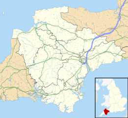
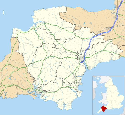
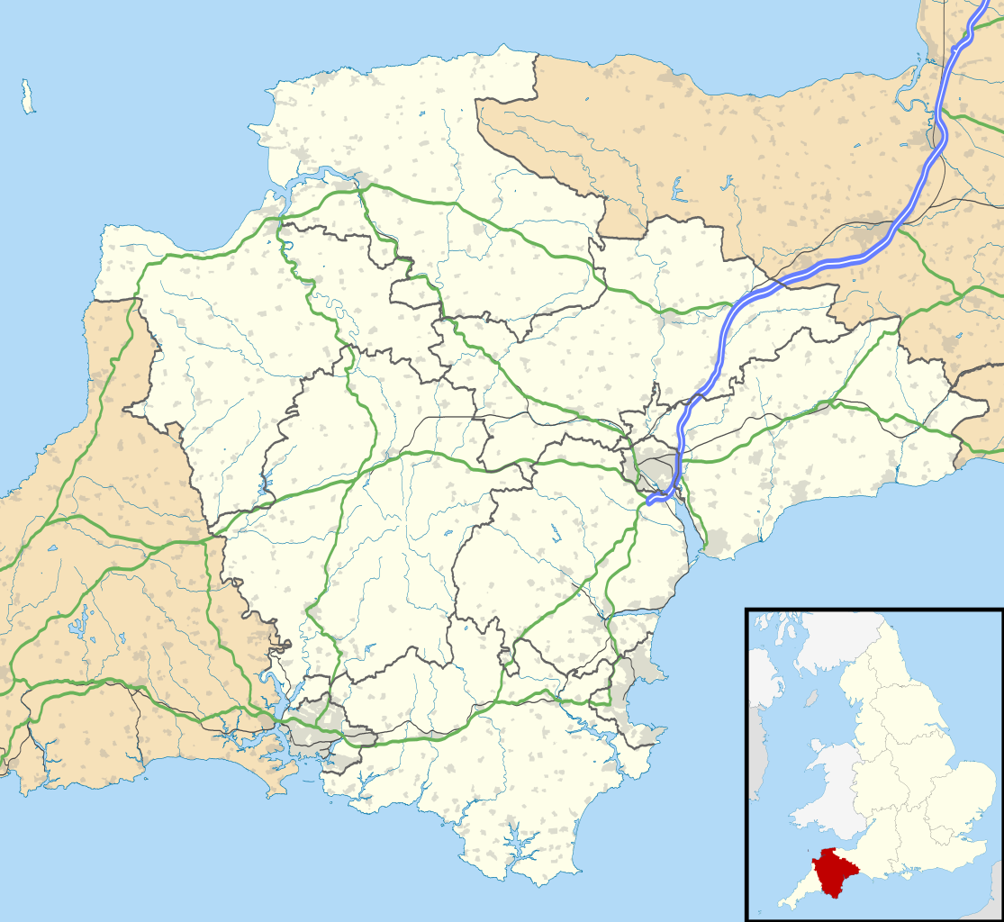
Map of Devon, England
| 描述 |
Map of Devon, UK with the following information shown:
Equirectangular map projection on WGS 84 datum, with N/S stretched 150% Geographic limits:
|
| 日期 | |
| 來源 |
|
| 作者 | Nilfanion, created using Ordnance Survey data |
| 授權許可 (重用此檔案) |
此檔案採用創用CC 姓名標示-相同方式分享 3.0 未在地化版本授權條款。 姓名標示: Contains Ordnance Survey data © Crown copyright and database right
|
| 其他版本 | File:Devon UK district map (blank).svg - Blank map with administrative borders only. |
.svg)
檔案歷史
點選日期/時間以檢視該時間的檔案版本。
| 日期/時間 | 縮圖 | 尺寸 | 使用者 | 備註 | |
|---|---|---|---|---|---|
| 目前 | 2010年9月26日 (日) 18:48 | | 1,292 × 1,187(2.43 MB) | Nilfanion(留言 | 貢獻) | tweak motorways... |
| 2010年9月6日 (一) 23:56 |  | 1,292 × 1,187(2.64 MB) | Nilfanion(留言 | 貢獻) | Tweaking urban areas, road colours and boundary lines | |
| 2010年9月4日 (六) 20:54 |  | 1,292 × 1,187(2.4 MB) | Nilfanion(留言 | 貢獻) | {{Information |Description=Map of Devon, UK with the following information shown: *Administrative borders *Coastline, lakes and rivers *Motorways and primary routes *Urban areas Equirectangular map projection on WGS 84 datum, with N/S stretch |
無法覆蓋此檔案。
檔案用途
下列頁面有用到此檔案:
全域檔案使用狀況
以下其他 wiki 使用了這個檔案:
- ar.wikipedia.org 的使用狀況
- arz.wikipedia.org 的使用狀況
- azb.wikipedia.org 的使用狀況
- هونیتون
- هولسوورتی، دوون
- هارتلند، دوون
- هاترلی، دوون
- نیوتون آبوت
- نورث تاوتون
- نورتهام، دوون
- مورتونهامپستید
- کینقزبریج
- کولیتون، دوون
- کردیتون
- کالومپتون
- قریت تورینقتون
- سیدموث
- سیتون، دوون
- ساوت مولتون
- سالکومب
- دونپورت، پلیموث
- داولیش
- دارتموث، دوون
- چالملی
- چاقفورد
- چادلی
- تیورتون، دوون
- تینموث
- تورکی
- توتنس
- تاویستوک، دوون
- پینتون
- پلمپتون
- بیدفورد
- بووی تریسی
- بودلی سالترتون
- بریکسهام
- برانسکومب
- برادنینچ
- باکفستلی
- بارنستاپل
- آیویبریج
- ایلفراکم
- اوکهامپتون
- اوتری سنت ماری
- اکسمینستر
- اکسموث
- اشبورتون، دوون
- bg.wikipedia.org 的使用狀況
檢視此檔案的更多全域使用狀況。