File:Dry Grassland Sugiez 01.jpg
Jump to navigation
Jump to search
Size of this preview: 800 × 474 pixels. Other resolutions: 320 × 189 pixels | 640 × 379 pixels | 1,024 × 606 pixels | 1,280 × 758 pixels | 2,560 × 1,515 pixels | 6,779 × 4,013 pixels.
Original file (6,779 × 4,013 pixels, file size: 5.57 MB, MIME type: image/jpeg)
Captions
Captions
Add a one-line explanation of what this file represents
Summary
[edit]| Description |
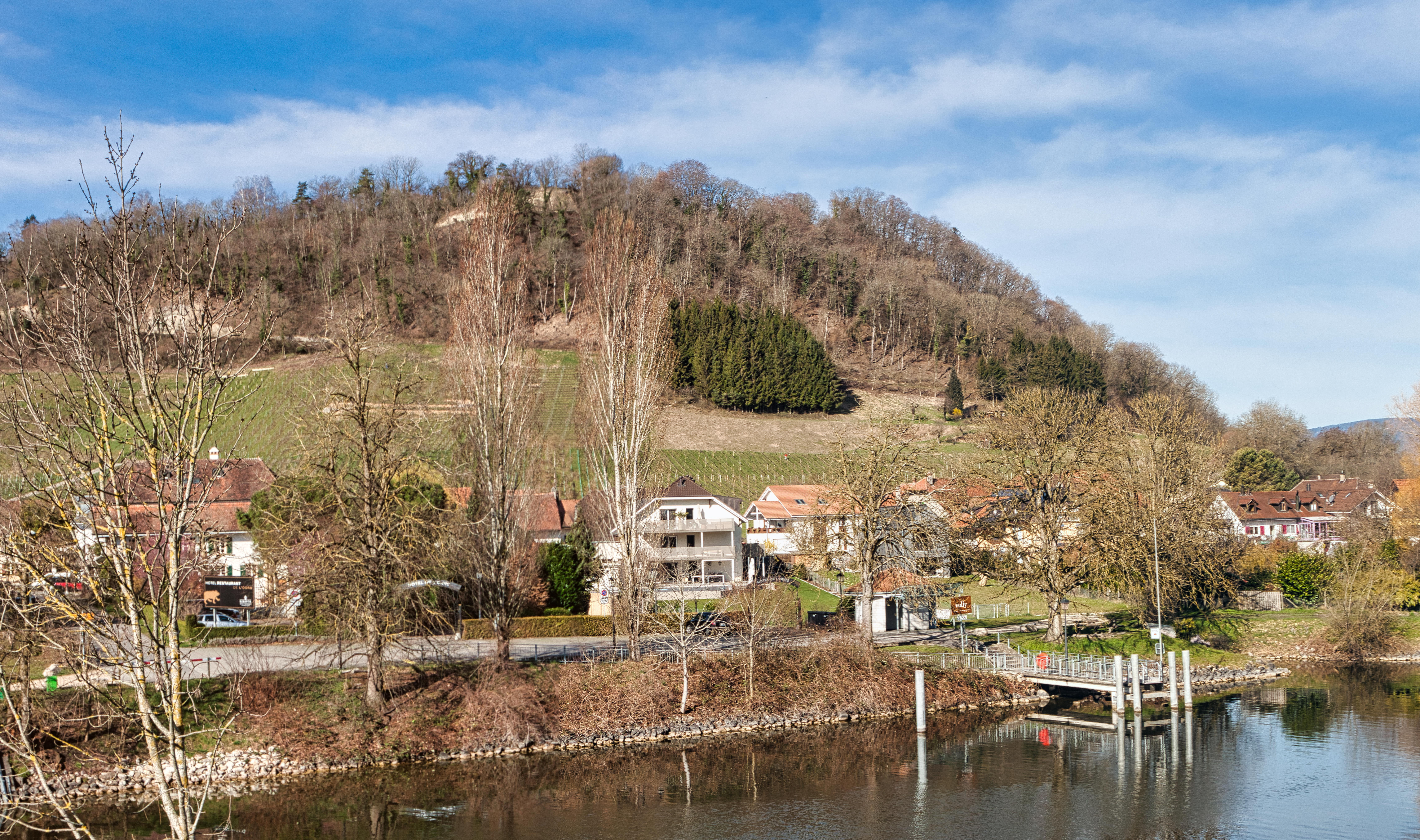
Deutsch: Blick über den Broye-Kanal auf den Mont Vully. An seiner Ostflanke sonnt sich über den Rebhängen eine Trockenwiese von nationaler Bedeutung (in der Bildmitte unter dem grünen, trabezförmigen Wäldchen) Français : Vue sur le canal de la Broye et le Mont Vully. Sur son flanc est, une prairie sèche d'importance nationale se prélasse au-dessus des vignes. English: View across the Broye Canal to Mont Vully. On its eastern flank, a dry grassland of national importance basks above the vineyards. |
||
| Protected |
|
||
| Date | |||
| Source | Own work | ||
| Author | Martin Thurnherr | ||
| Permission (Reusing this file) |
|
||
| Panorama |
|


| Object location | | View this and other nearby images on: OpenStreetMap |
|---|
| Annotations | This image is annotated: View the annotations at Commons |
Licensing
[edit]
I, the copyright holder of this work, hereby publish it under the following license:
This file is licensed under the Creative Commons Attribution-Share Alike 4.0 International license.
Attribution: Martin Thurnherr
- You are free:
- to share – to copy, distribute and transmit the work
- to remix – to adapt the work
- Under the following conditions:
- attribution – You must give appropriate credit, provide a link to the license, and indicate if changes were made. You may do so in any reasonable manner, but not in any way that suggests the licensor endorses you or your use.
- share alike – If you remix, transform, or build upon the material, you must distribute your contributions under the same or compatible license as the original.
File history
Click on a date/time to view the file as it appeared at that time.
| Date/Time | Thumbnail | Dimensions | User | Comment | |
|---|---|---|---|---|---|
| current | 13:04, 22 March 2023 | | 6,779 × 4,013 (5.57 MB) | Matutinho (talk | contribs) | {{Information |Description={{de|1=Blick über den Broye-Kanal auf den Mont Vully. An seiner Ostflanke sonnt sich über den Rebhängen eine Trockenwiese von nationaler Bedeutung}}{{fr|1=Vue sur le canal de la Broye et le Mont Vully. Sur son flanc est, une prairie sèche d'importance nationale se prélasse au-dessus des vignes.}}{{en|1=View across the Broye Canal to Mont Vully. On its eastern flank, a dry meadow of nationa... |
You cannot overwrite this file.
File usage on Commons
There are no pages that use this file.
File usage on other wikis
The following other wikis use this file:
- Usage on de.wikipedia.org
- Usage on www.wikidata.org