File:Dust Storm in the Taklimakan Desert (MODIS 2021-05-04).jpg
Jump to navigation
Jump to search

Size of this preview: 752 × 599 pixels. Other resolutions: 301 × 240 pixels | 602 × 480 pixels | 964 × 768 pixels | 1,280 × 1,020 pixels | 2,560 × 2,040 pixels | 6,514 × 5,191 pixels.
Original file (6,514 × 5,191 pixels, file size: 3.05 MB, MIME type: image/jpeg)
Captions
Captions
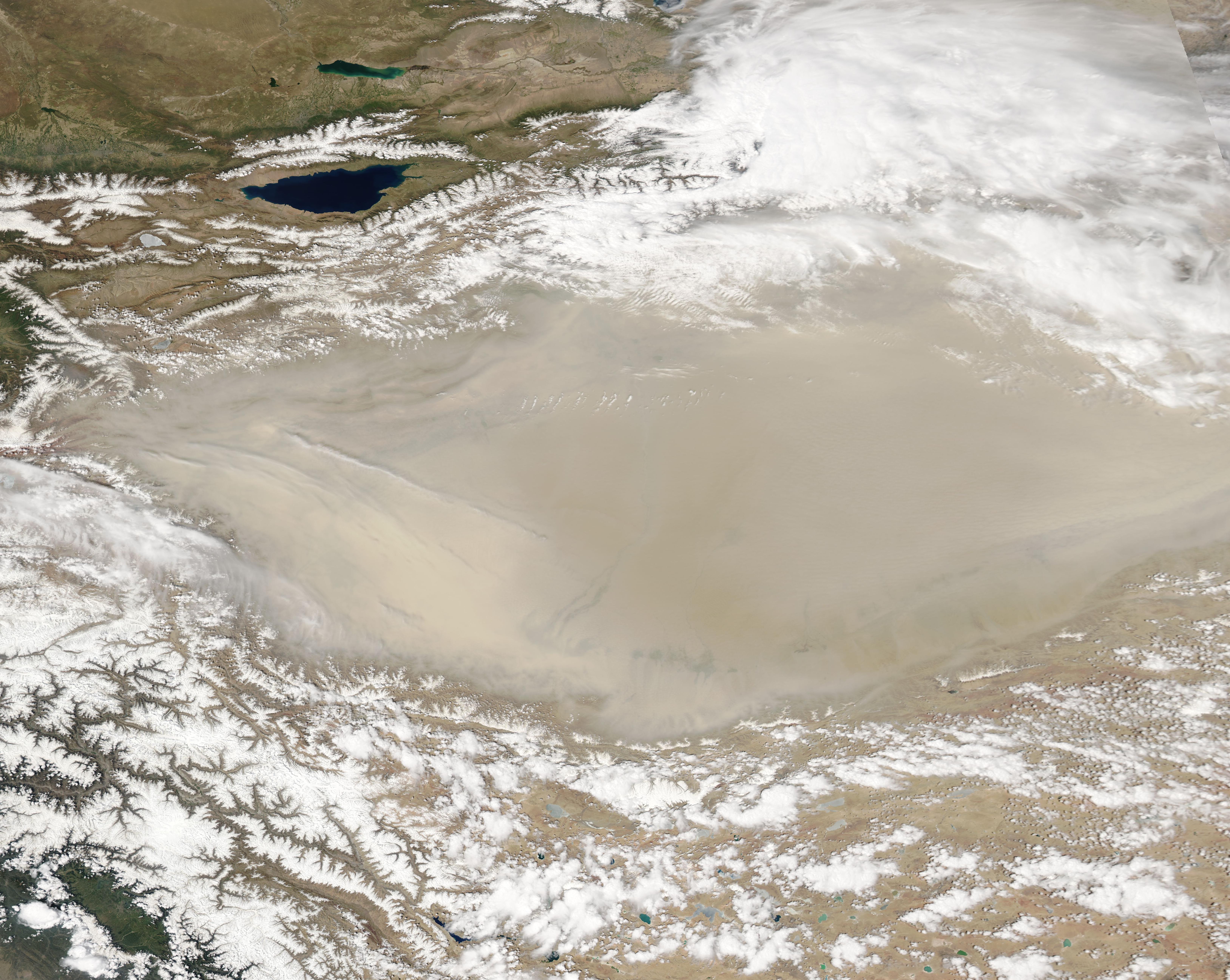
The Moderate Resolution Imaging Spectroradiometer (MODIS) on board NASA’s Aqua satellite acquired a true-color image of the sandy scene on May 1.
Summary[edit]
.jpg&action=edit§ion=1)
| Description |
English: The Taklimakan Desert was surrounded by snow and shrouded by dust in early May 2021. The Moderate Resolution Imaging Spectroradiometer (MODIS) on board NASA’s Aqua satellite acquired a true-color image of the sandy scene on May 1.
One of the driest, most barren places on Earth, the Taklimakan Desert sits in the Tarim Basin in Northwestern China. The Tarim Basin stretches over about 390,000 square miles (1,020,000 square kilometers) and is bordered by the Kunlun Shan mountains to the south and Tian Shan mountains to the north. Parched by the rain shadow of these tall mountain, parts of the desert received no more than 0.4 inches (10 mm) of rain per year. The extreme aridity means scant vegetation to hold sand in place, so almost 85 percent of the Taklimakan consists of shifting sand dunes, some of which rise to 900 feet (300 meters) tall. The vast stretches of sand, along with little vegetation or moisture, also create perfect conditions for dust storms any time winds blow across the region. Dust storms are a regular occurrence in the Taklimakan Desert, especially in the springtime. In spring, strong surface winds can sometimes lift dust up to 10 kilometers (6 miles). These particles can then be transported by higher-altitude winds that send them across China and the Pacific. In this image, it appears that dust has raised over the mountains in the northeast and may be mixing with lower levels of cloud. |
||
| Date | Taken on 1 May 2021 | ||
| Source |
Dust Storm in the Taklimakan Desert (direct link)
|
||
| Author | MODIS Land Rapid Response Team, NASA GSFC |
| This media is a product of the Aqua mission Credit and attribution belongs to the mission team, if not already specified in the "author" row |
Licensing[edit]
.jpg&action=edit§ion=2)
| This file is in the public domain in the United States because it was solely created by NASA. NASA copyright policy states that "NASA material is not protected by copyright unless noted". (See Template:PD-USGov, NASA copyright policy page or JPL Image Use Policy.) | ||
 |
Warnings:
|
File history
Click on a date/time to view the file as it appeared at that time.
| Date/Time | Thumbnail | Dimensions | User | Comment | |
|---|---|---|---|---|---|
| current | 17:49, 30 January 2024 | | 6,514 × 5,191 (3.05 MB) | OptimusPrimeBot (talk | contribs) | #Spacemedia - Upload of http://modis.gsfc.nasa.gov/gallery/images/image05042021_250m.jpg via Commons:Spacemedia |
You cannot overwrite this file.
File usage on Commons
There are no pages that use this file.
.jpg&oldid=852722777)