File:East African Rift (ASTER).jpg
Jump to navigation
Jump to search
Size of this preview: 760 × 599 pixels. Other resolutions: 304 × 240 pixels | 609 × 480 pixels | 974 × 768 pixels | 1,280 × 1,009 pixels | 2,560 × 2,019 pixels | 2,706 × 2,134 pixels.
Original file (2,706 × 2,134 pixels, file size: 1.21 MB, MIME type: image/jpeg)
Captions
Captions
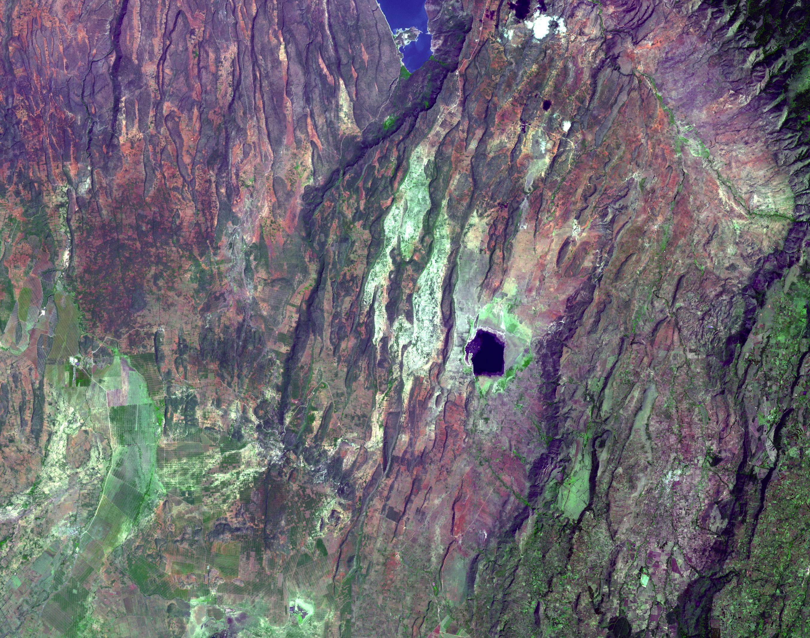
Places where the earth's crust has formed deep fissures and the plates have begun to move apart develop rift structures in which elongate blocks have subsided relative to the blocks on either side.
Summary
[edit].jpg&action=edit§ion=1)
| Description |
English: Places where the earth's crust has formed deep fissures and the plates have begun to move apart develop rift structures in which elongate blocks have subsided relative to the blocks on either side. The East African Rift is a world-famous example of such rifting. It is characterized by 1) topographic deep valleys in the rift zone, 2) sheer escarpments along the faulted walls of the rift zone, 3) a chain of lakes within the rift, most of the lakes highly saline due to evaporation in the hot temperatures characteristic of climates near the equator, 4) voluminous amounts of volcanic rocks that have flowed from faults along the sides of the rift, and 5) volcanic cones where magma flow was most intense. This example in Kenya displays most of these features near Lake Begoria. The image was acquired December 18, 2002, covers an area of 40.5 x 32 km, and is located at 0.1 degrees north latitude, 36.1 degrees east longitude. |
||
| Date | Taken on 18 December 2002 | ||
| Source |
East African Rift (direct link)
|
||
| Author | NASA/METI/AIST/Japan Space Systems, and U.S./Japan ASTER Science Team |
| Object location | | View this and other nearby images on: OpenStreetMap |
|---|
.jpg¶ms=000.100000_N_0036.100000_E_globe:Earth_class:object_type:object__&language=en)
| This media is a product of the Terra mission Credit and attribution belongs to the Advanced Spaceborne Thermal Emission and Reflection Radiometer (ASTER) team, NASA/METI/AIST/Japan Space Systems |
Licensing
[edit].jpg&action=edit§ion=2)
| This file is in the public domain in the United States because it was solely created by NASA. NASA copyright policy states that "NASA material is not protected by copyright unless noted". (See Template:PD-USGov, NASA copyright policy page or JPL Image Use Policy.) | ||
 |
Warnings:
|
File history
Click on a date/time to view the file as it appeared at that time.
| Date/Time | Thumbnail | Dimensions | User | Comment | |
|---|---|---|---|---|---|
| current | 19:16, 7 May 2023 | | 2,706 × 2,134 (1.21 MB) | OptimusPrimeBot (talk | contribs) | #Spacemedia - Upload of https://asterweb.jpl.nasa.gov/gallery/images/eastafricanrift.jpg via Commons:Spacemedia |
You cannot overwrite this file.
File usage on Commons
There are no pages that use this file.
.jpg&oldid=760622881)