File:Eda skans map 1813.jpg
Jump to navigation
Jump to search

Size of this preview: 798 × 600 pixels. Other resolutions: 320 × 240 pixels | 639 × 480 pixels | 1,022 × 768 pixels | 1,280 × 962 pixels | 2,560 × 1,923 pixels | 3,273 × 2,459 pixels.
Original file (3,273 × 2,459 pixels, file size: 860 KB, MIME type: image/jpeg)
Captions
Captions
Add a one-line explanation of what this file represents
Summary
[edit]
| Description |
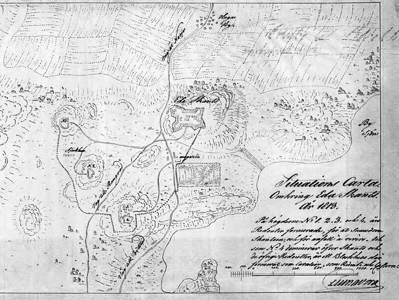
English: Detail from map covering the surroundings at Eda sconce, Värmland, Sweden at 1813.
Svenska: Detalj av situationskarta kring Eda skansar år 1813. |
|||||||||
| Date | ||||||||||
| Source |
Krigsarkivet: - Sverige, stads- och fästningsplaner, Eda skans. Eda sn, Värmlands län, 0424:024:027a https://sok.riksarkivet.se/arkiv/FUPWxXhwDa2MUN9a6VbTZ0 |
|||||||||
| Creator |
C Liungberg |
|||||||||
| Geotemporal data | ||||||||||
| Bounding box |
|
|||||||||
| Georeferencing | ||||||||||
Licensing
[edit]
|
This work is in the public domain in its country of origin and other countries and areas where the copyright term is the author's life plus 100 years or fewer. | |
| This file has been identified as being free of known restrictions under copyright law, including all related and neighboring rights. | |
File history
Click on a date/time to view the file as it appeared at that time.
| Date/Time | Thumbnail | Dimensions | User | Comment | |
|---|---|---|---|---|---|
| current | 17:12, 27 May 2014 | | 3,273 × 2,459 (860 KB) | Dagjoh (talk | contribs) | {{Information |Description ={{en|1=Detail from map covering the surroundings at Eda sconce, Värmland, Sweden at 1813.}} {{sv|1=Detalj av situationskarta kring Eda skansar år 1813.}} |Source =Krigsarkivet: - Sverige, stads- och fästningspl... |
You cannot overwrite this file.
File usage on Commons
The following page uses this file:
- File:EdaMap4.jpg (file redirect)
File usage on other wikis
The following other wikis use this file:
- Usage on sv.wikipedia.org