File:Eemhaven, Amersfoort.jpg
Jump to navigation
Jump to search

Size of this preview: 800 × 600 pixels. Other resolutions: 320 × 240 pixels | 640 × 480 pixels | 1,024 × 768 pixels | 1,280 × 960 pixels | 2,560 × 1,920 pixels | 3,648 × 2,736 pixels.
Original file (3,648 × 2,736 pixels, file size: 2.71 MB, MIME type: image/jpeg)
Captions
Captions
Add a one-line explanation of what this file represents
Summary[edit]
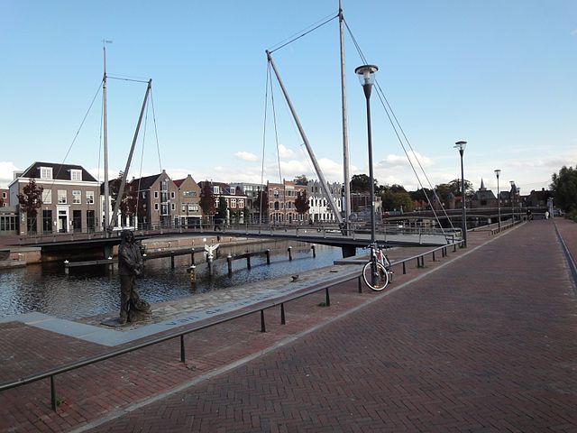
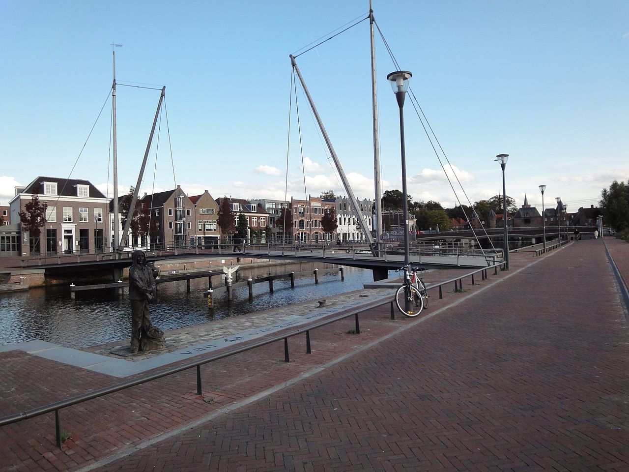
| Description | Bridge for cyclists & pedestrians in a new development area at the end of the Eemhaven near the old Koppelpoort fortification. |
| Date | |
| Source | Eemhaven, Amersfoort |
| Author | tED from Utrecht, Netherlands |
| Camera location | | View this and other nearby images on: OpenStreetMap |
|---|
Licensing[edit]
This file is licensed under the Creative Commons Attribution 2.0 Generic license.
- You are free:
- to share – to copy, distribute and transmit the work
- to remix – to adapt the work
- Under the following conditions:
- attribution – You must give appropriate credit, provide a link to the license, and indicate if changes were made. You may do so in any reasonable manner, but not in any way that suggests the licensor endorses you or your use.
| This image was originally posted to Flickr by ednl at https://www.flickr.com/photos/31392863@N04/3993975076. It was reviewed on 24 May 2011 by FlickreviewR and was confirmed to be licensed under the terms of the cc-by-2.0. |
File history
Click on a date/time to view the file as it appeared at that time.
| Date/Time | Thumbnail | Dimensions | User | Comment | |
|---|---|---|---|---|---|
| current | 19:59, 24 May 2011 | | 3,648 × 2,736 (2.71 MB) | Glabb (talk | contribs) | {{Information |Description=Bridge for cyclists & pedestrians in a new development area at the end of the Eemhaven near the old Koppelpoort fortification. |Source=[http://www.flickr.com/photos/dnet/3993975076/ Eemhaven, Amersfoort] |Date=2009-10-08 16:08 | |
You cannot overwrite this file.
File usage on Commons
The following page uses this file: