File:Einzugs- und Flussgebietskarte Saale.png
Jump to navigation
Jump to search
Size of this preview: 420 × 600 pixels. Other resolutions: 168 × 240 pixels | 336 × 480 pixels | 538 × 768 pixels | 717 × 1,024 pixels | 2,103 × 3,002 pixels.
Original file (2,103 × 3,002 pixels, file size: 7.24 MB, MIME type: image/png)
Captions
Captions
Add a one-line explanation of what this file represents
Summary
[edit]
| Description |
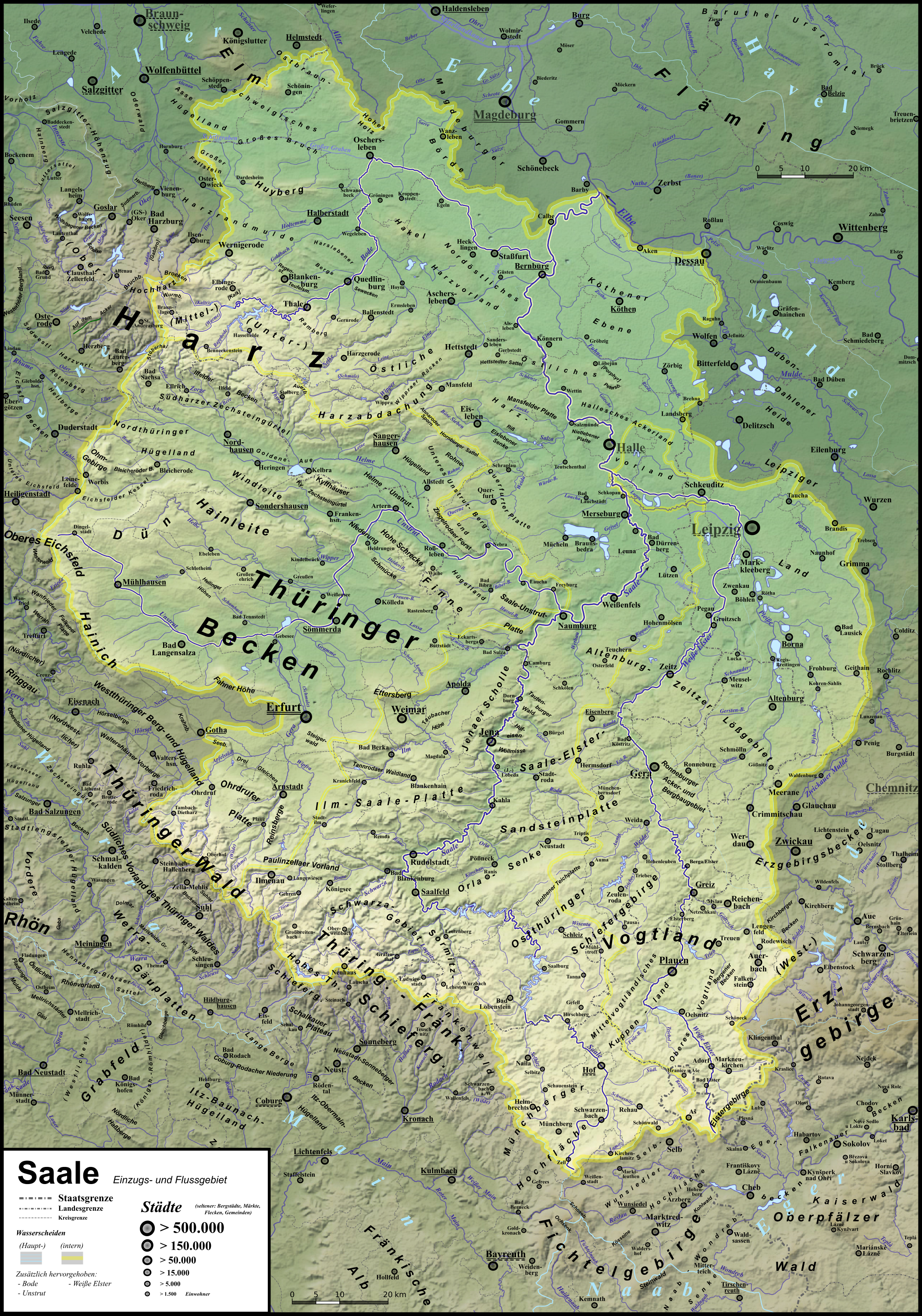
Deutsch: Einzugs- und Flussgebietskarte der Saale und ihrer wichtigsten Nebenflüsse Unstrut, Weiße Elster und Bode mit naturräumlichen Einheiten |
| Date | |
| Source | Own work |
| Author |
|
| Other versions | Siehe Galerie |
Licensing
[edit]
I, the copyright holder of this work, hereby publish it under the following license:
This file is licensed under the Creative Commons Attribution 3.0 Unported license.
- You are free:
- to share – to copy, distribute and transmit the work
- to remix – to adapt the work
- Under the following conditions:
- attribution – You must give appropriate credit, provide a link to the license, and indicate if changes were made. You may do so in any reasonable manner, but not in any way that suggests the licensor endorses you or your use.
File history
Click on a date/time to view the file as it appeared at that time.
| Date/Time | Thumbnail | Dimensions | User | Comment | |
|---|---|---|---|---|---|
| current | 12:20, 22 April 2013 | | 2,103 × 3,002 (7.24 MB) | Elop (talk | contribs) | Update |
| 23:03, 1 April 2013 |  | 2,103 × 3,002 (7.16 MB) | Elop (talk | contribs) | update | |
| 00:07, 25 March 2013 |  | 2,104 × 3,003 (7.21 MB) | Elop (talk | contribs) | Update | |
| 00:50, 19 March 2013 |  | 2,071 × 3,003 (7.02 MB) | Elop (talk | contribs) | Update | |
| 18:23, 16 March 2013 |  | 2,071 × 3,003 (7.04 MB) | Elop (talk | contribs) | + Beschr. Nachbareinzugsgebiete | |
| 17:17, 16 March 2013 |  | 2,071 × 3,003 (7.02 MB) | Elop (talk | contribs) | mit Werrasystem | |
| 23:23, 15 March 2013 |  | 2,071 × 3,003 (8.43 MB) | Elop (talk | contribs) | Update - leider ohne das System der Werra, weil das Scheiß-Inkscape immer bei der Hälfte der Karte abstürzt ... | |
| 23:06, 7 March 2013 |  | 2,071 × 2,998 (8.68 MB) | Elop (talk | contribs) | erg | |
| 22:18, 4 March 2013 |  | 2,021 × 3,000 (8.29 MB) | Elop (talk | contribs) | {{Information |Description={{de|1=Einzugs- und Flussgebietskarte der Saale und ihrer wichtigsten Nebenflüsse Unstrut, de:Weiße Wlster und Bode mit naturräumlichen Einheiten}} |Source={{own}} |D... |
You cannot overwrite this file.
File usage on Commons
The following page uses this file:
File usage on other wikis
The following other wikis use this file:
- Usage on cs.wikipedia.org
- Usage on de.wikipedia.org
- Usage on frr.wikipedia.org
- Usage on no.wikipedia.org
- Usage on pl.wiktionary.org
- Usage on sk.wikipedia.org
Metadata
Categories:
- Unstrut
- 2013 maps of Thuringia
- 2013 maps of Saxony
- 2013 maps of Saxony-Anhalt
- 2013 maps of Lower Saxony
- Topographic maps of Thuringia
- Topographic maps of Saxony
- Topographic maps of Saxony-Anhalt
- Topographic maps of Lower Saxony
- Maps of Saale
- Drainage basin maps of Saxony-Anhalt
- Drainage systems (geomorphology) of Saxony
- Drainage systems (geomorphology) of Thuringia