File:English Channel location map.svg

元のファイル (SVG ファイル、955 × 665 ピクセル、ファイルサイズ: 178キロバイト)
キャプション
キャプション
概要
[編集]| 解説 |
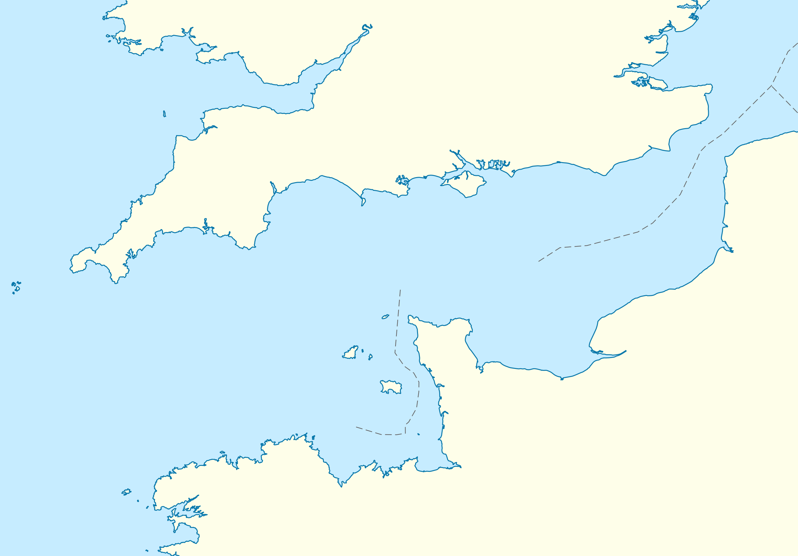
Deutsch: Positionskarte der Ärmelkanals
Quadratische Plattkarte, N-S-Streckung 155 %. Geographische Begrenzung der Karte:
English: Location map of the English Channel
Equirectangular projection, N/S stretching 155 %. Geographic limits of the map:
|
|
| 日付 | ||
| 原典 | own work, using United States National Imagery and Mapping Agency data | |
| 作者 | NordNordWest | |
| 許可 (ファイルの再利用) |
このファイルはクリエイティブ・コモンズ 表示-継承 3.0 ドイツライセンスのもとに利用を許諾されています。
 このファイルはクリエイティブ・コモンズ 表示-継承 3.0 非移植ライセンスのもとに利用を許諾されています。
|
|
| その他のバージョン | このファイルの派生的著作物: Condor ferries route map.svg |


|
この地図は、ドイツ語版の(地図研究室)で制作、もしくは改善されたものです。更なる改善の為、地図を提案することもできます。
|
ファイルの履歴
過去の版のファイルを表示するには、その版の日時をクリックしてください。
| 日付と時刻 | サムネイル | 寸法 | 利用者 | コメント | |
|---|---|---|---|---|---|
| 現在の版 | 2010年10月1日 (金) 16:55 | | 955 × 665 (178キロバイト) | NordNordWest (トーク | 投稿記録) | upd |
| 2010年9月28日 (火) 19:07 |  | 955 × 665 (178キロバイト) | NordNordWest (トーク | 投稿記録) | == {{int:filedesc}} == {{Information |Description= {{de|Positionskarte der Ärmelkanals}} Quadratische Plattkarte, N-S-Streckung 155 %. Geographische Begrenzung der Karte: * N: 52.0° N * S: 48.0° N * W: 6.5° W * O: 2.4° O {{en|Loca |
このファイルは上書きできません。
ファイルの使用状況
以下の 9 ページがこのファイルを使用しています:
- La Manche - English Channel
- User:NordNordWest/Gallery/Location maps
- File:Bailiwick of Guernsey in the English Channel.svg
- File:Condor ferries route map.svg
- File:The Bailiwick of Guernsey in the English Channel.svg
- Category:English Channel
- Category:Islands of the English Channel
- Category:Lighthouses of the English Channel
- Category:Tributaries of the English Channel
グローバルなファイル使用状況
以下に挙げる他のウィキがこの画像を使っています:
- an.wikipedia.org での使用状況
- ar.wikipedia.org での使用状況
- az.wikipedia.org での使用状況
- ba.wikipedia.org での使用状況
- bn.wikipedia.org での使用状況
- ceb.wikipedia.org での使用状況
- ce.wikipedia.org での使用状況
- cs.wikipedia.org での使用状況
- de.wikipedia.org での使用状況
- de.wikivoyage.org での使用状況
- en.wikipedia.org での使用状況
- Guernsey
- Sark
- Alderney
- Bailiwick of Guernsey
- Operation Biting
- Battle of Dover Strait (1917)
- Operation Jericho
- Bugaled Breizh
- Module:Location map/data/United Kingdom Channel Islands/doc
- White House (Herm)
- La Sablonnerie
- Armin Faber
- User:Keith-264/sandbox5
- Module:Location map/data/English Channel
- Template:Bailiwick of Guernsey location map
- Template:Bailiwick of Guernsey location map/doc
- Module:Location map/data/United Kingdom Channel Islands
- English Channel migrant crossings (2018–present)
- 2019 English Channel Piper PA-46 crash
- Jersey Bulls F.C.
- Wikipedia talk:WikiProject Military history/Archive 155
- November 2021 English Channel disaster
- Module:Location map/data/English Channel/doc
- es.wikipedia.org での使用状況
このファイルのグローバル使用状況を表示する。