File:España relieve M.png
Jump to navigation
Jump to search

Size of this preview: 508 × 599 pixels. Other resolutions: 203 × 240 pixels | 407 × 480 pixels | 651 × 768 pixels | 868 × 1,024 pixels | 2,356 × 2,778 pixels.
Original file (2,356 × 2,778 pixels, file size: 10.26 MB, MIME type: image/png)
Captions
Captions
Add a one-line explanation of what this file represents
Summary[edit]
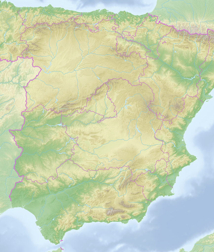
| Description |
Español: Mapa relieve de partes centrales de España, sin las Islas Baleares, Cataluña y Galicia English: Rielief map of the central section of Spain, wihout Balearic Islands, Catalonia and Galicia Deutsch: Reliefkarte Spanien, Ausschnitt ohne Balearen, Katalonien und Galicien
Fundamento topografico: NASA Shuttle Radar Topography Mission (public domain). SRTM3 v.2. |
||||||||
| Date | 2018-05-20, cutout 2019-12-10 | ||||||||
| Source | File:Reliefkarte Spanien.png | ||||||||
| Author | Tschubby, cutout Ulamm (talk) | ||||||||
| Permission (Reusing this file) |
I, the copyright holder of this work, hereby publish it under the following licenses:
This file is licensed under the Creative Commons Attribution-Share Alike 2.5 Generic, 2.0 Generic and 1.0 Generic license.
You may select the license of your choice. |

File history
Click on a date/time to view the file as it appeared at that time.
| Date/Time | Thumbnail | Dimensions | User | Comment | |
|---|---|---|---|---|---|
| current | 19:58, 10 December 2019 | | 2,356 × 2,778 (10.26 MB) | Ulamm (talk | contribs) | {{Information |Description= {{es|Mapa relieve de partes centrales de España, sin las Islas Baleares, Cataluña y Galicia}}{{en|Rielief map of the central section of Spain, wihout Balearic Islands, Catalonia and Galicia}}{{de|Reliefkarte Spanien, Ausschnitt ohne Balearen, Katalonien und Galicien}} Fundamento topografico: [http://www2.jpl.nasa.gov/srtm NASA Shuttle Radar Topography Mission] (public domain). SRTM3 v.2.<br /> Extensión: Latitudes 35.7764609° – 43.7913615° del norte, longitudes -7.... |
You cannot overwrite this file.
File usage on Commons
There are no pages that use this file.
File usage on other wikis
The following other wikis use this file:
- Usage on de.wikipedia.org