File:Europe countries map contours.xcf
Jump to navigation
Jump to search

Size of this PNG preview of this XCF file: 737 × 600 pixels. Other resolutions: 295 × 240 pixels | 590 × 480 pixels | 944 × 768 pixels | 1,259 × 1,024 pixels | 1,475 × 1,200 pixels.
Original file (1,475 × 1,200 pixels, file size: 438 KB, MIME type: image/x-xcf)
Captions
Captions
Add a one-line explanation of what this file represents
| Description |
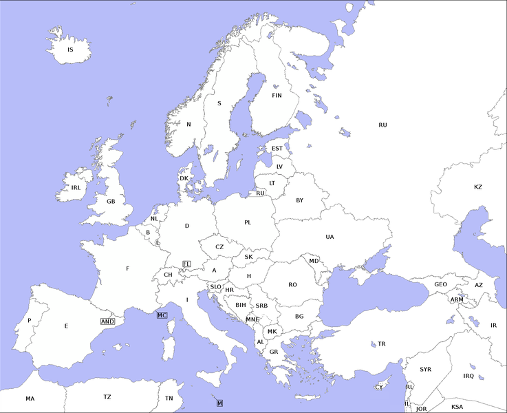
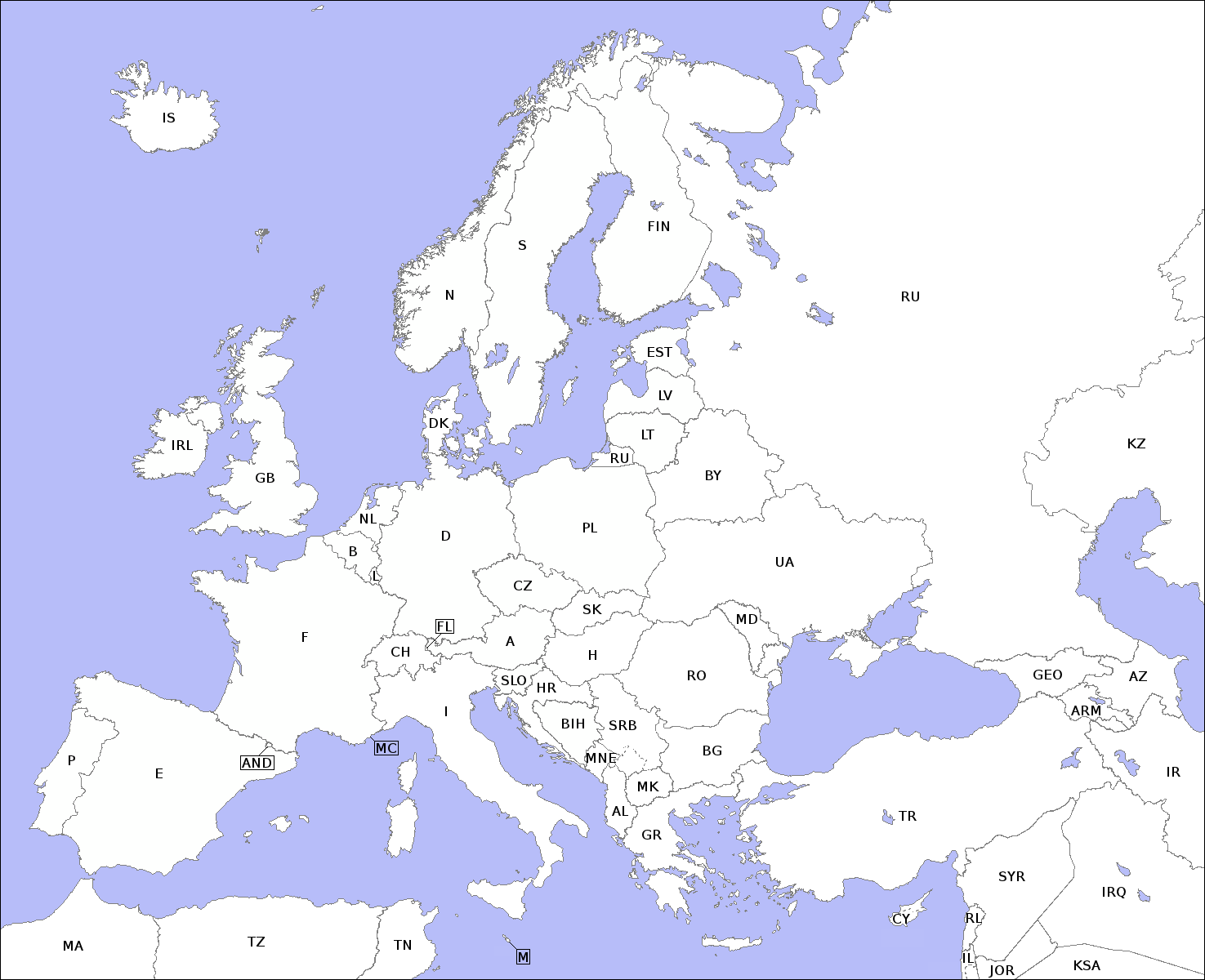
English: Map with the the outlines of countries in Europe and related international vehicle registration codes. Deutsch: Karte mit Umrissen der europäischen Länder und dem jeweiligen KFZ-Kürzel. |
| Date | (UTC) |
| Source | |
| Author |
|
| Other versions |
Derivative works of this file: |
| This is a retouched picture, which means that it has been digitally altered from its original version. Modifications: Karte reduziert auf die Umrisse der Länder plus des jeweiligen KFZ-Kürzels. Map reduced to the outlines of the countries and related international vehicle registration codes. The original can be viewed here: Europe countries map en.png:
|
I, the copyright holder of this work, hereby publish it under the following licenses:
| This file is licensed under the Creative Commons Attribution-Share Alike 3.0 Unported license. | ||
| ||
| This licensing tag was added to this file as part of the GFDL licensing update. |

|
Permission is granted to copy, distribute and/or modify this document under the terms of the GNU Free Documentation License, Version 1.2 or any later version published by the Free Software Foundation; with no Invariant Sections, no Front-Cover Texts, and no Back-Cover Texts. A copy of the license is included in the section entitled GNU Free Documentation License. |
You may select the license of your choice.
The map has been created with the Generic Mapping Tools: https://www.generic-mapping-tools.org/ using one or more of these public-domain datasets for the relief:
|
|
|
Permission is granted to copy, distribute and/or modify this document under the terms of the GNU Free Documentation License, Version 1.2 or any later version published by the Free Software Foundation; with no Invariant Sections, no Front-Cover Texts, and no Back-Cover Texts. A copy of the license is included in the section entitled GNU Free Documentation License. |
Original upload log
[edit]This image is a derivative work of the following images:
- File:Europe_countries_map_en.png licensed with Cc-by-sa-3.0-migrated, GFDL-GMT
Uploaded with derivativeFX
|
|
File history
Click on a date/time to view the file as it appeared at that time.
| Date/Time | Thumbnail | Dimensions | User | Comment | |
|---|---|---|---|---|---|
| current | 14:23, 12 March 2011 |  | 1,475 × 1,200 (438 KB) | Malenki (talk | contribs) | {{Information |Description={{en|Map with the the outlines of countries in Europe and related international vehicle registration codes.}}{{de|Karte mit Umrissen der europäischen Länder und dem jeweiligen KFZ-Kürzel.}} |Source=*[[:File:Europe_countries_m |
You cannot overwrite this file.
File usage on Commons
The following 2 pages use this file: